
 United Kingdom
 France
 Germany
 Netherlands
 Sweden
 USA
USA
 Italy
Italy
 Spain
Spain
More From Contributor


Wembley Park 1895
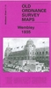
Wembley Park in 1895 in a fascinating series of reproductions of old Ordnance Survey plans in the Alan Godfrey Editions, ideal for anyone interested in the history of their neighbourhood or family. Two versions have been published to show how this area developed across the years. The two maps cover the same area but with immense differences. Wembley Park dominates the 1895 map, including cricket ground, Variety Hall, running track and the Wembley Tower. In the south-west corner is Sudbury & Wembley (now Wembley Central) station, while at the north of the map is Wembley Park station on the Metropolitan line. Outside Wembley Park all is rural, with two farms.The 1935 map is dominated by the Wembley Park of the 1924 British Empire Exhibition and includes the Empire Stadium, Palaces of
Engineering and Industry, LNER Stadium Loop, Neverstop Railway, Empire Pool, housing development around Chalkhill House, GEC`s Hirst Laboratories, and Wembley Hill. A street directory of High Road and Wembley Park Drive is on the reverse.About the Alan Godfrey Editions of the 25” OS Series:Selected towns in Great Britain and Ireland are covered by maps showing the extent of urban development in the last decades of the 19th and early 20th century. The plans have been taken from the Ordnance Survey mapping and reprinted at about 15 inches to one mile (1:4, 340). On the reverse most maps have historical notes and many also include extracts from contemporary directories. Most maps cover about one mile (1.6kms) north/south, one and a half miles (2.4kms) across; adjoining sheets can be
combined to provide wider coverage.FOR MORE INFORMATION AND A COMPLETE LIST OF ALL AVAILABLE TITLES PLEASE CLICK ON THE SERIES LINK.

Product Description
Reviews/Comments
Add New
Intelligent Comparison
Archived Product

Wembley 1935 Stanfords
£3.50
Archived Product

Osterley Park 1894 Stanfords
£3.50
Archived Product

Osterley Park 1935 Stanfords
£3.50
Vouchers
No voucher codes found.
Do you know a voucher code for this product or supplier? Add it to Insights for others to use.
Do you know a voucher code for this product or supplier? Add it to Insights for others to use.
 Denmark