More From Contributor
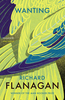
£9.99
Wanksy is the unheralded genius behind some of the most iconic urban images of our time: the seminal `cock & balls`, the timeless ` Leroy loves Sarah`, the devastating brevity of `sod` & countless other masterpieces. For the first time, this book collects Wanksy`s most significant works to date together with expert critiques that analyse & illuminate their hidden depths. You`ll never look at a crudely drawn penis in the same way again. ...
Archived Product
£3.50
Wanstead in 1894 in a fascinating series of reproductions of old Ordnance Survey plans in the Alan Godfrey Editions, ideal for anyone interested in the history of their neighbourhood or family. Two versions for this area have been published, stretching from Mornington Road & Whipps Cross Road eastward to the River Roding & Wanstead Lane; & from the southern tip of Snaresbrook station southward to Leybourne Road & part of Wanstead Park. Features include St Mary`s church, the site of Wanstead House, Bush Wood, Christ Church & George Green. Streets include Blake Hall Road, George Lane, Warren Road, New Wanstead, Cambridge Park, High Street, Spratt Hall Road, etc. The 1894 map has the list of private residents in Wanstead from Kelly`s Directory for 1895. About the Alan Godfrey Editions of the 25” OS Series: Selected towns in Great Britain & Ireland are covered by maps showing the extent of urban development in the last decades of the 19th & early 20th century. The plans have been taken from the Ordnance Survey mapping & reprinted at about 15 inches to one mile (1:4, 340). On the reverse most maps have historical notes & many also include extracts from contemporary directories. Most maps cover about one mile (1.6kms) north/south, one & a half miles (2.4kms) across; adjoining sheets can be combined to provide wider coverage.FOR MORE INFORMATION & A COMPLETE LIST OF ALL AVAILABLE TITLES PLEASE CLICK ON THE SERIES LINK. ...
Archived Product
£3.50
Wanstead in 1915 in a fascinating series of reproductions of old Ordnance Survey plans in the Alan Godfrey Editions, ideal for anyone interested in the history of their neighbourhood or family. Two versions for this area have been published, stretching from Mornington Road & Whipps Cross Road eastward to the River Roding & Wanstead Lane; & from the southern tip of Snaresbrook station southward to Leybourne Road & part of Wanstead Park. Features include St Mary`s church, the site of Wanstead House, Bush Wood, Christ Church & George Green. Streets include Blake Hall Road, George Lane, Warren Road, New Wanstead, Cambridge Park, High Street, Spratt Hall Road, etc. This 1915 map

Includes::
street directory extracts. About the Alan Godfrey Editions of the 25” OS Series: Selected towns in Great Britain & Ireland are covered by maps showing the extent of urban development in the last decades of the 19th & early 20th century. The plans have been taken from the Ordnance Survey mapping & reprinted at about 15 inches to one mile (1:4, 340). On the reverse most maps have historical notes & many also include extracts from contemporary directories. Most maps cover about one mile (1.6kms) north/south, one & a half miles (2.4kms) across; adjoining sheets can be combined to provide wider coverage.FOR MORE INFORMATION & A COMPLETE LIST OF ALL AVAILABLE TITLES PLEASE CLICK ON THE SERIES LINK.

...
Archived Product
£3.50
Wanstead Flats in 1893 in a fascinating series of reproductions of old Ordnance Survey plans in the Alan Godfrey Editions, ideal for anyone interested in the history of their neighbourhood or family. Two versions cover an area stretching from Montague Road & Odessa Road eastward to Forest Drive, & from Woodlands Avenue southward to Cobbold Road & Chestnut Avenue. The map is centred on the broad open space of Wanstead Flats, but it also

Includes::
fringe streets of Leytonstone & Forest Gate. In the north-eastern corner of the 1915 map is the new housing estate known as Aldersbrook. Features include West Ham cemetery, Manor Park cemetery, City of London cemetery, a short stretch of the GER main line including Manor Park station, part of the Tottenham & Forest Gate railway including Wanstead Park station, St Nicholas Industrial School. Streets include Dames Road, Capel Road, Woodford Road, Godwin Road, Trumpington Road & others. About the Alan Godfrey Editions of the 25” OS Series: Selected towns in Great Britain & Ireland are covered by maps showing the extent of urban development in the last decades of the 19th & early 20th century. The plans have been taken from the Ordnance Survey mapping & reprinted at about 15 inches to one mile (1:4, 340). On the reverse most maps have historical notes & many also include extracts from contemporary directories. Most maps cover about one mile (1.6kms) north/south, one & a half miles (2.4kms) across; adjoining sheets can be combined to provide wider coverage.FOR MORE INFORMATION & A COMPLETE LIST OF ALL AVAILABLE TITLES PLEASE CLICK ON THE SERIES LINK.

...
Archived Product
£3.50
Wanstead Flats in 1915 in a fascinating series of reproductions of old Ordnance Survey plans in the Alan Godfrey Editions, ideal for anyone interested in the history of their neighbourhood or family. Two versions cover an area stretching from Montague Road & Odessa Road eastward to Forest Drive, & from Woodlands Avenue southward to Cobbold Road & Chestnut Avenue. The map is centred on the broad open space of Wanstead Flats, but it also

Includes::
fringe streets of Leytonstone & Forest Gate. In the north-eastern corner of the 1915 map is the new housing estate known as Aldersbrook. Features include West Ham cemetery, Manor Park cemetery, City of London cemetery, a short stretch of the GER main line including Manor Park station, part of the Tottenham & Forest Gate railway including Wanstead Park station, St Nicholas Industrial School. Streets include Dames Road, Capel Road, Woodford Road, Godwin Road, Trumpington Road & others. About the Alan Godfrey Editions of the 25” OS Series: Selected towns in Great Britain & Ireland are covered by maps showing the extent of urban development in the last decades of the 19th & early 20th century. The plans have been taken from the Ordnance Survey mapping & reprinted at about 15 inches to one mile (1:4, 340). On the reverse most maps have historical notes & many also include extracts from contemporary directories. Most maps cover about one mile (1.6kms) north/south, one & a half miles (2.4kms) across; adjoining sheets can be combined to provide wider coverage.FOR MORE INFORMATION & A COMPLETE LIST OF ALL AVAILABLE TITLES PLEASE CLICK ON THE SERIES LINK.

...
Archived Product
£8.99
FROM THE WINNER OF THE MAN BOOKER PRIZE 2014. Mathinna, an Aboriginal girl from Van Diemen`s L&, is adopted by nineteenth-century explorer, Sir John Franklin, & his wife, Lady Jane. Franklin is confident that shining the light of reason on Mathinna will lift her out of savagery & desire. But when Franklin dies on an Arctic expedition, Lady Jane writes to Charles Dickens, asking him to defend Franklin`s reputation amid rumours of his crew lapsing into cannibalism. Dickens responds by staging a play in which he takes the leading role as Franklin, his symbol of reason`s triumph, only to fall in love with an eighteen-year-old actress. As reason gives way to wanting, the frontier between civilisation & barbarity dissolves, & Mathinna, now a teenage prostitute, goes drinking on a fatal night. ...
Archived Product
£19.95
Wapusk National Park in Manitoba at 1:250, 000 in a series of GPS compatible recreational maps at various scales from Go Trekkers highlighting recreational possibilities including trekking and/or snowshoe trails, canoeing & kayaking routes, campgrounds, warden stations, etc. Cartography of each title varies according to the terrain of the national park, but the maps are contoured & have spot heights plus, as appropriate, graphics to show wetlands, relief shading in mountainous areas, etc. All the titles are GPS compatible with either a UTM or latitude/longitude grid. Presentation of trails, recreational facilities such as campgrounds, access to the park by road or air, etc, also varies according to what each park has to offer & where it is situated. Each map also

Includes::
notes about the park.

...
Archived Product
£8.99
From the author of The Perfect Storm, a gripping book about Sebastian Junger`s almost fatal year with the 2nd battalion of the American Army. For 15 months, Sebastian Junger accompanied a single platoon of thirty men from the celebrated 2nd battalion of the U.S. Army, as they fought their way through a remote valley in Eastern Afghanistan. Over the course of five trips, Junger was in more firefights than he could count, men he knew were killed or wounded, & he himself was almost killed. His relationship with these soldiers grew so close that they considered him part of the platoon, & he enjoyed an access & a candidness that few, if any, journalists ever attain. But this is more than just a book about Afghanistan or the ` War on Terror`; it is a book about the universal truth of all men, in all wars. Junger set out to answer what he thought of as the `hand grenade question`: why would a man throw himself on a hand grenade to save other men he has probably known for only a few months? The answer is elusive but profound, & goes to the heart of what it means not just to be a soldier, but to be human.` War` is a narrative about combat: the fear of dying, the trauma of killing & the love between platoon-mates who would rather die than let each other down. Gripping, honest, intense, it explores the neurological, psychological & social elements of combat, & the incredible bonds that form between these small groups of men. ...
Archived Product
£19.99
Take a guided tour of every major conflict through the ages. Trace the epic 5, 000-year story of warfare from the earliest battles to the War on Terror with War, now in compact format. Explore the campaigns & conflicts, the warriors & commanders & the tactics, weapons & technology that have shaped human warfare, with fascinating features on topics including the role of infantry, siege warfare, military tactics & the treatment of wounded soldiers. Combining a clear & compelling historical narrative with a wealth of fascinating eyewitness accounts & photography throughout, War is a definitive visual guide to this brutal, intense & often heroic dimension of the human story. ...
Archived Product
£5.99
Imagine if war broke out
- not in Iraq or Afghanistan, somewhere far far away, but here, in our country. In War, Janne Teller
...
Archived Product

Wanting

In 1841, and in the remote penal colony of Van Diemen's Land, a barefoot aboriginal girl wearing a red silk dress sits for her portrait. She is Mathinna, the adopted daughter of the island's governor, Sir John Franklin, and his wife, Lady Jane, and the subject of a grand experiment in civilization - one that will determine whether science, Christianity and reason can be imposed in place of savagery, impulse and desire. A quarter of a century passes. Somewhere in the Arctic, Sir John Franklin has disappeared, along with his crew and two ships, on an expedition to find the fabled Northwest Passage. England is horrified as reports of cannibalism filter back from search parties, no one more so than the most celebrated novelist of the day, Charles Dickens, for whom Franklin's
story becomes a means to plumb the frozen depths of his soul. As several lives become conjoined by unexpected events and tragedies, Wanting transforms into a remarkable meditation on the ways in which desire - and its denial - shape our lives.
RIP - This product is no longer available on our network. It was last seen on 25.09.2019

This page now acts as a permanent archive for this product. Add more information using the comments box below to ensure it can still be found by future generations.

Use our search facility to see if it is available from an alternative contributor.
  • Availability: Out Of Stock
  • Supplier: Stanfords
  • SKU: 9781848870772
Availability: In Stock
£7.99

Product Description

In 1841, & in the remote penal colony of Van Diemen's L&, a barefoot aboriginal girl wearing a red silk dress sits for her portrait. She is Mathinna, the adopted daughter of the island's governor, Sir John Franklin, & his wife, Lady Jane, & the subject of a grand experiment in civilization
- one that will determine whether science, Christianity & reason can be imposed in place of savagery, impulse & desire. A quarter of a century passes. Somewhere in the Arctic, Sir John Franklin has disappeared, along with his crew & two ships, on an expedition to find the fabled Northwest Passage. England is horrified as reports of cannibalism filter back from search parties, no one more so than the most celebrated novelist of the day, Charles Dickens, for whom Franklin's story becomes a means to plumb the frozen depths of his soul. As several lives become conjoined by unexpected events & tragedies, Wanting transforms into a remarkable meditation on the ways in which desire
- & its denial
- shape our lives.

Reviews/Comments

Add New

Price History

Vouchers

No voucher codes found.
Do you know a voucher code for this product or supplier? Add it to Insights for others to use.

Facebook

Jargon Buster

Silk - A natural fibre made by silk worms
Filter - A device used to separate mixtures
Filter - An optical device to remove or enhance particular wavelengths of light.
England - A country within the United Kingdom.
Red - One of the three primary colours
Parties - A gathering of people to celebrate and event or occasion
Day - The time it takes a planet or other space objects to complete one rotation.
Experiment - A procedure that is undergone to clarify facts and discover new unknown facts

Supplier Information

Stanfords
Stanfords was established in 1853 and opened their iconic Covent Garden flagship store in 1901. They have become the top retailer of maps, travel books and accessories in the UK and arguably offer the largest selection of maps and travel books worldwide. Famous names such as Captain Robert Falcon Scott, Ranulph Fiennes and Michael Palin have purchased from Stanfords. They now have a shop in Bristol and both stores together with other venues operate a calendar of events including talks, book signings and exhibitions. As a specialist map retailer, the map selection is comprehensive and includes road maps, street maps and walking maps from worldwide destinations, as well as a selection of world atlases and wall maps. Books include travel guides and travel literature. Stanfords also stock globes, from miniatures made of blue marble to magnificent floor-standing globes. The website features a selection of interesting articles on travel topics.
Page Updated: 2023-11-12 20:15:36

Community Generated Product Tags

Oh No! The productWIKI community hasn't generated any tags for this product yet!
Menu