
 United Kingdom
 France
 Germany
 Netherlands
 Sweden
 USA
USA
 Italy
Italy
 Spain
Spain
More From Contributor


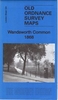


Wandsworth 1894
Wandsworth in 1894 in a fascinating series of reproductions of old Ordnance Survey plans in the Alan Godfrey Editions, ideal for anyone interested in the history of their neighbourhood or family. Two versions have been published for this area, extending from Red Lion Street and the River Wandle eastwards to Leathwaite Road, and from St John`s Hill and Clapham Junction station southwards to Dorlcote Road. Features include the southern part of Clapham Junction station, Wandsworth station, brewery, mill and canal near the River Wandle, Royal Paper Mills, part of Wandsworth Common, Royal Victoria Patriotic Asylum, St Peter`s Hospital, New Wandsworth goods station, Wandsworth & Clapham Union Infirmary, tramways, St Mary`s Cemetery. Churches include St Anne`s, St Paul`s, St
Mark`s Battersea Rise. Streets include Bolingbroke Grove, part of Lavender Hill, St John`s Hill, East Hill, North Street, South Street and many more. Each map has on the reverse extracts from a contemporary directory.About the Alan Godfrey Editions of the 25” OS Series:Selected towns in Great Britain and Ireland are covered by maps showing the extent of urban development in the last decades of the 19th and early 20th century. The plans have been taken from the Ordnance Survey mapping and reprinted at about 15 inches to one mile (1:4, 340). On the reverse most maps have historical notes and many also include extracts from contemporary directories. Most maps cover about one mile (1.6kms) north/south, one and a half miles (2.4kms) across; adjoining sheets can be combined to provide
wider coverage.FOR MORE INFORMATION AND A COMPLETE LIST OF ALL AVAILABLE TITLES PLEASE CLICK ON THE SERIES LINK.

Product Description
Reviews/Comments
Add New
Intelligent Comparison
Archived Product

Handsworth 1913 Stanfords
£3.50
Archived Product

Isleworth 1894 Stanfords
£3.50
Archived Product

Wandsworth Common 1893 Stanfords
£3.50
Archived Product

Windsor 1897 Stanfords
£3.50
Archived Product

Dodworth 1904 Stanfords
£3.50
Archived Product

Cudworth 1904 Stanfords
£3.50
Archived Product

Putney & NW Wandsworth 1894 Stanfords
£3.50
Archived Product

Wandsworth Common 1868 Stanfords
£3.50
Vouchers
No voucher codes found.
Do you know a voucher code for this product or supplier? Add it to Insights for others to use.
Do you know a voucher code for this product or supplier? Add it to Insights for others to use.
 Denmark