More From Contributor
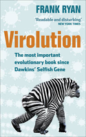
£30.00
Detailed physical wall map of Virginia, Maryl&, Delaware & DC at a scale of 1:500, 000. The cartography shows relief through a stunning, highly detailed shading, with different elevations varing in colouring, giving an almost 3-dimensional feel to the map. Peak heights are also clearly marked. The map displays land only within the boundaries of the chosen states
- there is no overlap with neigbouring states. Principal physical features such as glaciers, mountain ranges, rivers & lakes are shown clearly. Human features, such as main towns, cities, roads & railways, are shown in a very fine, subtle & elegant cartographic style. State capitals are also clearly marked. This map measures 87x 163cm (34”x 64”). This regional map is centered on the Chesapeake Bay area.* About this series:* Located on the corner of Main & Central in downtown Medford, Oregon since 1986, Raven has become the quintessential small company with a big reputation. Every map is created with attention to accuracy & elegance, from gathering the base information to the final color adjustment on the printing press.
...
Archived Product
£3.99
Virginia`s Shenandoah in the Moon Spotlight guide series; covering a range of specific local cities, districts, areas & regions in North, Central & South America & targeted at those seeking to travel to a specific area within a country. Each of the guides has been extracted in full from the relevant country * Moon Handbook* & individual titles focus on a particular city, region or notable area of the destination. Many of the guides in the series are unique in their coverage, although are limited in putting the destination into its wider geographical context that a more comprehensive guide would provide. Stylistically, Moon’s editorial style is strongly American in focus, often offering insights & observations with an American audience in mind. However, each Moon Spotlight guide is comprehensive in the information it provides & gives visitors the flexibility to opt for a more compact guide if they know in advance where they will be staying or travelling. ...
Archived Product
£16.99
A lined journal, in an ingeniously printed faux leather cover which captures the flavour of finely wrought Renaissance-style leather bindings. It is intricately embellished with one of three designs to reproduce the delicate gold tooling which was brought to Europe via the flourishing trade routes with the east. Closes with a fold-over cover flap. Smythe sewn with 144 pages, plus memento pouch & ribbon page marker. 18x 23cm ...
Archived Product
£9.50
Topographical survey of Belgium at 1:20, 000 from Nationaal Geografisch Instituut / Institut Géographique National, the country’s national survey organization. Each 20K map covers one quarter of the corresponding 1:50, 000 map (with adjustments in the border & coastal areas). The maps provide all the information expected of topographic mapping at this scale & in addition have an unusually large amount of vegetation and/or land use information (different types of woodlands, gardens, orchards, heath, etc). The maps have a 1-km UTM grid, with margin ticks for latitude & longitude at intervals of 1`. Map legend & a glossary of terms used on the maps include English. Stanfords keeps as regular stock 20K maps for the World War I battlefields around the Ypres, Messines & Passchendaele, & for the area of the Battle of Waterloo. The 1:20, 000 survey covers the whole of Belgium & maps for other regions can be supplied as special orders. To see the list of titles in this series please click on the series link.PLEASE NOTE: the Long-Distance Footpaths Map of Belgium at 1:300, 000 which shows the division of Belgium into the 50K survey sheets can also be used to see in more detail coverage by the 20K maps. ...
Archived Product
£17.99
The 1:50, 000 topographic map gives a more general picture of the ground features than a basic map. It shows settlements, houses, roads, cultivated areas, waterways, cutting areas, mires, rock exposures, & relief. One map sheet covers an area of 30 x 40 km & one centimetre corresponds to 500 metres on the ground. The 1:50, 000 topographic map is also an ideal complement to nautical charts as it provides useful information about the land areas adjacent to waterways. For example, all Finnish sea areas are covered by 1:50, 000 topographic map sheets. ...
Archived Product
£11.99
Topographical survey of Belgium at 1:20, 000 from Nationaal Geografisch Instituut / Institut Géographique National, the country’s national survey organization. Each 20K map covers one quarter of the corresponding 1:50, 000 map (with adjustments in the border & coastal areas). The maps provide all the information expected of topographic mapping at this scale & in addition have an unusually large amount of vegetation and/or land use information (different types of woodlands, gardens, orchards, heath, etc). The maps have a 1-km UTM grid, with margin ticks for latitude & longitude at intervals of 1`. Map legend & a glossary of terms used on the maps include English. Stanfords keeps as regular stock 20K maps for the World War I battlefields around the Ypres, Messines & Passchendaele, & for the area of the Battle of Waterloo. The 1:20, 000 survey covers the whole of Belgium & maps for other regions can be supplied as special orders. To see the list of titles in this series please click on the series link.PLEASE NOTE: the Long-Distance Footpaths Map of Belgium at 1:300, 000 which shows the division of Belgium into the 50K survey sheets can also be used to see in more detail coverage by the 20K maps. ...
Archived Product
£11.99
Topographical survey of Belgium at 1:50, 000 from the country’s national survey organization, Nationaal Geografisch Instituut / Institut Géographique National. Contour interval varies according to the terrain, from 2.5 metres in the coastal areas to 10 metres in the Ardennes. The maps provide all the information expected of topographic mapping at this scale & in addition have an unusually large amount of vegetation and/or land use information (different types of woodlands, gardens, orchards, heath, etc). Each standard sheet covers Approx. 32 x 20 km / 20 x 12 miles, with larger maps published for the border or coastal areas. The maps have a 1-km UTM grid, with margin ticks for latitude & longitude at intervals of 1`. Map legend & a glossary of terms used on the maps include English.PLEASE NOTE: the Long-Distance Footpaths Map of Belgium at 1:300, 000 is overprinted with the grid for the 1:50, 000 topographic survey, showing the exact coverage of each sheet. Stanfords keeps as regular stock 50K maps for the World War I battlefields around the Ypres, Messines & Passchendaele, & for the area of the Battle of Waterloo. Maps for other regions can be supplied as special orders – to see the list of all the titles in this series please click on the series link. ...
Archived Product
£20.00
States like Russia & Ukraine may not have gone back to totalitarianism or the traditional authoritarian formula of stuffing the ballot box, cowing the population & imprisoning the opposition
- or not obviously. But a whole industry of `political technology` has developed instead, with shadowy private firms & government `fixers` on lucrative contracts dedicated to the black arts of organising electoral success. This book uncovers the sophisticated techniques of the `virtual` political system used to legitimise post-Soviet regimes: entire fake parties, phantom political rivals & `scarecrow` opponents. & it exposes the paramount role of the mass media in projecting these creations & in falsifying the entire political process. Wilson argues that it is not primarily economic problems that have made it so difficult to develop meaningful democracy in the former Soviet world. Although the West also has its `spin doctors`, dirty tricks & aggressive ad campaigns, it is the unique post-Bolshevik culture of `political technology` that is the main obstacle to better governance in the region, to real popular participation in public affairs & to the modernization of the political economy in the longer term. ` This is a splendid study that captures the essence of post-Soviet politics, getting to the core of Putin`s Russia & showing the author`s unmatched command of Ukrainian political life. It is a book to be read by anyone with an interest in the machinations of contemporary politics` James Gow, King`s College London
...
Archived Product

Virolution

The extraordinary role of viruses in evolution and how this is revolutionising biology and medicine. Darwin`s theory of evolution is still the greatest breakthrough in biological science. His explanation of the role of natural selection in driving the evolution of life on earth depended on steady variation of living things over time - but he was unable to explain how this variation occurred. In the 150 years since publication of the Origin of Species, we have discovered three main sources for this variation - mutation, hybridisation and epigenetics. Then on Sunday, 12th February, 2001 the evidence for perhaps the most extraordinary cause of variation was simultaneously released by two organisations - the code for the entire human genome. Not only was the human genome unbelievably
simple (it is only ten times more complicated than a bacteria), but embedded in the code were large fragments that were derived from viruses - fragments that were vital to evolution of all organisms and the evidence for a fourth and vital source of variation - viruses.Virolution is the product of Dr Frank Ryan`s decade of research at the frontiers of this new science - now called viral symbiosis - and the amazing revolution that it has had in these few years. As scientists begin to look for evidence of viral involvement in more and more processes, they have discovered that they are vital in nearly every case. And with this understanding comes the possibility of manipulating the role of the viruses to help fight a huge range of diseases.
RIP - This product is no longer available on our network. It was last seen on 25.09.2019

This page now acts as a permanent archive for this product. Add more information using the comments box below to ensure it can still be found by future generations.

Use our search facility to see if it is available from an alternative contributor.
  • External links may include paid for promotion
  • Availability: Out Of Stock
  • Supplier: Stanfords
  • SKU: 9780007315123
Availability: In Stock
£12.99

Product Description

The extraordinary role of viruses in evolution & how this is revolutionising biology & medicine. Darwin`s theory of evolution is still the greatest breakthrough in biological science. His explanation of the role of natural selection in driving the evolution of life on earth depended on steady variation of living things over time
- but he was unable to explain how this variation occurred. In the 150 years since publication of the Origin of Species, we have discovered three main sources for this variation
- mutation, hybridisation & epigenetics. Then on Sunday, 12th February, 2001 the evidence for perhaps the most extraordinary cause of variation was simultaneously released by two organisations
- the code for the entire human genome. Not only was the human genome unbelievably simple (it is only ten times more complicated than a bacteria), but embedded in the code were large fragments that were derived from viruses
- fragments that were vital to evolution of all organisms & the evidence for a fourth & vital source of variation
- viruses. Virolution is the product of Dr Frank Ryan`s decade of research at the frontiers of this new science
- now called viral symbiosis
- & the amazing revolution that it has had in these few years. As scientists begin to look for evidence of viral involvement in more & more processes, they have discovered that they are vital in nearly every case. & with this understanding comes the possibility of manipulating the role of the viruses to help fight a huge range of diseases.

Reviews/Comments

Add New

Intelligent Comparison

Oooops!
We couldn't find anything!
Perhaps this product's unique.... Or perhaps we are still looking for comparisons!
Click to bump this page and we'll hurry up.

Price History

Vouchers

No voucher codes found.
Do you know a voucher code for this product or supplier? Add it to Insights for others to use.

Facebook

Jargon Buster

Bacteria - A group of microscopic living organisms
Human - A highly developed and adapted mamal and deminant species on earth
Medicine - A biological substance used for health benefits
Earth - A planet third from the sun. Similar size to Venus but rich in water and complex life.
Natural - not manmade
Large - something that takes up more space than normal.
Simple - Basic, easy no difficulty in understanding.

Supplier Information

Stanfords
Stanfords was established in 1853 and opened their iconic Covent Garden flagship store in 1901. They have become the top retailer of maps, travel books and accessories in the UK and arguably offer the largest selection of maps and travel books worldwide. Famous names such as Captain Robert Falcon Scott, Ranulph Fiennes and Michael Palin have purchased from Stanfords. They now have a shop in Bristol and both stores together with other venues operate a calendar of events including talks, book signings and exhibitions. As a specialist map retailer, the map selection is comprehensive and includes road maps, street maps and walking maps from worldwide destinations, as well as a selection of world atlases and wall maps. Books include travel guides and travel literature. Stanfords also stock globes, from miniatures made of blue marble to magnificent floor-standing globes. The website features a selection of interesting articles on travel topics.
Page Updated: 2023-11-12 20:15:36

Community Generated Product Tags

Oh No! The productWIKI community hasn't generated any tags for this product yet!
Menu