
 United Kingdom
 France
 Germany
 Netherlands
 Sweden
 USA
USA
 Italy
Italy
 Spain
Spain
More From Contributor


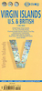


Virgin Islands (US And British) ITMB
Virgin Islands, both US and British, at 1;50, 000 from ITMB on a double-sided, indexed map printed on light, waterproof and tear-resistant paper, with eight insets showing street plans of main towns across the whole group.On one side are the US Virgin Islands, accompanied by street plans of Charlotte Amalie on St. Thomas, including an enlargement of its historic district; Chistiansted, Friedensfeld and Frederiksted on St. Croix; and Cruz Bay on St. John.On the reverse are the British Virgin Islands, with street plans of Road Town on Tortola and The Valley (Spanish Town) on Virgin Gorda.The map shows the road network on the islands, with symbols indicating various places ot interest including campsites, beaches, scuba diving/snorkeling/surfing sites, national park and other
protected areas, including wildlife and bird sanctuaries, sport and recreational facilities, marinas, etc. Swamps or mangrove areas, and in the coastal waters coral reefs are marked. Topography is shown by altitude colouring and contours at 50m intervals, but with peak heights shown in feet. Latitude and longitude are expressed in decimal parts of a degree, with the lines drawn at 0.01º intervals. Each side of the map has a separate index.The street plans highlight locations of selected hotels, local markets and various tourist facilities, places of interest, etc.
protected areas, including wildlife and bird sanctuaries, sport and recreational facilities, marinas, etc. Swamps or mangrove areas, and in the coastal waters coral reefs are marked. Topography is shown by altitude colouring and contours at 50m intervals, but with peak heights shown in feet. Latitude and longitude are expressed in decimal parts of a degree, with the lines drawn at 0.01º intervals. Each side of the map has a separate index.The street plans highlight locations of selected hotels, local markets and various tourist facilities, places of interest, etc.
%20ITMB "Pin It")
Product Description
Reviews/Comments
Add New
Intelligent Comparison
Archived Product

Virgin Islands (US And British) Stanfords
£9.99
Vouchers
No voucher codes found.
Do you know a voucher code for this product or supplier? Add it to Insights for others to use.
Do you know a voucher code for this product or supplier? Add it to Insights for others to use.
 Denmark