More From Contributor
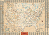
£13.95
USA Deluxe Midsize Road Atlas 2011 edition from Rand Mc Nally in an A4 spiral-bound format, designed to combine tourist information for 81 great city destinations in US, Canada & Mexico with road maps of US states & Canadian provinces. The main section of the atlas cover 81 city destinations, arranged alphabetically from Albuquerque to Washington DC, including places in Canada & Mexico. Each location is covered on one or two pages (more for the largest cities such as NYC, LA or Chicago) & is presented on a city map showing main roads & streets, & highlighting numerous places of interest. The accompanying text provides lists of main attractions, shopping centres & visitor information centres, all with addresses and/or contact details. The second part of the atlas has state maps, usually one per page, accompanied by an index. The maps show main highways, connecting state roads & selected local routes. National parks, state forest & other recreational areas are highlighted & various other places of interest are also marked. Topography is indicated by occasional spot heights. Also provided are similar maps of Canadian provinces, plus a one-page overview map of Mexico. Other features include a route planning & a mileage-&-driving times maps of USA, a distance table, lists of contact details for information on road works, car rentals & hotel chains. The atlas also

Includes::
a

...
Archived Product
£13.95
USA Deluxe Midsize Road Atlas from Rand Mc Nally in an A4, spiral-bound format, designed to combine tourist information for 81 great city destinations in US, Canada & Mexico with road maps of US states & Canadian provinces. The main section of the atlas cover 81 city destinations, arranged alphabetically from Albuquerque to Washington DC, including places in Canada & Mexico. Each location is covered on one or two pages (more for the largest cities such as NYC, LA or Chicago) & is presented on a city map showing main roads & streets, & highlighting numerous places of interest. The accompanying text provides lists of main attractions, shopping centres & visitor information centres, all with addresses and/or contact details. The second part of the atlas has state maps, usually one per page, accompanied by an index. The maps show main highways, connecting state roads & selected local routes. National parks, state forest & other recreational areas are highlighted & various other places of interest are also marked. Topography is indicated by occasional spot heights. Also provided are similar maps of Canadian provinces, plus a one-page overview map of Mexico. Other features include a route planning & a mileage-&-driving times maps of USA, a distance table, lists of contact details for information on road works, car rentals & hotel chains. The atlas also

Includes::
a

...
Archived Product
£13.59
USA's Best National Parks in the Discover series from Lonely Planet; covering a range of countries worldwide & practically designed to allow travellers to find the most iconic sites & attractions at a glance. Uniquely designed, each title in the series

Includes::
a series of lists of the best things to do & see, with highlights, thematic

...
Archived Product
£14.39
USA's Best National Parks in the Discover series from Lonely Planet; covering a range of countries worldwide & practically designed to allow travellers to find the most iconic sites & attractions at a glance. Uniquely designed, each title in the series

Includes::
a series of lists of the best things to do & see, with highlights, thematic

...
Archived Product
£17.99
DUE OUT MAY 2014
- Lonely Planet: The world's leading travel guide publisher Lonely Planet's Discover USA is your passport to the
...
Archived Product
£10.95
USA East at 1:2, 000, 000 from Mair Dumont with special features to aid navigation & an extensive index

Includes::


...
Archived Product
£6.99
Eastern USA at 1:2, 000, 000 from Marco Polo Travel Publishing with an index which

Includes::
geographical

...
Archived Product
£14.99
USA East in the Green Guide series from Michelin; detailed guides exploring the major sights & attractions of a range of cities, regions & countries. Drawing on a long publishing history, Michelin guides are renowned for their individual ‘star rating’, ranking restaurants, sights & attractions. Listings in each guide are organised alphabetically, allowing readers to access information quickly as well as being designed for practical use on the road. With an emphasis on cultural activities & history, each sight is graded & has extensive background information. Practical visitor information is clearly highlighted with symbols. Predominantly recognised for their extensive coverage of French regions (shown on our website in a separate series), the Green Guides also cover international destinations. An extensive introductory section on planning your trip provides information on when & where to go, useful pre-trip information, getting there, where to stay & eat & what to do & see. There are also individual sections on Nature, History & Art ad Culture & a selection of driving tours of the area. Fold-out maps at the front & back of the book give an overview of the area covered by the guide. The structure of each guide varies depending on the type of destination. National & regional guides cover regions alphabetically, each with their own accommodation, sights & food & drink listings, while City guides cover sights alphabetically with one city-wide section for listings. Accommodation & food & drink listings are both concise & comprehensive, aiming to cater for all budgets & tastes. Both sights & listings often include information specific to travelling with kids. Each of the places covered in the guide is listed alphabetically & three Michelin star ratings
- highly recommended, recommended & interesting, which have been used for more than 100 years
- help readers identify places of interest, restaurants & notable local attractions. Individual listings include principal sights for each city or town, local walking & driving tours in addition to tips on local excursions. There is also an ‘address book’ information box in each section including recommendations for the best restaurants & accommodation in the area, as well as any relevant leisure activities. A series of overview regional & city plans also helps navigation & orientation for each region.

...
Archived Product
£15.99
Michelin`s updated Green Guide USA East presents eight distinct regions covering 31 states from Maine to Florida & across to the Great Plains. Discover the varied culture & rich history of the Eastern US through rated attractions & points of interest, multiple driving tours, regional culinary specialties, suggested outdoor activities & family-friendly fun. Also included are recommended hotels & restaurants. However long your stay, whatever your budget, with its maps, colour photos & plentiful practical information, this guide covers it all. ...
Archived Product
£14.99
Etymological Wall Map of the United States, called by its publishers Kalimedia the Atlas of True Names of the United States of the Home Ruler. Presented on pleasant beige background, the map shows state boundaries but with the familiar names replaced by their etymological equivalents. Names on the map: states, cities, mountains, surrounding oceans & other geographical features are shown using their etymological derivation, producing unusual & often intriguing results, from Heraldwolf’s Stone in the Land at the Little Big Hills, across the South Wind People’s Land with a town called Good Place for Potatoes, to the Snowy Mountains in the Land of the Successor. The index surrounding the map lists the names as they are shown on it, indicating their official equivalents & explaining how the “ True Name” has been derived. The map is printed on waterproof & tear-resistant plastic paper & can be written on with suitable marker pens. ...
Archived Product

USA East

Eastern USA on a map from the German publishers Hildebrand, providing an overview of the road and rail networks on a base with bold colouring and plenty of names of mountain ranges and other geographical features, plus prominent marking of national parks and Indian Reservation Areas. Coverage of southern Canada includes New Brunswick and part of Nova Scotia, and extends to Winnipeg. State and time zone boundaries are marked. Main interstate highways are prominently coloured, with connecting main roads clearly numbered. Scenic routes are highlighted. Railway lines are included. Some places of interest are marked, although not as clearly visible as on other maps, given the colouring of the base map and a large number of place names.The map has latitude and longitude lines at intervals
of 2
RIP - This product is no longer available on our network. It was last seen on 25.09.2019

This page now acts as a permanent archive for this product. Add more information using the comments box below to ensure it can still be found by future generations.

Use our search facility to see if it is available from an alternative contributor.
  • External links may include paid for promotion
  • Availability: Out Of Stock
  • Supplier: Stanfords
  • SKU: 9783889892805
Availability: In Stock
£8.50

Product Description

Eastern USA on a map from the German publishers Hildebr&, providing an overview of the road & rail networks on a base with bold colouring & plenty of names of mountain ranges & other geographical features, plus prominent marking of national parks & Indian Reservation Areas. Coverage of southern Canada

Includes::
New Brunswick & part of Nova Scotia, & extends to Winnipeg. State & time zone boundaries are marked. Main interstate highways are prominently coloured, with connecting main roads clearly numbered. Scenic routes are highlighted. Railway lines are included. Some places of interest are marked, although not as clearly visible as on other maps, given the colouring of the base map & a large number of place names. The map has latitude & longitude lines at intervals of 2

Reviews/Comments

Add New

Price History

Vouchers

No voucher codes found.
Do you know a voucher code for this product or supplier? Add it to Insights for others to use.

Facebook

Jargon Buster

Large - something that takes up more space than normal.
Road - a manmade lane or a path that is used to speed up travel.

Supplier Information

Stanfords
Stanfords was established in 1853 and opened their iconic Covent Garden flagship store in 1901. They have become the top retailer of maps, travel books and accessories in the UK and arguably offer the largest selection of maps and travel books worldwide. Famous names such as Captain Robert Falcon Scott, Ranulph Fiennes and Michael Palin have purchased from Stanfords. They now have a shop in Bristol and both stores together with other venues operate a calendar of events including talks, book signings and exhibitions. As a specialist map retailer, the map selection is comprehensive and includes road maps, street maps and walking maps from worldwide destinations, as well as a selection of world atlases and wall maps. Books include travel guides and travel literature. Stanfords also stock globes, from miniatures made of blue marble to magnificent floor-standing globes. The website features a selection of interesting articles on travel topics.
Page Updated: 2023-11-12 20:15:36

Community Generated Product Tags

Oh No! The productWIKI community hasn't generated any tags for this product yet!
Menu