
 United Kingdom
 France
 Germany
 Netherlands
 Sweden
 USA
USA
 Italy
Italy
 Spain
Spain
More From Contributor


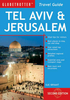

Tel Aviv
Clear, indexed street plan of Tel Aviv, with an enlargement of the city centre and the Old Town of Jaffa, plus lots of tourist information on the reverse. All place names are in Roman alphabet and all the text is in English.The main plan extends north to the motorway ring road and south to Yafo/Jaffa. Colour coding indicates different types of facilities: culture and education, shopping and commerce, sport and leisure, etc. One way streets, traffic lights and locations of petrol stations and car parks are marked.On longer street, selected house numbers are shown to help locate addresses. Symbols highlight places of interest including hotels and youth hostels, religious buildings of various denominations, police stations and first aid points, etc. An enlargement presents the city
centre in greater detail. On the reverse the map has a street index and an extensive guide to the city with descriptions of various sites and museums, a list of festivals and annual events, recommendations for hotels, restaurants, bars, etc. Also included is an enlargement of the Old Town of Jaffa.
centre in greater detail. On the reverse the map has a street index and an extensive guide to the city with descriptions of various sites and museums, a list of festivals and annual events, recommendations for hotels, restaurants, bars, etc. Also included is an enlargement of the Old Town of Jaffa.
Product Description
Reviews/Comments
Add New
Intelligent Comparison
Archived Product
Tel Aviv Stanfords
£12.95
Archived Product
Tel Aviv Stanfords
£12.95
Vouchers
No voucher codes found.
Do you know a voucher code for this product or supplier? Add it to Insights for others to use.
Do you know a voucher code for this product or supplier? Add it to Insights for others to use.
 Denmark