
 United Kingdom
 France
 Germany
 Netherlands
 Sweden
 USA
USA
 Italy
Italy
 Spain
Spain
More From Contributor


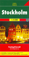
Stockholm
Indexed street plan of Stockholm with an enlargement for the city centre and a diagram of the metro and suburban railway lines. The plan shows metro stations, bus routes with stops and line numbers, ferry lines, one way streets and parking facilities. An inset at 1:10, 000 covers the city centre, including the historic Gamla Stan area, in greater detail. Map legend includes English.Coverage extends from Bromma airport in the west to Jarla in the east, and from Vastberga in the south to the university in the north. Street index is on the reverse side and includes lists of museums and galleries, theatres and concert halls, various public buildings, etc.Also provided are a road map of the city with its outer suburbs and a diagram of the metro and suburban railway lines.

Product Description
Reviews/Comments
Add New
Intelligent Comparison
Archived Product
Stockholm Stanfords
£8.95
Archived Product
Stockholm Stanfords
£4.99
Archived Product
Stockholm Stanfords
£11.99
Archived Product
Stockholm F&B Stanfords
£9.99
Archived Product

Stockholm Borch Stanfords
£8.99
Archived Product

North Stockholm Stanfords
£13.99
Archived Product

South Stockholm Stanfords
£16.99
Archived Product

North Stockholm Stanfords
£16.99
Vouchers
No voucher codes found.
Do you know a voucher code for this product or supplier? Add it to Insights for others to use.
Do you know a voucher code for this product or supplier? Add it to Insights for others to use.
 Denmark