
 United Kingdom
 France
 Germany
 Netherlands
 Sweden
 USA
USA
 Italy
Italy
 Spain
Spain
More From Contributor
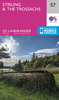


Stirling And The Trossachs OS ACTIVE MAP
Map No. 57, Stirling and The Trossachs, in a waterproof and tear-resistant version of the Ordnance Survey Landranger series at 1:50, 000, including Denny, Fintry, Likkearn, Croftamie, Drymen, Balfron, Buchlyvie, Kippen, Bannockburn, Gargunnock, Bridge of Allan, Dunblane, Doune, Port Menteith, Gartmore, Aberfoyle, Drumvaich, Kinbuck, Braco, Callander, Dalginross, Strathyre and Balquhidder, with the Loch Lomond and the Trossachs National Park, Queen Elizabeth Forest Park, Glen Artney, the peaks of Ben Vorlich, Mor Bheinn, Cromlet, Uamh Bheag, Ben Ledi, Gualann, and Ling Hill, Carron Valley Reservoir, Lochs Ard, Voil, Katrine, Venachar and Lubnaig, plus a section of the West Highland Way. Edition B2; Revised for selected changes 2009; Copyright date
2009 This title is also available on our website in a paper version.Maps in this series are only published folded. Stanfords can also print flat versions of Ordnance Survey maps through the OS Select system, centring the map on a location of your choice and with a picture provided by you on the cover. For more information please click on the link at the bottom of this description.About Ordnance Survey
2009 This title is also available on our website in a paper version.Maps in this series are only published folded. Stanfords can also print flat versions of Ordnance Survey maps through the OS Select system, centring the map on a location of your choice and with a picture provided by you on the cover. For more information please click on the link at the bottom of this description.About Ordnance Survey
Product Description
Reviews/Comments
Add New
Intelligent Comparison
Archived Product
Stirling And The Trossachs Stanfords
£5.59
Archived Product

The Trossachs OS ACTIVE Map Stanfords
£11.19
Vouchers
No voucher codes found.
Do you know a voucher code for this product or supplier? Add it to Insights for others to use.
Do you know a voucher code for this product or supplier? Add it to Insights for others to use.
 Denmark