
 United Kingdom
 France
 Germany
 Netherlands
 Sweden
 USA
USA
 Italy
Italy
 Spain
Spain
More From Contributor


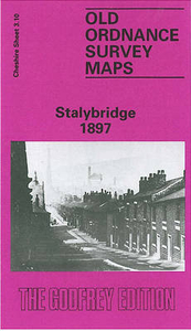
Stalybridge 1897
Stalybridge in 1897 in a fascinating series of reproductions of old Ordnance Survey plans in the Alan Godfrey Editions, ideal for anyone interested in the history of their neighbourhood or family. This detailed map is split between Lancashire and Cheshire, with the River Tame, the historic county boundary, running through Stalybridge. Coverage stretches from Stamford Park eastward to Copley, and from Darnton Road southward to Gorse Hall. Features include Stalybridge station, Stamford Park, Mount Pleasant, Clough, Cocker Hill, Riverside Mills, New St George`s church, Thompson`s Cross House, Tameside Mills, Glent Quarry, Globe Iron Works, Castle Street Mills, Holy Trinity church, Stayley Bridge, Bankwood Mills, Spring Bank, Castle Iron Works, Huddersfield Canal, Castle
Hall, Quarry Street Mills, Castle Mill, Bayley Street Mill, other cotton mills, Saunder`s Green, etc. Extracts from a contemporary directory are on the reverse. About the Alan Godfrey Editions of the 25” OS Series:Selected towns in Great Britain and Ireland are covered by maps showing the extent of urban development in the last decades of the 19th and early 20th century. The plans have been taken from the Ordnance Survey mapping and reprinted at about 15 inches to one mile (1:4, 340). On the reverse most maps have historical notes and many also include extracts from contemporary directories. Most maps cover about one mile (1.6kms) north/south, one and a half miles (2.4kms) across; adjoining sheets can be combined to provide wider coverage.FOR MORE INFORMATION AND A COMPLETE LIST
OF ALL AVAILABLE TITLES PLEASE CLICK ON THE SERIES LINK.

Product Description
Reviews/Comments
Add New
Intelligent Comparison
Archived Product

Coatbridge 1897 Stanfords
£3.50
Archived Product

Sale 1897 Stanfords
£3.50
Vouchers
No voucher codes found.
Do you know a voucher code for this product or supplier? Add it to Insights for others to use.
Do you know a voucher code for this product or supplier? Add it to Insights for others to use.
 Denmark