More From Contributor
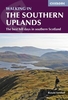
£13.99
Southern Tajikistan in a series of maps of Tajikistan & the adjoining areas of the neighbouring countries, providing coverage from Samarkand to Kashgar, including the Pamir Mountains. The maps have been produced under the auspices of the Swiss Agency for Development & Cooperation & each title

Includes::
information on the area’s culture, economy, history, etc. The maps have contours at 200m intervals, enhanced by relief shading, numerous spot heights, plus names of peaks & mountain passes. Road network

Includes::
dirt tracks & trekking routes are marked. Numerous population centres are finely graded according to the number of inhabitants. The maps also show local administrative boundaries.A wide range of symbols mark various places of interest & general facilities: cultural sites including museums, shrines, archaeological sites, etc; natural sites such as caves, interesting geological formations, waterfalls & springs; general facilities including accommodation, bazaars, fuel supplies, information centres, border crossings, etc. The maps have a latitude & longitude grid as indicated in the individual descriptions. On the reverse each map has a description of the area, its history, culture, economy, ecology, etc. &

Includes::
a street plan of the main town. Map legend & all the text are in English. * In this title:* latitude grid lines at 20’ intervals, with longitude at 30’. On the reverse is a street plan of Dushanbe indicating various places of interest & facilities.


...
Archived Product
£12.99
Southern Tenerife & La Gomera is the Sunflower Landscapes guide to exploring the best walking & touring possibilities in the region. The guide covers a range of routes including walks in Montana Guaza, Masca, Arure, Degollada de Peraza & Vallehermoso. A double-sided, fold-out touring map at the back of the book gives an overview of Tenerife & La Gomera, a street outline of San Sebastian & the locations of each walk. Detailed information about touring by hired car or public transport, as well as on foot, is provided, helping walkers to navigate & plan day-trips. Shorter strolls are also included as an alternative for each main route for those seeking more leisurely days out. The guide is structured in two main parts ...
Archived Product
£8.99
Southern Thailand at 1:550, 000 in a series of regional road maps of Thailand from the Bangkok based Think Net, with an enlargement showing Ko Samui Island in greater detail. Also provided ar, plus plans of Krabi, Phangnga, & Hat Yai
- Songkhla. All information is bilingual, shown in Thai & English. The map covers southern Thailand from Prachuap Khiri Khan province to the Malaysian border, divided north-west / south-east with a generous overlap. Road & rail networks are shown on a base with colouring indicating the country’s administrative provinces. The map offers no topographic information beyond rivers & lakes. Road network does not give driving distances but does indicate locations of petrol stations. The map is indexed & has latitude & longitude lines are drawn at intervals of 30’. Map legends are in English. No information is provided outside Thailand’s borders. Both the main map & the city plans have very extensive bilingual overprint highlighting not only various places of interest but also public buildings and/or facilities such as schools, medical centres, etc. PLEASE NOTE: place names on maps in this series, apart from names of administrative units, are in print size significantly smaller than usually found on most road maps. All the information is clearly legible, but it’s not always easy to locate main towns. To see the list of titles in this series please click on the series link.
...
Archived Product
£14.95
The Southern Upland Way is Alan Castle’s Cicerone guide to Scotland’s coast to coast trail. The guide covers the length of the route from picturesque Portpatrik on the west coast across the Galloway & Border Hills to finish on the east coast at Cockburnspath, south of Dunbar. The route, at 212 miles, is one of the longest National Trails north of the Border & can be walked as a long distance- trail or broken into shorter sections or day-walks. The guide is organized into 13 stages detailing the route & would therefore be suitable for a two-week walking holiday. Each section begins with an information box breaking down the day’s walking into manageable distances. Alternative routes are also offered for several of the stages to allow for those of differing walking abilities. Appendices provide useful information on Bothies along the route & a Bibliography. A detailed introduction features practical advice on what time of year to attempt the trail, which direction to walk in, equipment, accommodation & access in Scotl&. Detailed route descriptions are accompanied by Ordnance Survey extracts mapping the route ahead in addition to colour photographs illustrating some of the highlights of the region. ...
Archived Product
£14.95
This guidebook describes 44 routes & over 100 summits stretching across the Southern Uplands of Scotl&, stretching south-west from Edinburgh to the English border, including the Galloway & Pentland Hills. The walks range between 2 & 29km, suitable for walkers of all abilities. The Scottish Southern Uplands is a range that is about as big as the English Pennines. It is wild hill country, with over 80 hills of 2000ft or more, & it boasts a real remoteness that is difficult to find elsewhere. All hillwalkers should experience these wonderfully characterful landscapes: green & gentle, but with hidden surprises & remote escapes. The routes are suitable from spring to autumn, & on winter days with good weather & snow conditions. Each route provides OS mapping, information on distance, ascent, time, maximum altitude & terrain, as well as details of any variants or shortcuts. With notes on points of interest along the way as well as on transport & accommodation, the guide provides extensive information for walkers. ...
Archived Product
£19.99
The southern part of Sweden in a series of 30 double-sided cycling maps from Norstedts printed on light, waterproof & tear-resistant synthetic paper. Mainland is covered at 1:90, 000 with Gotland at 1:100, 000. The maps, prepared in association with Cykelfrämjandet
- Sweden’s largest national cycling organization, highlight all the national & other major cycle routes, plus a selection of local routes. The overprint indicates sections which are on gravel roads and/or not singposted. Also marked are selected hiking trails. A range of symbols indicate various facilities & places of interest, including campsites & youth hostels, wind shelters, cultural & historical sites, interesting nature & geological spots, etc. The maps provide a very detailed picture of the road network, including privately maintained roads open to the general public. Railway lines are shown with stations & ferry connections are marked. Topography is indicated by light relief shading with spot heights, plus colouring and/or graphics for forests & marshl&. The maps have a UTM grid, plus latitude & longitude lines at intervals of 10’. Map legend

Includes::
English. Each map also provides phone numbers & web addresses of local tourist offices.


...
Archived Product
£9.99
Double-sided indexed map with street plans of central Ho Chi Min City, Da Lat & Can Tho. The main map at 1:800, 000 shows the area’s road & rail networks & local airports. The Ho Chi Minh Trail is highlighted, as are national parks, nature reserves, beaches, numerous places of interest, fuel supplies, etc. Provincial boundaries are marked & names of administrative regions prominently shown. Topography is indicated by altitude colouring. Latitude & longitude lines are drawn at 30’ intervals. On the reverse, the Mekong Delta is shown in greater detail at 1:500, 000 with many small waterways. The map also

Includes::
street plans of central Ho Chi Minh City, Can Tho & Da Lat, annotated with symbols showing accommodation, various facilities & places of interest. Further insets show Phu Quoc Island at 1:200, 000 &, for travelers venturing further north, the environs of Hue at 1:250, 000. All place names are shown in the Roman alphabet but with scrupulous transliteration, since the map was prepared by a company with strong Vietnamese connections & a number of local cartographers.

...
Archived Product
£12.99
Southern Vulcan Eifel: Daun
- Trier area in a series of cycling maps from Sportoena covering Belgium & the adjoining regions of
...
Archived Product

Southern Uplands

This guide contains 40 circular routes in the Southern Uplands. From the rugged and remote Galloway region to the sweeping rounded hills of the Borders and to Edinburgh's own Pentland skyline, the Southern Uplands give fantastic walking but are often overlooked for bigger hills further north. Each route in this guide is accompanied by a full colour photograph, contoured map and additional facts about the history, geology and wildlife of the area.
RIP - This product is no longer available on our network. It was last seen on 25.09.2019

This page now acts as a permanent archive for this product. Add more information using the comments box below to ensure it can still be found by future generations.

Use our search facility to see if it is available from an alternative contributor.
  • External links may include paid for promotion
  • Availability: Out Of Stock
  • Supplier: Stanfords
  • SKU: 9780954421779
Availability: In Stock
£5.99

Product Description

This guide contains 40 circular routes in the Southern Uplands. From the rugged & remote Galloway region to the sweeping rounded hills of the Borders & to Edinburgh's own Pentland skyline, the Southern Uplands give fantastic walking but are often overlooked for bigger hills further north. Each route in this guide is accompanied by a full colour photograph, contoured map & additional facts about the history, geology & wildlife of the area.

Reviews/Comments

Add New

Price History

Vouchers

No voucher codes found.
Do you know a voucher code for this product or supplier? Add it to Insights for others to use.

Facebook

Jargon Buster

Edinburgh - The capital city of Scotland
History - Anything that happens in the past. An acedemic subject.
Colour - The categorised spectrum of light visable to humans
Borders - A line that sometimes can be built up separating off an area, e.g. countries "the welsh boarder"

Supplier Information

Stanfords
Stanfords was established in 1853 and opened their iconic Covent Garden flagship store in 1901. They have become the top retailer of maps, travel books and accessories in the UK and arguably offer the largest selection of maps and travel books worldwide. Famous names such as Captain Robert Falcon Scott, Ranulph Fiennes and Michael Palin have purchased from Stanfords. They now have a shop in Bristol and both stores together with other venues operate a calendar of events including talks, book signings and exhibitions. As a specialist map retailer, the map selection is comprehensive and includes road maps, street maps and walking maps from worldwide destinations, as well as a selection of world atlases and wall maps. Books include travel guides and travel literature. Stanfords also stock globes, from miniatures made of blue marble to magnificent floor-standing globes. The website features a selection of interesting articles on travel topics.
Page Updated: 2023-11-12 20:15:36

Community Generated Product Tags

Oh No! The productWIKI community hasn't generated any tags for this product yet!
Menu