More From Contributor

£8.99
Southampton & Totton in the Cassini Past & Present map series which covers town & cities of England & Wales & offers a unique way of tracing their history & expansion by showing four different periods of their development using Ordnance Survey mapping from the mid-19th century, the late 19th century, the 1920s & the present day. Coverage

Includes::
Ashurst, Beaulieu, Blackfield, Bursleden, Fawley, Hythe, Marchwood, Netley & Rownhams, with part of the New Forest National Park. Each Past & Present map consists of four panels, all centred on a city or a town & covering exactly the same 15km x 15km area. Three of the panels reproduce Ordnance Survey

...
Archived Product
£3.50
Southampton Docks in 1908 in a fascinating series of reproductions of old Ordnance Survey plans in the Alan Godfrey Editions, ideal for anyone interested in the history of their neighbourhood or family. Southampton is covered by three titles. The dominant features of this map are the Docks, including Inner Dock, Outer Dock, Empress Dock, Trafalgar Dry Dock, Prince of Wales Dry Dock & the Ocean Dock, here shown under construction. They are shown in detail, with dry docks, railway lines, warehouses, even mooring posts. Across the Itchen is part of Woolston, including the shipbuilding works, Weston Point, Weston Grove, Weston Park. On the reverse is part of adjacent sheet 65.14, which covers the Royal Pier & Town Quay. About the Alan Godfrey Editions of the 25” OS Series Selected towns in Great Britain & Ireland are covered by maps showing the extent of urban development in the last decades of the 19th & early 20th century. The plans have been taken from the Ordnance Survey mapping & reprinted at about 15 inches to one mile (1:4, 340). On the reverse most maps have historical notes & many also include extracts from contemporary directories. Most maps cover about one mile (1.6kms) north/south, one & a half miles (2.4kms) across; adjoining sheets can be combined to provide wider coverage.FOR MORE INFORMATION & A COMPLETE LIST OF ALL AVAILABLE TITLES PLEASE CLICK ON THE SERIES LINK. ...
Archived Product
£3.50
Southampton East in 1908 in a fascinating series of reproductions of old Ordnance Survey plans in the Alan Godfrey Editions, ideal for anyone interested in the history of their neighbourhood or family. Southampton is covered by three titles. This map covers much of the town centre, continuing across the River Itchen to include a part of Itchen parish. Coverage stretches from the High Street eastward to Manor Road Itchen, & from Clovelly Road southward to Canute Road. Features include Bargate, Hartley University College, St Mary`s church, Holy Rood church, All Saints church, Deanery, Cattle Market, Hoglands, Houndwell, East Park, Kingsland Square, Town & Dock station, Northam station, Itchen Ferry, Coal Barge Dock, Chapel, Crosshouse, Belvidere, many wharves along the Itchen, tramways, Millbank, St Augustine`s church, Nichols Town, Millstone Point. East of the Itchen features include Peartree, Oakbank Ballast Wharf, Hill Street, area where Supermarine Aviation Works would be established, Woolston station & northern part of Woolston, Jesus Church. On the reverse are street directories for Canute Road, High Street, Marine Parade, Marsh Lane, Queen`s Terrace & South Front. About the Alan Godfrey Editions of the 25” OS Series Selected towns in Great Britain & Ireland are covered by maps showing the extent of urban development in the last decades of the 19th & early 20th century. The plans have been taken from the Ordnance Survey mapping & reprinted at about 15 inches to one mile (1:4, 340). On the reverse most maps have historical notes & many also include extracts from contemporary directories. Most maps cover about one mile (1.6kms) north/south, one & a half miles (2.4kms) across; adjoining sheets can be combined to provide wider coverage.FOR MORE INFORMATION & A COMPLETE LIST OF ALL AVAILABLE TITLES PLEASE CLICK ON THE SERIES LINK. ...
Archived Product
£4.99
Fully revised & updated for 2009, Street by Street Southampton Midi clearly shows AA recommended restaurants, pubs, hotels, one-way streets & car parks. Featuring a clever use of colour to ensure they can be read under street lighting, these road maps are all you need to keep you on the move. New
- speed cameras with speed limits are now shown on the mapping.
...
Archived Product
£3.50
Southampton Water in 1884 in a series of reproductions of Ordnance Survey’s famous ” Inch to the Mile” maps published in the Alan Godfrey Editions to provide a historical record of England & Wales in the second half of 19th & early 20th century. The map covers an area of Hampshire centred on Southampton, stretching from Mogshade Hill & Landford eastwards to Botley & Swanwick, & from Melchet Park & Romsey southwards to Beaulieu Heath & Hamble Spit. Other locations include Bartley, Bishopstoke, Bitterne, Bramshaw, Bursledon, Cadnam, Chilworth, Dibden, Durley, East Wellow, Eling, Hamble, Hound, Hythe, Lyndhurst, Millbrook, Minstead, Netley, North Baddesley, Otterbourne, Sarisbury, Sherfield English, South Stoneham, Totton & Woolston, plus Plaitford & West Wellow in Wiltshire. On the reverse is a more detailed map of Sarisbury. About the Alan Godfrey Editions of the OS Inch to the Mile Maps: the maps provide an invaluable overview of a wider area, typically 18 x 12 miles (29 x 19 kms approx.), & offer historical mapping for small towns & villages not covered by the more detailed series for which the Godfrey Editions are better known. On the reverse all the maps have historical notes & most titles also include a more detailed, large scale map of a small town or a village in the area. To see other titles in this series please click on the series link. ...
Archived Product
£13.99
Southeast
- Middle Atlantic at 1:1, 000, 000 in a series of indexed touring road maps of USA from Hallwag, with each title conveniently
...
Archived Product
£10.99
Alaska’s panhandle & the Canadian coastline southwards to Vancouver & onto Seattle on a map from Great Pacific Recreation & Travel Map with several street plans & exceptionally extensive lists of various facilities & places of interest. On one side is a map of the Alaska’s panhandle indicating cruise ship & ferry routes. Small islands, bays & inlets & other coastal features are named. On land colouring indicates national/state parks & other protected areas. Local roads are shown & symbols mark airports/airstrips & seaplane bases, trailheads, campsites & other places of interest. The map is accompanied by an extensive index listing physical features on land & sea; mountains, peaks, rivers, islands, inlets, peninsulas, bays, etc. Also provided is a separate list of towns indicating what facilities can be found there, plus a list of Alaska’s state & national parks, also indicating facilities. A separate panel extends coverage southwards along the Canadian coast to Vancouver & Seattle, with an index of towns & provincial parks. Another panel shows a street plan of Prince Rupert in Canada, with a list of various facilities & places of interest highlighted on the plan. On the reverse an enlargement presents the environs of Juneau is greater detail, with two separate panels providing street plans of the downtown & the airport areas. Further panels cover Wrangell, Ketchikan, Craig, Petersburg, Sitka, Skagway & Haines, with where appropriate enlargements for the downtown area. All the panels are accompanied by very extensive lists of numerous facilities & places of interest. ...
Archived Product
£5.99
Southeast Alaska in the Moon Spotlight guide series; covering a range of specific local cities, districts, areas & regions in North, Central & South America & targeted at those seeking to travel to a specific area within a country. Each of the guides has been extracted in full from the relevant country Moon Handbook & individual titles focus on a particular city, region or notable area of the destination. Many of the guides in the series are unique in their coverage, although are limited in putting the destination into its wider geographical context that a more comprehensive guide would provide. Stylistically, Moon ...
Archived Product
£7.95
South East Asia at 1:4, 500, 000 from Nelles Verlag, with its smaller size, double-sided map offering a convenient format for use when travelling. The map divides the region north/south, with coverage on the northern side including the Philippines & Taiwan. On the reverse is the whole of Malaysia & Indonesia. Vivid relief shading with spot heights & names of mountain ranges presents the topography. Road network distinguishes between highways in good & poor condition & shows partially paved roads & cart tracks, with distances on main routes. Railway lines & local airports are included & the map also shows internal administrative boundaries with names of the provinces. Various places of interest are prominently marked. Latitude & longitude margin ticks are at 4 ...
Archived Product
£12.99
The first edition of Southeast Asia: An Introductory History was published in 1979 & immediately filled a need for travellers & students interested in a tantalisingly different part of the world. Subsequent editions (translated into Japanese, Khmer, Korean & Thai) have continued to document with great perception the enormous changes & dramatic growth experienced in the region. Dr Milton Osborne has been a resident, student & fascinated observer of Southeast Asia for over 50 years. This familiarity has resulted in a highly readable & lively chronicle. While giving due regard to the early history of the region, Osborne concentrates on the changes that have taken place since the eighteenth century: the impact of colonial rule, economic transformations of the 19th & 20th centuries, the emergence & triumph of the independence movements, the impact of social change & the pivotal roles played by religion, ethnic minorities & immigrant groups. He also provides an introduction to the art of the region & a comprehensive guide to literature about Southeast Asia. Clearly written & extensively illustrated, this eleventh edition of Southeast Asia: An Introductory History remains a classic in the field. ...
Archived Product

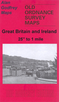
Southampton West 1908

Southampton West in 1908 in a fascinating series of reproductions of old Ordnance Survey plans in the Alan Godfrey Editions, ideal for anyone interested in the history of their neighbourhood or family. Southampton is covered by three titles. Few areas have changed more comprehensively than this map, for in 1908 the tide still came up to the western shore and almost up to the station. This land was infilled as part of the Western Docks project between 1927 and 1934. The map shows the area from French Street northward to Polygon Road, and westward to Waterloo Road. Though much of the map was mud and sand in 1908, with several creeks, there is still much of interest, including Bugle Street, St Michael`s church, Western Esplanade, Corporation Baths, West Quay, Lansdowne Hill,
Polygon, West Marlands (before the Civic Centre was built), West Park, Thorners Charity, Southampton West station, Fourposts, Blechynden, etc..About the Alan Godfrey Editions of the 25” OS SeriesSelected towns in Great Britain and Ireland are covered by maps showing the extent of urban development in the last decades of the 19th and early 20th century. The plans have been taken from the Ordnance Survey mapping and reprinted at about 15 inches to one mile (1:4, 340). On the reverse most maps have historical notes and many also include extracts from contemporary directories. Most maps cover about one mile (1.6kms) north/south, one and a half miles (2.4kms) across; adjoining sheets can be combined to provide wider coverage.FOR MORE INFORMATION AND A COMPLETE LIST OF ALL AVAILABLE
TITLES PLEASE CLICK ON THE SERIES LINK.
RIP - This product is no longer available on our network. It was last seen on 25.09.2019

This page now acts as a permanent archive for this product. Add more information using the comments box below to ensure it can still be found by future generations.

Use our search facility to see if it is available from an alternative contributor.
  • External links may include paid for promotion
  • Availability: Out Of Stock
  • Supplier: Stanfords
  • SKU: 9781847840752
Availability: In Stock
£3.50

Product Description

Southampton West in 1908 in a fascinating series of reproductions of old Ordnance Survey plans in the Alan Godfrey Editions, ideal for anyone interested in the history of their neighbourhood or family. Southampton is covered by three titles. Few areas have changed more comprehensively than this map, for in 1908 the tide still came up to the western shore & almost up to the station. This land was infilled as part of the Western Docks project between 1927 & 1934. The map shows the area from French Street northward to Polygon Road, & westward to Waterloo Road. Though much of the map was mud & sand in 1908, with several creeks, there is still much of interest, including Bugle Street, St Michael`s church, Western Esplanade, Corporation Baths, West Quay, Lansdowne Hill, Polygon, West Marlands (before the Civic Centre was built), West Park, Thorners Charity, Southampton West station, Fourposts, Blechynden, etc.. About the Alan Godfrey Editions of the 25” OS Series Selected towns in Great Britain & Ireland are covered by maps showing the extent of urban development in the last decades of the 19th & early 20th century. The plans have been taken from the Ordnance Survey mapping & reprinted at about 15 inches to one mile (1:4, 340). On the reverse most maps have historical notes & many also include extracts from contemporary directories. Most maps cover about one mile (1.6kms) north/south, one & a half miles (2.4kms) across; adjoining sheets can be combined to provide wider coverage.FOR MORE INFORMATION & A COMPLETE LIST OF ALL AVAILABLE TITLES PLEASE CLICK ON THE SERIES LINK.

Reviews/Comments

Add New

Price History

Vouchers

No voucher codes found.
Do you know a voucher code for this product or supplier? Add it to Insights for others to use.

Facebook

Jargon Buster

Contemporary - Modern era design
Contemporary - A design reference to indicate post war modern design
Mud - A combination of water and soil/clay/silt. Oftern brown in colour
History - Anything that happens in the past. An acedemic subject.
Road - a manmade lane or a path that is used to speed up travel.
Contemporary - An object that is living in the same time.
Ideal - Something that satisfies a perfect criteria.
Family - A group of people that live together made up from parents and children.

Supplier Information

Stanfords
Stanfords was established in 1853 and opened their iconic Covent Garden flagship store in 1901. They have become the top retailer of maps, travel books and accessories in the UK and arguably offer the largest selection of maps and travel books worldwide. Famous names such as Captain Robert Falcon Scott, Ranulph Fiennes and Michael Palin have purchased from Stanfords. They now have a shop in Bristol and both stores together with other venues operate a calendar of events including talks, book signings and exhibitions. As a specialist map retailer, the map selection is comprehensive and includes road maps, street maps and walking maps from worldwide destinations, as well as a selection of world atlases and wall maps. Books include travel guides and travel literature. Stanfords also stock globes, from miniatures made of blue marble to magnificent floor-standing globes. The website features a selection of interesting articles on travel topics.
Page Updated: 2023-11-12 20:15:36

Community Generated Product Tags

Oh No! The productWIKI community hasn't generated any tags for this product yet!
Menu