
 United Kingdom
 France
 Germany
 Netherlands
 Sweden
 USA
USA
 Italy
Italy
 Spain
Spain
More From Contributor


Shooters Hill 1914
Shooters Hill in 1914 in a fascinating series of reproductions of old Ordnance Survey plans in the Alan Godfrey Editions, ideal for anyone interested in the history of their neighbourhood or family. Three versions for this area have been published, stretching from the Brook Hospital eastward to Oxleas Wood and Woodlands Farm, and from Genesta Road, Plumstead southward to Severndroog Castle, an area dominated by the old Roman Road now largely followed by Shooters Hill Road. Other features include Herbert Hospital, Shrapnel Barracks, Royal Military Academy, tramways, and some of the southern streets of Woolwich and Plumstead, including part of Herbert Road, Cantwell Road and Woolwich Common. The 1866 map has on the reverse a six-inch to the mile map, Kent Sheet 2SW of 1894,
giving a good picture of a wider area, including Charlton, Kidbroke, Woolwich and part of Plumstead. The 1894 and 1914 maps have extracts from street directories. About the Alan Godfrey Editions of the 25” OS Series:Selected towns in Great Britain and Ireland are covered by maps showing the extent of urban development in the last decades of the 19th and early 20th century. The plans have been taken from the Ordnance Survey mapping and reprinted at about 15 inches to one mile (1:4, 340). On the reverse most maps have historical notes and many also include extracts from contemporary directories. Most maps cover about one mile (1.6kms) north/south, one and a half miles (2.4kms) across; adjoining sheets can be combined to provide wider coverage.FOR MORE INFORMATION AND A COMPLETE LIST OF
ALL AVAILABLE TITLES PLEASE CLICK ON THE SERIES LINK.

Product Description
Reviews/Comments
Add New
Intelligent Comparison
Archived Product

Shooters Hill 1894 Stanfords
£3.50
Archived Product

Shooters Hill 1866 Stanfords
£3.50
Archived Product
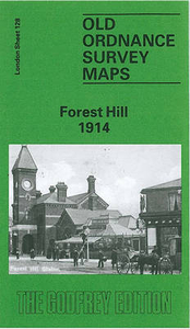
Forest Hill 1914 Stanfords
£3.50
Archived Product

Buckhurst Hill 1914 Stanfords
£3.50
Vouchers
No voucher codes found.
Do you know a voucher code for this product or supplier? Add it to Insights for others to use.
Do you know a voucher code for this product or supplier? Add it to Insights for others to use.
 Denmark