More From Contributor

£5.00
This is a beautifully illustrated cut-paper souvenir, featuring San Francisco`s most important sights. Bring San Francisco to life with this amazing three-dimensional expanding city skyline. This cut-paper guide unfolds to a length of 1.5 metres & features the most important sights in San Francisco, such as the Golden Gate Bridge, Alcatraz Isl&, Fisherman`s Wharf, the AT&T Park & the San Francisco Museum of Modern Art. Presented in a beautiful slipcase, this is the perfect souvenir or gift for anyone wishing to remember a trip to this fantastic city. The skyline is presented in a beautiful slipcase & unfolds to a length of 1.5-metres. Featuring the most important sights in San Francisco & a map showing their locations around the city, this is the perfect alternative to a postcard. It is an ideal gift, souvenir or impulse purchase. It is part of a series of city skylines. Previous titles include New York, Washington, D.C., London, Paris, Rome & Berlin. ...
Archived Product
£12.99
San Francisco in the Michelin Red Guides series; hotel & restaurant guides that have an unparalleled reputation for reliability & consistency, making extensive use of keyed information to provide detailed & concise reviews. Guides are predominantly intended for the markets they are reviewing &, as such, are more often than not written in the native language (s) of their featured destination, that said, most foreign language guides do come with a range of English language introductory & explanatory information such as thorough details on how to use the guide & a description of its symbol classifications. The obvious exceptions to this structure are locations which already have English as their official language. Guides feature hundreds of hotels and/or restaurants & rate them according to the time honoured Michelin standards. Reviews are arranged alphabetically by location & introduce places & establishments, providing you with details of other relevant Michelin publications, situating the businesses & detailing facilities & services, as well as the all important price range. Establishment descriptions look at the atmosphere, décor/style, character & specialities of each hotel/restaurant, marking them with levels of comfort. Hotels & restaurants are regularly & anonymously visited by Michelin inspectors, who experience their stay at each concern as would an ordinary customer. Reader’s comments are an additional valuable source of information when independently compiling each guide. Guides aim to offer a selection of the best hotels & restaurants for comfort & price within each category. The criterion for each establishment’s classification is consistent, irrespective of location. Guides include additional information such as establishment locator maps, European telephone dialing codes, introductory vocabulary & distance charts. ...
Archived Product
£4.00
Distinctively San Francisco in a series of City Map/ Guides from Herb Lester Associates with 40 recommendations offering something distinctive about the city, its history, its location & its inhabitants from Goldrush to post-dotcom. Ranging from shops & taquerias to museums, some are perhaps obvious like the Golden Gate Park or Alcatraz, but all show the city ...
Archived Product
£4.00
Distinctively San Francisco in a series of City Map/ Guides from Herb Lester Associates with 40 recommendations offering something distinctive about the city, its history, its location & its inhabitants from Goldrush to post-dotcom. Ranging from shops & taquerias to museums, some are perhaps obvious like the Golden Gate Park or Alcatraz, but all show the city’s unique flavour. Maps in this series are an eclectic selection of quirky titles designed to illuminate particular aspects of a city or a district. Each title lists publishers’ recommendations, ranging from the already famous attractions to little gems known only to the well informed locals, all with brief descriptions &, where appropriate, contact details. Accompanying maps are designed to highlight the locations of the recommended places rather than to provide an accurate presentation of the street network. To see other titles in this series please click on the series link. ...
Archived Product
£29.95
One of the maps in the topographic survey of Peru from the country’s national survey organization, Instituto Geográfico Nacional. Contours are at 25m intervals & colouring/symbols indicate different types of terrain & vegetation. Some of the maps may contain small blank spaces representing as yet unmapped areas. Each sheet covers 30’ latitude by 30’ longitude. The maps have a 1km UTM grid & margin ticks for latitude & longitude at intervals of 1’. Publication dates vary; most maps were published in 1960s to 1990s, with some sheets revised more recently. Map legend is in Spanish only, except in the more recent editions which also include English. ...
Archived Product
£6.50
Topographic coverage of mainland Spain at 1:25, 000 published by the Centro Nacional de Información Geograficá, the country’s civilian survey organization. The maps have contours at 10m intervals & colouring and/or graphics to show different types of vegetation or land use. Boundaries of national parks & other protected areas are marked. In addition to all the usual information shown on topographic maps at this scale, detailed presentation of the road & rail networks, rural tracks & paths, etc, the maps also show campsites. The maps have a 1-km UTM grid, with margin ticks for latitude & longitude at 1` intervals. Map legend is in Spanish only.PLEASE NOTE: our grid for the whole of Spain is in preparation
- in the meantime, for areas other than those shown on the attached grid please use CNIG’s topographic survey at 1:50, 000 by searching for ‘SI00000832’. Each 25K map covers one quarter of the corresponding 50K map, with the numbering system: I = NW quarter, II = NE quarter, III = SW quarter & IV = SE quarter. CNIG maps in the Provincial Road Maps series at 1:200, 000 are overprinted with the grid for the 1:50, 000 survey & can be used to see the area covered by each 50K or 25K title in more detail. To see the list of titles in this series please click on the series grid
- for map numbers not yet listed on our website please contact us by email.

...
Archived Product
£11.99
San Gimignano
- Colle Val d` Elsa – Poggibonsi area at 1:25, 000 in a series of hiking maps from Edizioni Multigraphic covering
...
Archived Product
£12.99
Contoured, GPS compatible map of one of Tuscany’s most visited areas, with hiking & mountain bike routes, plus on the reverse street plans of San Gimignano & Volterra, recommendations for rural accommodation, etc. The main map covers the area at 1:25, 000 & has contours at 25m intervals. An overprint highlights numerous waymarked hiking trails, cross-referenced to a list of recommended routes. The map indicates picturesque towns & villages & highlights various places of interest & facilities, including campsites. UTM grid is at 1km intervals. On the reverse are two large street plans of San Gimignano (1:3, 000) & Volterra (1:4, 500), both annotated with main sights & indexed. Unusually for street plans, both are contoured to show the topography of these interesting towns. Also included are historical notes plus lists of recommended accommodation. Map legend & all the notes include English. ...
Archived Product
£6.50
San Gimignano & Volterra, two of Tuscany’s most picturesque & popular tourist destinations, on an indexed street plan from Litografia Artistica Cartografica in their Globalmap imprint, presenting the two towns at 1:2, 500 & 1:3, 000 respectively. The plans have very clear cartography & large, easy to read print. Main traffic routes to the centre are highlighted, with car prominently marked. Given the topography of these towns, streets with steps are shown &, unusually for street plans, contour lines at 10m intervals are also printed. Each plan highlights monuments including historic buildings, churches, museums, etc: 30 in San Gimignano & 31 in Volterra. Several famous buildings are also shown by small drawings. Both plans are indexed & also provide lists of useful addresses. There is no map legend as all the information of self-explanatory. The headings in the index include English. ...
Archived Product
£10.95
High quality relief shaded topographic trekking map. Trails are clearly marked with distances between junctions shown in miles. Clear contours at 80ft intervals, vegetation information & symbols to show the location of various features & facilities of use to hikers, such as ranger stations & campsites. To ensure durability the map is printed upon special waterproof plastic paper.

Includes::
latitude & longitude & UTM grid markings

...
Archived Product

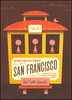
San Fransisco Insight Select Guide

San Francisco in the Select Guide series offers a more exclusive handy-sized city break guide from the publisher Insight, with a collection of over 100 inspiring ideas for your chic-urban stay, including plenty of secret gems and off-beat haunts designed for informed, experienced travellers and those on a repeat visit but looking for fresh insights. All recommends have been carefully selected by a local writer who knows the city inside out and can sincerely recommend great places to eat, drink, relax and explore.The guide is constructed with an introductory city overview and then an
RIP - This product is no longer available on our network. It was last seen on 25.09.2019

This page now acts as a permanent archive for this product. Add more information using the comments box below to ensure it can still be found by future generations.

Use our search facility to see if it is available from an alternative contributor.
  • Availability: Out Of Stock
  • Supplier: Stanfords
  • SKU: 9789812822734
Availability: In Stock
£9.99

Product Description

San Francisco in the Select Guide series offers a more exclusive handy-sized city break guide from the publisher Insight, with a collection of over 100 inspiring ideas for your chic-urban stay, including plenty of secret gems & off-beat haunts designed for informed, experienced travellers & those on a repeat visit but looking for fresh insights. All recommends have been carefully selected by a local writer who knows the city inside out & can sincerely recommend great places to eat, drink, relax & explore. The guide is constructed with an introductory city overview & then an

Reviews/Comments

Add New

Intelligent Comparison

Oooops!
We couldn't find anything!
Perhaps this product's unique.... Or perhaps we are still looking for comparisons!
Click to bump this page and we'll hurry up.

Price History

Vouchers

No voucher codes found.
Do you know a voucher code for this product or supplier? Add it to Insights for others to use.

Facebook

Jargon Buster

Chic - A design term meaning smart or stylish
Exclusive - Something that is not including other things.

Supplier Information

Stanfords
Stanfords was established in 1853 and opened their iconic Covent Garden flagship store in 1901. They have become the top retailer of maps, travel books and accessories in the UK and arguably offer the largest selection of maps and travel books worldwide. Famous names such as Captain Robert Falcon Scott, Ranulph Fiennes and Michael Palin have purchased from Stanfords. They now have a shop in Bristol and both stores together with other venues operate a calendar of events including talks, book signings and exhibitions. As a specialist map retailer, the map selection is comprehensive and includes road maps, street maps and walking maps from worldwide destinations, as well as a selection of world atlases and wall maps. Books include travel guides and travel literature. Stanfords also stock globes, from miniatures made of blue marble to magnificent floor-standing globes. The website features a selection of interesting articles on travel topics.
Page Updated: 2023-11-12 20:15:36

Community Generated Product Tags

Oh No! The productWIKI community hasn't generated any tags for this product yet!
Menu