More From Contributor
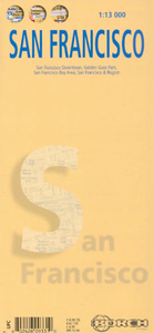
£11.99
Covering the most popular Bay Area biking destinations, this is the biker's guide to finding the best rides throughout the region. Moon Outdoors Bay Area Biking guides bikers through the East Bay, the North Bay, the South Bay & surrounding areas with rides alongside the Pacific Coast & through lush state parks. This book describes both road & trails, outlining those which are family friendly, best for wildlife viewing, & best for wine-tasting to challenging single-track rides. Complete with elevation charts, route maps & options to extend or shorten each route, as well as bike shops, riding clubs & bike organizations throughout the Bay Area, Moon Bay Area Biking has the details on the best Bay Area biking available. ...
Archived Product
£10.99
San Francisco in the Michelin Red Guides series; hotel & restaurant guides that have an unparalleled reputation for reliability & consistency, making extensive use of keyed information to provide detailed & concise reviews. Guides are predominantly intended for the markets they are reviewing &, as such, are more often than not written in the native language (s) of their featured destination, that said, most foreign language guides do come with a range of English language introductory & explanatory information such as thorough details on how to use the guide & a description of its symbol classifications. The obvious exceptions to this structure are locations which already have English as their official language. Guides feature hundreds of hotels and/or restaurants & rate them according to the time honoured Michelin standards. Reviews are arranged alphabetically by location & introduce places & establishments, providing you with details of other relevant Michelin publications, situating the businesses & detailing facilities & services, as well as the all important price range. Establishment descriptions look at the atmosphere, d ...
Archived Product
£11.99
San Francisco in the Michelin Red Guides series; hotel & restaurant guides that have an unparalleled reputation for reliability & consistency, making extensive use of keyed information to provide detailed & concise reviews. Guides are predominantly intended for the markets they are reviewing &, as such, are more often than not written in the native language (s) of their featured destination, that said, most foreign language guides do come with a range of English language introductory & explanatory information such as thorough details on how to use the guide & a description of its symbol classifications. The obvious exceptions to this structure are locations which already have English as their official language. Guides feature hundreds of hotels and/or restaurants & rate them according to the time honoured Michelin standards. Reviews are arranged alphabetically by location & introduce places & establishments, providing you with details of other relevant Michelin publications, situating the businesses & detailing facilities & services, as well as the all important price range. Establishment descriptions look at the atmosphere, d ...
Archived Product
£7.99
San Francisco Bay Area in a series of Rand Mc Nally’s regional road maps covering the environs of main US cities. Coverage extends north to include Napa & Sonoma valleys, & southwards beyond San Jose to the start of Highway 1, Santa Cruz, Capitola, Watsonville & Gilroy. Additional panels provide street plans of downtown San Francisco, Oakland & San Jose; street plans with access to the San Francisco the Oakland airports; plus a road map of a wider part of central California including Sacramento & Monterey. Other communities covered include Berkeley, Freemont, Paolo Alto, Petaluma, Pleasanton, Redwood City, San Mateo, Santa Clara, Santa Rosa, Sausalito & Sunnyvale. Maps in this series present the road network on a clear background with no relief shading to show the area’s topography, but with national or state parks, forests & other protected areas indicated by colouring. Roads are numbered and/or named, showing toll highways, exit numbers of interchanges, services & rest areas. Local airports are marked, but railways & other urban transport lines are not included unless specifically indicated in the individual description. Each town is presented in a different colour, providing those unfamiliar with the region a very clear picture of the area. Various places of interest & facilities are highlighted, including cultural & historical sites, educational institutions, sport & recreational facilities, etc. Each title is indexed. Several maps also include enlargements of the downtown area, plans of international airports, a mileage & driving times diagram for a much wider region than covered by the main map, etc
- for more information please see the individual descriptions. To see all the titles in this series please click on the series link.
...
Archived Product
£14.95
Spiral bound, 120-page, map/guide to the cycle route around the San Francisco Bay, including the northern section along the San Pablo Bay, returning to the city across the Golden Gate Bridge. The route is presented on clear maps & street plans at 1:75, 000, indicating sections without or the density of motorized traffic, types of road surface, & gradient markings. A wide range of symbols indicate accommodation (hotels, guesthouses, youth hostels, campsites or tent sites), restaurants & shopping facilities, tourist information centres, bike workshops & rentals, covered or lockable bike stands, as well as various places of interest & recreational facilities. The maps are accompanied by detailed descriptions of the route & places of interest along it. Each section is designed to be accessible from local public transport. The guide also

Includes::
an introductory section about the history of the city itself. Verlag Esterbauer are Europe

...
Archived Product
£6.50
San Francisco on an indexed street plan from Global Graphics with in the reverse detailed enlargements for its downtown area, Fisherman’s Wharf & the Golden Gate Park. On one side is a street plan at 1:19, 000 of the whole city within its municipal boundary. The map shows main traffic arteries across the city, one way streets, & the route of the 49 Mile Scenic Drive. Also marked are BART lines with stations & cable car lines. On the reverse three large panel present in greater detail the downtown area (with streets annotated with block numbers for easier identification of addresses), plus Fisherman’s Wharf & Golden Gate Park, both with symbols indicating car parks, restaurants, bars, public toilets, recreational facilities, etc. ...
Archived Product
£3.95
Wonderful double-sided street plan of San Francisco from Guy Fox, perfectly tailored for children, highlighting major attractions, museums & landmarks, with stickers to mark them off as you go along. The accompanying index gives websites & phone numbers, & indicates free entry for children, great views of the city, etc. The map also shows the city ...
Archived Product
£11.99
San Francisco in the City Guide Series from Lonely Planet, profiling in comprehensive detail the history, major sights, best places to eat, nightlife, accommodation & shopping possibilities of an extensive range of cities worldwide. Frank & informal in style, the guides are renowned for their appeal to independent travellers & are written & researched by local authors. Each guide is divided into 11 main sections
- Getting Started, Background, Neighbourhoods, Shopping, Eating, Drinking & Nightlife, The Arts, Sports & Activities, Gay & Lesbian, Sleeping & Day Trips & Excursions. The Background section details the history, arts, architecture, environment, media, fashion & government & politics of the city. An
...
Archived Product
£13.99
San Francisco in the City Guide Series from Lonely Planet, profiling in comprehensive detail the history, major sights, best places to eat, nightlife, accommodation & shopping possibilities of an extensive range of cities worldwide. Frank & informal in style, the guides are renowned for their appeal to independent travellers & are written & researched by local authors. Each guide is divided into 11 main sections
- Getting Started, Background, Neighbourhoods, Shopping, Eating, Drinking & Nightlife, The Arts, Sports & Activities, Gay & Lesbian, Sleeping & Day Trips & Excursions. The Background section details the history, arts, architecture, environment, media, fashion & government & politics of the city. An
...
Archived Product
£14.99
Lonely Planet: The world's leading travel guide publisher Lonely Planet San Francisco is your passport to all the most relevant & up-to-date advice on what to see, what to skip, & what hidden discoveries await you. Loll in Golden Gate Park, stroll across the iconic Golden Gate Bridge, get spooked at Alcatraz, ride a legendary cable car, maneuver down the crookedest street in the world, or take a day trip to wine-soaked Napa Valley; all with your trusted travel companion. Get to the heart of San Francisco & begin your journey now! Inside Lonely Planet's San Francisco Travel Guide: Full-color maps & images throughout. Highlights & itineraries show you the simplest way to tailor your trip to your own personal needs & interests. Insider tips save you time & money, & help you get around like a local, avoiding crowds & trouble spots. Essential info at your fingertips
- including hours of operation, phone numbers, websites, transit tips, & prices. Honest reviews for all budgets
- including eating, sleeping, sight-seeing, going out, shopping, & hidden gems that most guidebooks miss. Cultural insights give you a richer & more rewarding travel experience
- including history, music, art, architecture, literature, cinema, cuisine, wine, & more. Free, convenient pull-out San Francisco map (included in print version), plus over 38 full-color maps. Useful features
- including Top Itineraries, Walking Tours, With Kids, What's New, Month by Month (annual festival calendar), & Day Trips. Coverage of Golden Gate Park, Fisherman's Wharf, downtown, North Beach, Chinatown, Nob Hill, the Mission, the Haight, & the Castro, as well as Berkeley, Muir Woods, Sausalito, Napa & Sonoma Wine Country, & more The Perfect Choice: Lonely Planet San Francisco, our most comprehensive guide to San Francisco, is perfect for those planning to both explore the top sights & take the road less travelled. Looking for just the highlights of San Francisco? Check out Lonely Planet's Pocket San Francisco, a handy-sized guide focused on the can't-miss sights for a quick trip. Looking for more extensive coverage? Check out Lonely Planet's California guide for a comprehensive look at all the state has to offer, or Lonely Planet's Discover California, a photo-rich guide to the state's most popular attractions. Authors: Written & researched by Lonely Planet, Alison Bing, Sara Benson, & John A Vlahides. About Lonely Planet: Started in 1973, Lonely Planet has become the world's leading travel guide publisher with guidebooks to every destination on the planet, as well as an award-winning website, a suite of mobile & digital travel products, & a dedicated traveler community. Lonely Planet's mission is to enable curious travelers to experience the world & to truly get to the heart of the places they find themselves in. Trip Advisor Travelers' Choice Awards 2012 & 2013 winner in Favorite Travel Guide category ' Lonely Planet guides are, quite simply, like no other.'
- The New York Times ' Lonely Planet. It's on everyone's bookshelves; it's in every traveller's hands. It's on mobile phones. It's on the Internet. It's everywhere, & it's telling entire generations of people how to travel the world.' -Fairfax Media (Australia).


...
Archived Product

San Francisco Borch

Very clear, indexed street plan of San Francisco from Borch on durable laminated paper, showing downtown San Francisco at 1:13, 000, with a plan of Golden Gate Park and general road map of the Bay Area on the reverse. Detail includes one-way streets, notable buildings, public buildings, shopping malls, pedestrian zones, tram lines, railway lines and stations, and ferry links. Symbols denote information centres, monuments, places of worship, theatres, sites of interest, car parks, hospitals, hotels, bus stations and post offices.The main map coverage extends from the South Beach Harbour westwards to Golden Gate Bridge, and from Fisherman’s wharf southwards to Potrero Hill district. The Golden Gate Park inset is at the same scale. The Bay Area road map is at 1:400, 000
and shows the main road and rail communications. A more detailed map at 1:150, 000 shows the city from Golden Gate Bridge to the airport. Thirty recommended attractions are highlighted on the maps. All the maps are indexed for streets and locations of interest, and the multilingual map legend includes English.
RIP - This product is no longer available on our network. It was last seen on 25.09.2019

This page now acts as a permanent archive for this product. Add more information using the comments box below to ensure it can still be found by future generations.

Use our search facility to see if it is available from an alternative contributor.
  • External links may include paid for promotion
  • Availability: Out Of Stock
  • Supplier: Stanfords
  • SKU: 9783866093317
Availability: In Stock
£8.99

Product Description

Very clear, indexed street plan of San Francisco from Borch on durable laminated paper, showing downtown San Francisco at 1:13, 000, with a plan of Golden Gate Park & general road map of the Bay Area on the reverse. Detail

Includes::
one-way streets, notable buildings, public buildings, shopping malls, pedestrian zones, tram lines, railway lines & stations, & ferry links. Symbols denote information centres, monuments, places of worship, theatres, sites of interest, car parks, hospitals, hotels, bus stations & post offices. The main map coverage extends from the South Beach Harbour westwards to Golden Gate Bridge, & from Fisherman’s wharf southwards to Potrero Hill district. The Golden Gate Park inset is at the same scale. The Bay Area road map is at 1:400, 000 & shows the main road & rail communications. A more detailed map at 1:150, 000 shows the city from Golden Gate Bridge to the airport. Thirty recommended attractions are highlighted on the maps. All the maps are indexed for streets & locations of interest, & the multilingual map legend

Includes::
English.

Reviews/Comments

Add New

Price History

Vouchers

No voucher codes found.
Do you know a voucher code for this product or supplier? Add it to Insights for others to use.

Facebook

Jargon Buster

Paper - A thin sheet mainly used for writing. Available in a variety of colours. Made mainly from wood pulp.
Beach - An area on the coast consisting of a sandy or pebbled area
Car - A machine used for transport which runs on roads
Road - a manmade lane or a path that is used to speed up travel.
Tram - A large vehicle common in cities for public transport, also known as a cable car.
Laminated - A thin layer of plastic that gives a coating and shine to a material.

Supplier Information

Stanfords
Stanfords was established in 1853 and opened their iconic Covent Garden flagship store in 1901. They have become the top retailer of maps, travel books and accessories in the UK and arguably offer the largest selection of maps and travel books worldwide. Famous names such as Captain Robert Falcon Scott, Ranulph Fiennes and Michael Palin have purchased from Stanfords. They now have a shop in Bristol and both stores together with other venues operate a calendar of events including talks, book signings and exhibitions. As a specialist map retailer, the map selection is comprehensive and includes road maps, street maps and walking maps from worldwide destinations, as well as a selection of world atlases and wall maps. Books include travel guides and travel literature. Stanfords also stock globes, from miniatures made of blue marble to magnificent floor-standing globes. The website features a selection of interesting articles on travel topics.
Page Updated: 2023-11-12 20:15:36

Community Generated Product Tags

Oh No! The productWIKI community hasn't generated any tags for this product yet!
Menu