
 United Kingdom
 France
 Germany
 Netherlands
 Sweden
 USA
USA
 Italy
Italy
 Spain
Spain
More From Contributor


Russia Pysical Wall Map (2-sheet Set)
Beautiful, very detailed physical wall map of Russia, including all the ex-USSR countries in Europe and central Asia, plus Mongolia. Bold altitude colouring vividly presents the topography of the region. Communications network shows main trunk roads, railways, including the whole of the Trans-Siberian railway and the spur across Mongolia to Beijing, airports and ferry routes. Within Russian Federation internal administrative boundaries are marked. All place names are in Cyrillic alphabet. Albers' Conical Equal-Area projection is used and latitude and longitude lines are drawn at 4
Product Description
Reviews/Comments
Add New
Intelligent Comparison
Archived Product
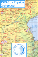
Israel Physical Map 2-Sheet Set Stanfords
£17.99
Vouchers
No voucher codes found.
Do you know a voucher code for this product or supplier? Add it to Insights for others to use.
Do you know a voucher code for this product or supplier? Add it to Insights for others to use.
 Denmark