More From Contributor

£3.50
Renfrew in 1895 in a fascinating series of reproductions of old Ordnance Survey plans in the Alan Godfrey Editions, ideal for anyone interested in the history of their neighbourhood or family. The map covers most of the small town of Renfrew, extending southward to Moorpark. Features include White Cart Water, Renfrew Forge & Steel Works, Albert Cabinet Works, GSWR Renfrew Branch with station, Town Hall, town centre, Home Farm, Millburn Bridge, Elderslie House, The King`s Inch, etc. On the reverse is a trade directory of Renfrew in 1896. About the Alan Godfrey Editions of the 25” OS Series: Selected towns in Great Britain & Ireland are covered by maps showing the extent of urban development in the last decades of the 19th & early 20th century. The plans have been taken from the Ordnance Survey mapping & reprinted at about 15 inches to one mile (1:4, 340). On the reverse most maps have historical notes & many also include extracts from contemporary directories. Most maps cover about one mile (1.6kms) north/south, one & a half miles (2.4kms) across; adjoining sheets can be combined to provide wider coverage.FOR MORE INFORMATION & A COMPLETE LIST OF ALL AVAILABLE TITLES PLEASE CLICK ON THE SERIES LINK. ...
Archived Product
£3.50
Renfrew North & Yoker in 1896 in a fascinating series of reproductions of old Ordnance Survey plans in the Alan Godfrey Editions, ideal for anyone interested in the history of their neighbourhood or family. The map covers the northern part of Renfrew around Meadowside Street, extending across the Clyde to Yoker. Features include Blythswood House, Black Cart Water, Engineering & Shipbuilding Works, London Works, Wharf station, Ferry Road Head, Yoker, Distillery, Lanarkshire & Dumbartonshire Railway, Glasgow Yoker & Clydebank Railway with Yoker station, southern outskirts of Clydebank, etc. On the reverse is a directory shipbuilders & ship finishers. About the Alan Godfrey Editions of the 25” OS Series: Selected towns in Great Britain & Ireland are covered by maps showing the extent of urban development in the last decades of the 19th & early 20th century. The plans have been taken from the Ordnance Survey mapping & reprinted at about 15 inches to one mile (1:4, 340). On the reverse most maps have historical notes & many also include extracts from contemporary directories. Most maps cover about one mile (1.6kms) north/south, one & a half miles (2.4kms) across; adjoining sheets can be combined to provide wider coverage.FOR MORE INFORMATION & A COMPLETE LIST OF ALL AVAILABLE TITLES PLEASE CLICK ON THE SERIES LINK. ...
Archived Product
£8.50
Street plan of Rennes, with an enlargement for the town centre, part of an extensive series covering French cities & towns from Blay-Foldex, the country’s largest, oldest & most experienced publisher of urban mapping. Blay plans include outer suburbs &, where appropriate, adjoining localities forming part of the urban agglomeration & provide brief descriptions of the town’s main sights, contact details for hotels & other places of interest, etc. The plans show one way streets, car parks & pedestrian zones. Important public buildings are clearly marked & identified. Blay street maps are usually double-sided & include an enlargement for the town centre & a street index with separate lists of “edifices publics”: main public buildings, places of worship, schools, sport facilities, stations, etc. Each of the outer suburbs or the adjoining localities, identified with its postcode, has a separate index. Many titles also provide a road map of the environs. All the text is in French only.PLEASE NOTE: to see the list of Blay-Foldex street plans of French towns & cities please click on the series link – the series description also

Includes::
a comparison between Blay & IGN street plans.

...
Archived Product
£12.99
Topographic survey of France at 1:25, 000 in IGN`s excellent TOP25 / Série Bleue series. All the maps are GPS compatible, with a 1km UTM grid plus latitude & longitude lines at 5’ intervals. Contours are at 5m intervals except for mountainous areas where the maps have contours at 10m intervals, vividly enhanced by hill shading & graphics for rocky terrain. Colouring with graphics indicates different types of vegetation or land use (deciduous or coniferous forests, moors, orchards, vineyards, etc). PLEASE NOTE: coverage of France at this scale is currently being revised – the format & the presentation of each title are indicated by the letters at the end of its Sheet Reference number (e.g. 0416ET, 3531ETR, 1923SB, etc.)MAPS WITH FULL TOURIST OVERPRINT & AN ENGLISH MAP LEGEND: all TOP25 maps & the SB editions of Série Bleue have an overprint highlighting waymarked walking trails including long-distance GR routes &, where appropriate, ski routes. Symbols indicate campsites, gîtes d’etape, refuges, equestrian centres & other recreational facilities or sites, tourist information centres, cultural heritage, etc. Towns & locations of particular interest are highlighted.- ET or OT = single-sided TOP25 map covering approx. 29x 21 km / 18x 13 miles.- ETR or OTR = waterproof & tear resistant TOP25 map covering the same area as the corresponding ET or OT number, but double-sided, printed on a smaller size sheet with a good overlap between the sides.- SB = Série Bleue map with full tourist overprint; these maps, first introduced in summer 2014, each cover approx. 29x 24km / 18x 15 miles.SÉRIE BLEUE maps with numbers ending in E (Est) or O (Ouest): most editions now indicate the GR routes, but do not show any other tourist information. Map legend is in French only. Each map covers approx. 14x 20km / 9x 12 miles. ...
Archived Product
£8.99
Map No. 115, Rennes
- Saint-Malo, at 1:100, 000, part of the TOP100 series from the Institut Géographique National (IGN). These
...
Archived Product
£6.99
Rennes Michelin Centenary Map-Pack, a set of two maps showing the area at 1:200, 000: a current road map from 2014 plus a reproduction from Michelin’s very first series of regional maps published between 1910 & 1924. The combination of the two maps shows not only how this area & its road network have developed but also provides an interesting comparison of the changes in the cartographic presentation over the past 100 years. Coverage

Includes::
Pontivy, Mayenne, Ploërmel, Laval & Château-Gontier. The 2014 map is indexed & has a map legend in French only. To see the full list of the titles available in this series please click on the series link.

...
Archived Product
£10.25
A 195km long cycle route along the Thuringian Forest. Detailed maps show the route & its variants & extensive information is conveyed by symbols, indicating road surface, campsites & other accommodation, repair workshops, recreational facilities, places of interest, etc. A list of various types of accommodation facilities is included.IMPORTANT
- PLEASE NOTE: ALL THE TEXT IN THIS TITLE IS GERMAN ONLY. MAP LEGEND

Includes::
ENGLISH, please see our sample image, & the information provided on the maps is sufficient to use this title without any knowledge of German, particularly in the absence of a similar product in English from other publishers. There is currently no English edition this title available in this series. About the series: All the titles have been meticulously researched & are highly regarded in their native Germany. Most titles, as indicated in their individual descriptions, also include a separate section listing selected accommodation, from hotels to campsites, youth hostels & rooms in private houses, all with addresses, telephone numbers & price range. Information on towns along each route

Includes::
a list of places of interest, with opening hours, etc. Several of the guides also have street plans.


...
Archived Product
£14.99
Rennsteig Cycle Route, a 210-km long cycle trail along the Thuringian Forest from Hörchel to Blankenstein, presented by the Verlag Esterbauer in a guide with maps at 1:50, 000 showing the route & its variants. Extensive information is conveyed by symbols, indicating road surface, campsites & other accommodation, repair workshops, recreational facilities, places of interest, etc. A list of various types of accommodation facilities is included.IMPORTANT
- PLEASE NOTE BEFORE ORDERING
- ALL THE TEXT IN THIS TITLE IS GERMAN ONLY. MAP LEGEND

Includes::
ENGLISH (please see our sample image) & the information provided on the maps is sufficient to use this title without any knowledge of German.ABOUT THE BIKELINE SERIES: all the titles have been meticulously researched & are highly regarded in their native Germany. Most titles, as indicated in their individual descriptions, also include a separate section listing selected accommodation, from hotels to campsites, youth hostels & rooms in private houses, all with addresses, telephone numbers & price range. Information on towns along each route

Includes::
a list of places of interest, with opening hours, etc. Several of the guides also have street plans. To see the list of other titles in the Bikeline series please click on the series link.


...
Archived Product
£5.99
Reno & Tahoe in the Moon Spotlight guide series; covering a range of specific local cities, districts, areas & regions in North, Central & South America & targeted at those seeking to travel to a specific area within a country. Each of the guides has been extracted in full from the relevant country Moon Handbook & individual titles focus on a particular city, region or notable area of the destination. Many of the guides in the series are unique in their coverage, although are limited in putting the destination into its wider geographical context that a more comprehensive guide would provide. Stylistically, Moon ...
Archived Product
£6.50
Reno & Sparks in Nevada on an indexed street plan from Rand Mc Nally in their extensive range of maps covering cities in the United States. Insets provide a more detailed plan of downtown Reno, plus a map of Reno & vicinity, including Lake Tahoe. Communities covered by this map include Black Springs, Golden Valley, Lemmon Valley, Panther Valley, South Hills, Spanish Springs, Sun Valley & Verdi. Rand Mc Nally street plans provide coverage of cities with their outer suburbs, clearly indicating main traffic arteries: highways (distinguishing between free & toll access), plus primary & secondary routes. Road numbers and/or names are clearly displayed & exit numbers are indicated. Locations of service & rest areas are marked & one way streets are shown. Longer streets are annotated with block numbers for easier identification of addresses. The maps show railway, bus &, where appropriate, metro stations. A range of symbols indicate various places of interest including cultural & academic institutions, various municipal facilities, golf courses, etc. The plans have extensive street indexes, supplemented by lists of points of interest, parks & recreational areas, shopping malls, stations, schools, etc. ...
Archived Product

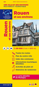
Rennes And Its Environs IGN Map

Rennes and its Environs in a series of detailed road maps at 1:80, 000 from the IGN, designed to highlight places of interest and recreational possibilities, with a city centre street plan and an enlargement of a selected hiking area.Cartography is an enlargement from 1:100, 000 to 1:80, 000 of the publisher’s highly popular TOP100 series, with very detailed presentation of the road network, including classification of local roads according to lanes, rest areas, access restrictions, etc. Railway lines are shown with stations. Topography is shown by relief shading, with spot heights and colouring for woodlands, vineyards, orchards, etc. Cycle tracks and long-distance GR routes are marked. A wide range of symbols indicate various places of interest and recreational facilities,
historical and cultural sites, golf courses, rock climbing, nature reserves, etc. Refuges and gîtes d’etape are marked, but no campsites. The maps have no geographical coordinates for GPS. Each title has an index of communes. Map legend includes English.A special feature of this series is the inclusion of a large city centre street plan and an enlargement of a particularly interesting recreational area. Presentation of these features varies, so please check the individual descriptions for more information.* IN THIS TITLE: a street plan of central Rennes highlighting main traffic arteries and indicating one way streets. Instead of an enlargement for a hiking area, an additional panel extends coverage to include the coast around St-Malo, shown at the same scale as the main map.
RIP - This product is no longer available on our network. It was last seen on 25.09.2019

This page now acts as a permanent archive for this product. Add more information using the comments box below to ensure it can still be found by future generations.

Use our search facility to see if it is available from an alternative contributor.
  • Availability: Out Of Stock
  • Supplier: Stanfords
  • SKU: 9782758524021
Availability: In Stock
£7.50

Product Description

Rennes & its Environs in a series of detailed road maps at 1:80, 000 from the IGN, designed to highlight places of interest & recreational possibilities, with a city centre street plan & an enlargement of a selected hiking area. Cartography is an enlargement from 1:100, 000 to 1:80, 000 of the publisher’s highly popular TOP100 series, with very detailed presentation of the road network, including classification of local roads according to lanes, rest areas, access restrictions, etc. Railway lines are shown with stations. Topography is shown by relief shading, with spot heights & colouring for woodlands, vineyards, orchards, etc. Cycle tracks & long-distance GR routes are marked. A wide range of symbols indicate various places of interest & recreational facilities, historical & cultural sites, golf courses, rock climbing, nature reserves, etc. Refuges & gîtes d’etape are marked, but no campsites. The maps have no geographical coordinates for GPS. Each title has an index of communes. Map legend

Includes::
English.A special feature of this series is the inclusion of a large city centre street plan & an enlargement of a particularly interesting recreational area. Presentation of these features varies, so please check the individual descriptions for more information.* IN THIS TITLE: a street plan of central Rennes highlighting main traffic arteries & indicating one way streets. Instead of an enlargement for a hiking area, an additional panel extends coverage to include the coast around St-Malo, shown at the same scale as the main map.

Reviews/Comments

Add New

Price History

Vouchers

No voucher codes found.
Do you know a voucher code for this product or supplier? Add it to Insights for others to use.

Facebook

Jargon Buster

GPS - Global Positioning System - Global position using satellites
Hiking - An outdoor activity envolving walking in nature
Network - A link and communication between things. Often computers or people.
Large - something that takes up more space than normal.
Road - a manmade lane or a path that is used to speed up travel.
Wide - Something with a large width.
Golf - A sport played on a large outside grass course, the aim to hit a small ball with a club into small holes.
Popular - Something that is admired and liked by many people.
Feature - An attribute that makes something stand out.
Individual - A single separate item or person.

Supplier Information

Stanfords
Stanfords was established in 1853 and opened their iconic Covent Garden flagship store in 1901. They have become the top retailer of maps, travel books and accessories in the UK and arguably offer the largest selection of maps and travel books worldwide. Famous names such as Captain Robert Falcon Scott, Ranulph Fiennes and Michael Palin have purchased from Stanfords. They now have a shop in Bristol and both stores together with other venues operate a calendar of events including talks, book signings and exhibitions. As a specialist map retailer, the map selection is comprehensive and includes road maps, street maps and walking maps from worldwide destinations, as well as a selection of world atlases and wall maps. Books include travel guides and travel literature. Stanfords also stock globes, from miniatures made of blue marble to magnificent floor-standing globes. The website features a selection of interesting articles on travel topics.
Page Updated: 2023-11-12 20:15:36

Community Generated Product Tags

Oh No! The productWIKI community hasn't generated any tags for this product yet!
Menu