
 United Kingdom
 France
 Germany
 Netherlands
 Sweden
 USA
USA
 Italy
Italy
 Spain
Spain
More From Contributor


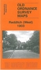


Redditch West 1903
Redditch West in 1903 in a fascinating series of reproductions of old Ordnance Survey plans in the Alan Godfrey Editions, ideal for anyone interested in the history of their neighbourhood or family. Selected towns in Great Britain and Ireland are covered by maps showing the extent of urban development in the last decades of the 19th and early 20th century.In this title: the map covers the western part of Redditch, stretching from Unicorn Hill westward to Foxlydiate Wood, with the Fox & Goose Inn at the western edge of the map. Features include the railway with station, Pitcher Oak Wood, Ferny Hill Brickworks, cemetery; Victoria needle works, Easemore needle works, Windsor Mills, Standard Works, Ashleigh Works, all representing the town's major needle and fishing tackle industry;
iron foundry, Bates Hill, Unicorn Hotel, Bridley Moor Farm. The first half of an 1896 directory is included on the reverse.About the Alan Godfrey Editions of the 25
iron foundry, Bates Hill, Unicorn Hotel, Bridley Moor Farm. The first half of an 1896 directory is included on the reverse.About the Alan Godfrey Editions of the 25
Product Description
Reviews/Comments
Add New
Intelligent Comparison
Archived Product

Redditch West 1903 Stanfords
£3.50
Archived Product
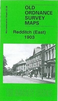
Redditch East 1903 Stanfords
£3.50
Archived Product

Dalkeith West 1905 Stanfords
£3.50
Vouchers
No voucher codes found.
Do you know a voucher code for this product or supplier? Add it to Insights for others to use.
Do you know a voucher code for this product or supplier? Add it to Insights for others to use.
 Denmark