
 United Kingdom
 France
 Germany
 Netherlands
 Sweden
 USA
USA
 Italy
Italy
 Spain
Spain
More From Contributor


Puebla City Plan
Detailed street map of Puebla City, distinguishing several types of roads from divided highways to minor roads. Shows numbered highways, districts, airports, public buildings, hospitals, markets, churches, archaeological sites, points of interest and landmarks eg. museums, libraries, monuments, schools, golf courses, sports arenas, parks, and state and municipal boundaries. Indexed for streets and places. Legend in Spanish.
Product Description
Reviews/Comments
Add New
Intelligent Comparison
Archived Product
Puebla City Plan Stanfords
£12.99
Archived Product
Dublin City Plan Stanfords
£2.99
Archived Product
Budapest City Plan Stanfords
£5.50
Archived Product
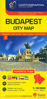
Budapest City Plan Stanfords
£6.50
Vouchers
No voucher codes found.
Do you know a voucher code for this product or supplier? Add it to Insights for others to use.
Do you know a voucher code for this product or supplier? Add it to Insights for others to use.
 Denmark