More From Contributor
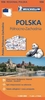
£5.99
North-Western Poland at 1:300, 000 in a series of four large indexed touring maps at 1:300, 000 from Michelin, with coverage extending south beyond Poznan & east to Olsztyn. On the reverse are city maps highlighting principal traffic arteries & naming main streets in Szczecin, Bydgoszcz, Poznan & the Gdansk – Sopot – Gdynia conurbation. Also provided is a distance table for the whole country. Michelin’s touring maps of Poland show road network graded into seven types, indicate road width, give driving distances on national & regional roads, & show locations of fixed speed radars. Railway lines are shown with stations & local airports are marked. Topography is indicated by names of mountain ranges & peaks with heights, plus colouring for national parks or regional landscape parks & forested areas. Small symbols mark various places of interest, although the maps are designed primarily for driving rather than for planning sightseeing trips. The maps have latitude & longitude lines at intervals of 15’. The index is on the reverse, together with city maps of main towns. Map legend

Includes::
English. To see the list of all the titles in this series please click on the series link.

...
Archived Product
£4.99
Poland in the Pocket Guide series from Berlitz; a collection of handy, pocket-sized guides dedicated to an extensive range of cities, regions & countries worldwide. Written in narrative form, individual guides explore the history, main sights & attractions, food & drink, accommodation & local culture of the destination in detail. Each Berlitz pocket guide has a similar format, with colour-coded sections helping readers locate information quickly in addition to distinctive chapters exploring the city or region. An introduction outlines the destination for visitors & a section dedicated to 'A Brief History' actually explores the area in relative depth. A where to go chapter is organized by region & city & is written in prose form with references to individual sites highlighted in bold for clarity. There are also further suggestions on where & when to eat. Recommendations for leisure activities in the region, including sport, nightlife & shopping, are also provided & tailored accordingly for each destination. Handy travel tips are listed alphabetically in a dedicated section, providing practical guidance & helping visitors make the most of their stay. The main hotels, particularly for cities, are also listed in an accommodation section, offering a brief overview with approximate price bandings & relevant contact details. ...
Archived Product
£6.99
Berlitz Pocket Guide Poland combines snappy text with full-colour photography to highlight the very best that this remarkable country has to offer. The Where To Go chapter details all the key sights that you will not want to miss; from constantly evolving capital Warsaw, to the port town of Gdansk in the north & the country`s artistic & spiritual heart of Krakow in the south. The What to Do chapter explores Poland`s musical scene & opportunities to sample its famed vodka, whilst the Eating Out chapter investigates the local cuisine & provides a list of recommended restaurants for you to try. Top 10 Attractions & A Perfect Tour itinerary present inspiration for experiencing the very best of Pol&. Background information about the turbulent history of the country & the character of its people is also provided to help you really understand the culture you have come to experience. Clear & detailed maps plot all the major sights, & the Travel Tips section offers practical advice on how to get there & where to stay. ...
Archived Product
£10.50
Poland at 1:675, 000 on a road map printed on light, waterproof & tear-resistant synthetic paper & published by Reise Know-How as part of their highly acclaimed World Mapping Project. The map is double-sided to provide the best balance between a good scale & a convenient size sheet. The map divides the country east/west with a small overlap between the sides. Road & rail networks are easy to see on a clear base which presents topography by altitude colouring with contours, spot heights, & names of mountain ranges, selected peaks & other geographical features. National parks are highlighted. Road network

Includes::
local roads & selected tracks & gives driving distances on main & secondary roads. Symbols highlight various places of interest, including campsites, UNESCO world heritage sites, etc. The map has a grid with latitude & longitude at intervals of 1º & is indexed. Map legend

Includes::
English.


...
Archived Product
£33.95
Poland Road Atlas 2011 for Professional Users at 1:200, 000 from Carta Blanca/ Kompas, spiral-bound with weight & clearance information, 53 street plans, 11 city transit maps, plus mapping of the whole of Europe for route planning. The atlas is presented in spiral-bound format just larger than A4. Very detailed classification of the road network indicates the number of lanes & road surface & gives distances on many small local roads. Specially designed for freight carriers the atlas also shows main roads open to traffic of up to 11.5t or over 8t axle loads, plus regional roads up to 10t. Also shown are TIR parking sites, weight & clearance on relevant bridges & viaducts, plus different types of border crossings. Locations of fuel supplies are annotated with the name of the relevant oil company. The atlas also provides information such as restricted access, fixed speed cameras, road sections liable to traffic jams & dangerous points, cross-river ferries, selected hotels & motels outside cities, campsites & youth hostels, places of interest & protected areas, etc. Railway lines are shown with stations, including the narrow gauge lines; local airports & ferry routes are included. The maps have latitude grid at intervals of 5 ...
Archived Product
£33.95
Poland Road Atlas for Professional Users at 1:200, 000, 2012 edition, from Carta Blanca/ Kompas, spiral-bound with weight & clearance information, 53 street plans, 11 city transit maps, plus mapping of the whole of Europe for route planning. The atlas is presented in spiral-bound format just larger than A4. Very detailed classification of the road network indicates the number of lanes & road surface & gives distances on many small local roads. Specially designed for freight carriers, the atlas also shows main roads open to traffic of up to 11.5t or over 8t axle loads, plus regional roads up to 10t. Also shown are TIR parking sites, weight & clearance on relevant bridges & viaducts, plus different types of border crossings. Locations of fuel supplies are annotated with the name of the relevant oil company. The atlas also provides information such as restricted access, fixed speed cameras, road sections liable to traffic jams & dangerous points, cross-river ferries, selected hotels & motels outside cities, campsites & youth hostels, places of interest & protected areas, etc. Railway lines are shown with stations, including the narrow gauge lines; local airports & ferry routes are included. The maps have latitude grid at intervals of 5 ...
Archived Product
£26.95
Poland Road Atlas 2011 at 1:250, 000 from Carta Blanca/ Kompas, spiral-bound & in an A4 format, with street plans of 53 cities, transit maps of 11 cities, plus mapping of the whole of Europe for route planning. The atlas has good overlap between individual plates making it easy to use when navigating. Very detailed classification of the road network indicates the number of lanes & road surface & gives distances on many small local roads. For freight carriers the atlas also shows roads open to heavy traffic. Different types of border crossings are clearly marked. The atlas also indicates location of petrol stations, fixed speed cameras & particularly dangerous stretches of roads. Railway lines are shown with stations, including the narrow gauge lines, & local airports & ferry routes are marked. Landscape is shown by colouring for woodlands & forested areas, with spot heights for significant hills, peaks & passes, plus names of mountain ranges, lake districts & other geographical features. National parks & regional landscape parks are highlighted. Symbols indicate selected rural hotels, campsites & youth hostels. The maps have latitude grid at intervals of 5 ...
Archived Product
£20.95
Poland Road Atlas 2011 at 1:300, 000 from Carta Blanca/ Kompas, spiral-bound & in a handy glovebox format, with extensive tourist information, transit plans of 20 cities, plus mapping of the whole of Europe for route planning. The atlas, presented in a very handy compact format of just larger than A5 has good overlap between individual plates making it easy to use when navigating. Very detailed classification of the road network indicates the number of lanes & road surface & gives distances on many small local roads. For freight carriers the atlas also shows roads open to heavy traffic. Different types of border crossings are clearly marked. The atlas also shows railway lines with stations, including the narrow gauge lines, as well as local airports & ferry routes. Landscape is shown by colouring for woodlands & forested areas, with spot heights for significant hills, peaks & passes, plus names of mountain ranges, lake districts & other geographical features. National parks & regional landscape parks are highlighted. A wide range of symbols indicate various services & places of interest, including selected hotels & restaurants, campsites & youth hostels, sport & recreational facilities, cultural & historical sites, attractions for children, etc. The maps have latitude grid at intervals of 5 ...
Archived Product
£17.95
Poland Road Atlas 2011 at 1:500, 000 from Carta Blanca/ Kompas, with main regions & tourist areas also shown at 1:200, 000, transit plans of 20 cities, plus mapping of the whole of Europe for route planning. The atlas, spiral-bound & in a handy glovebox format, covers the whole of the country at 1:500, 000, but with its more densely populated regions around main cities or tourist areas such as the Baltic Coast, Mazury Lake District, Tatra Mountains & Bieszczady also shown in greater detail at 1:200, 000. Detailed classification of the road network indicates the number of lanes & road surface. Driving distances are shown on main routes (500K) & on many small local roads (200K) & locations of petrol stations are marked. For freight carriers the atlas also shows roads open to heavy traffic. Different types of border crossings are clearly indicated. The atlas also shows railway lines (on 200K mapping with stations & the narrow gauge lines), as well as local airports & ferry routes. Landscape is shown by colouring for woodlands & forested areas, with spot heights for significant hills, peaks & passes, plus names of mountain ranges, lake districts & other geographical features. National parks & regional landscape parks are highlighted. Symbols indicate selected hotels/motels in rural areas, campsites & youth hostels, etc, with the 200K mapping also highlighting various cultural & historical places of interest. The maps have no geographical coordinates. Map legend

Includes::
English. The atlas

Includes::
transit plans of 20 cities highlighting main through routes & access to the centre. Also provided is an indexed section covering the whole of Europe at 1:4, 000, 000, ideal for route planning. Other additional information

Includes::
a map of the country showing driving distances on main roads & a distance table.


...
Archived Product

Poland Road Atlas

Poland Road Atlas 2011/2012 at 1:200, 000 in an A4, spiral-bound format from Daunpol, with an extensive index of over 50, 000 locations, transit maps of 27 cities, more detailed mapping of the Upper Silesia industrial districts, Europe at 1:4, 000, 000, etc. Road network is clear and easy to see on the base map with just colouring for woodlands and includes local roads, but its presentation is less detailed than on other road atlases of Poland. On motorways toll booths are marked and the atlas also indicates border crossings, roadside car parks including TIR, fixed speed cameras, etc. Driving distances are shown on many smaller local roads. Railway lines are shown with stations. Boundaries of national and landscape parks are clearly highlighted as are towns and villages worth
visiting. Symbols mark other places of interest, including campsites, youth hostels, mountain shelters, selected rural hotels/motels/inns, cultural and historical monuments, etc. The maps have latitude and longitude lines at intervals of 10
RIP - This product is no longer available on our network. It was last seen on 25.09.2019

This page now acts as a permanent archive for this product. Add more information using the comments box below to ensure it can still be found by future generations.

Use our search facility to see if it is available from an alternative contributor.
  • External links may include paid for promotion
  • Availability: Out Of Stock
  • Supplier: Stanfords
  • SKU: 9788374755719
Availability: In Stock
£33.95

Product Description

Poland Road Atlas 2011/2012 at 1:200, 000 in an A4, spiral-bound format from Daunpol, with an extensive index of over 50, 000 locations, transit maps of 27 cities, more detailed mapping of the Upper Silesia industrial districts, Europe at 1:4, 000, 000, etc. Road network is clear & easy to see on the base map with just colouring for woodlands &

Includes::
local roads, but its presentation is less detailed than on other road atlases of Pol&. On motorways toll booths are marked & the atlas also indicates border crossings, roadside car parks including TIR, fixed speed cameras, etc. Driving distances are shown on many smaller local roads. Railway lines are shown with stations. Boundaries of national & landscape parks are clearly highlighted as are towns & villages worth visiting. Symbols mark other places of interest, including campsites, youth hostels, mountain shelters, selected rural hotels/motels/inns, cultural & historical monuments, etc. The maps have latitude & longitude lines at intervals of 10

Reviews/Comments

Add New

Price History

Vouchers

No voucher codes found.
Do you know a voucher code for this product or supplier? Add it to Insights for others to use.

Facebook

Jargon Buster

Car - A machine used for transport which runs on roads
speed - A measurement of how fast an object travels between two points
Network - A link and communication between things. Often computers or people.
Road - a manmade lane or a path that is used to speed up travel.

Supplier Information

Stanfords
Stanfords was established in 1853 and opened their iconic Covent Garden flagship store in 1901. They have become the top retailer of maps, travel books and accessories in the UK and arguably offer the largest selection of maps and travel books worldwide. Famous names such as Captain Robert Falcon Scott, Ranulph Fiennes and Michael Palin have purchased from Stanfords. They now have a shop in Bristol and both stores together with other venues operate a calendar of events including talks, book signings and exhibitions. As a specialist map retailer, the map selection is comprehensive and includes road maps, street maps and walking maps from worldwide destinations, as well as a selection of world atlases and wall maps. Books include travel guides and travel literature. Stanfords also stock globes, from miniatures made of blue marble to magnificent floor-standing globes. The website features a selection of interesting articles on travel topics.
Page Updated: 2023-11-12 20:15:36

Community Generated Product Tags

Oh No! The productWIKI community hasn't generated any tags for this product yet!
Menu