
 United Kingdom
 France
 Germany
 Netherlands
 Sweden
 USA
USA
 Italy
Italy
 Spain
Spain
More From Contributor


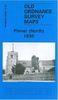


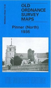
Pinner South 1940
Pinner South in 1940 in a fascinating series of reproductions of old Ordnance Survey plans in the Alan Godfrey Editions, ideal for anyone interested in the history of their neighbourhood or family. The map covers the southern half of Pinner, stretching from the High Street southward to Chestnut Drive, and from Field End Road eastward to Melrose Road. Features include stretch of Metropolitan railway with Pinner station, Pinner Village Gardens, The Grove, Pinner House, West End area, Bennetts Park, West House, Eastcote House, Fieldend Farm, Hornend, Nower Hill, River Pinn, etc. On the reverse is a commercial directory for Pinner in 1933. About the Alan Godfrey Editions of the 25” OS Series:Selected towns in Great Britain and Ireland are covered by maps showing the extent of
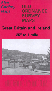
urban development in the last decades of the 19th and early 20th century. The plans have been taken from the Ordnance Survey mapping and reprinted at about 15 inches to one mile (1:4, 340). On the reverse most maps have historical notes and many also include extracts from contemporary directories. Most maps cover about one mile (1.6kms) north/south, one and a half miles (2.4kms) across; adjoining sheets can be combined to provide wider coverage.FOR MORE INFORMATION AND A COMPLETE LIST OF ALL AVAILABLE TITLES PLEASE CLICK ON THE SERIES LINK.
urban development in the last decades of the 19th and early 20th century. The plans have been taken from the Ordnance Survey mapping and reprinted at about 15 inches to one mile (1:4, 340). On the reverse most maps have historical notes and many also include extracts from contemporary directories. Most maps cover about one mile (1.6kms) north/south, one and a half miles (2.4kms) across; adjoining sheets can be combined to provide wider coverage.FOR MORE INFORMATION AND A COMPLETE LIST OF ALL AVAILABLE TITLES PLEASE CLICK ON THE SERIES LINK.

Product Description
Reviews/Comments
Add New
Intelligent Comparison
Archived Product
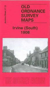
Irvine South 1908 Stanfords
£3.50
Archived Product
Pinner North 1935 Stanfords
£3.50
Archived Product

Colne South 1910 Stanfords
£3.50
Archived Product

Dundee South 1901 Stanfords
£3.50
Archived Product

Lancaster South 1910 Stanfords
£3.50
Archived Product
Doncaster South 1901 Stanfords
£3.50
Vouchers
No voucher codes found.
Do you know a voucher code for this product or supplier? Add it to Insights for others to use.
Do you know a voucher code for this product or supplier? Add it to Insights for others to use.
 Denmark