More From Contributor
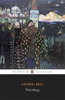
£11.19
Laminated waterproof edition of a detailed topographic map of Peterhead & Fraserburgh from the Ordnance Survey Explorer series. Edition A1; Publication date September 2007 About this series: These highly detailed maps show all the administrative boundaries, settlements as small as isolated farms, the road network down to unfenced roads & country tracks, & field boundaries (hedges & drystone walls) which make navigation across the countryside much easier. Steep gradients on roads are indicated. Various landmarks, e.g. powerlines, archaeological sites, windmills, churches & lighthouses are shown & additional graphics indicate natural terrain features such as cliffs, scree, mud & vegetation variations. The contour interval is 5 metres in the lower parts of the country & 10 metres in the uplands, & spot heights are marked. Each map covers an area of 30 x 20km (i.e. approx. 19 x 12 miles), with some double-sided maps covering more, as indicated in the individual descriptions. The maps are fully GPS compatible, with the National Grid shown at 1km intervals & latitude & longitude indicated by margin ticks at 1'. The Explorer series has replaced the earlier, green-cover Pathfinder maps. The Explorer series is now complete & covers all of Engl&, Wales & Scotl&. Some sheets for popular areas like the National Parks are still branded as Outdoor Leisure (OL) maps, but are now included in this series as the cartography is the same as that in the Explorer Maps. The Explorer maps offer a substantial improvement on the Pathfinder series, with greater use of colour, larger area per map, & stronger emphasis on information for ramblers & tourists. This series is ideal for walking & other outdoor pursuits & each map shows a large amount of information for ramblers & tourists. Public rights of way are shown (except in Scotland), together with other routes with public access: National Trails & Recreational Paths, permitted paths & bridleways, & selected cycle routes. Open access land created under the Countryside & Rights of Way Act 2000 is marked. Tourist information

Includes::
caravan & camp sites, Park & Ride locations, recreation/leisure/sport centres, museums, historic buildings, English Heritage & National Trust sites, rural pubs, etc. The map legend is in English only, except for the tourist information content which is also in French & German.

...
Archived Product
£14.99
Peterhead & Fraserburgh area on a detailed topographic & GPS compatible map No. 427, waterproof version, from the Ordnance Survey’s 1:25, 000 Explorer series. MOBILE DOWNLOADS: this title & all the other OS Explorer maps include a code for downloading after purchase the digital version onto your smartphone or tablet for viewing on the OS smartphone app.OS EXPLORER SERIES: to see the list of all the titles in the OS Explorer series, both paper & waterproof versions, please click on the series link. The Explorer series, Ordnance Survey’s most detailed maps recommended for anyone enjoying outdoor activities, provides topographic coverage of Great Britain at 1:25, 000 on GPS compatible maps with hiking trails, cycling routes & extensive tourist information. Each printed map is available either on paper or as a waterproof & tear-resistant OS Active Map, as indicated in its title. Britain’s National Parks & other areas of particular tourist interest are presented on often double-sided OL (Outdoor Leisure) maps, whilst most standard format Explorers cover an area of 30 x 20km (approx. 19 x 12 miles). All three versions (paper, waterproof & digital) are the same & provide plenty of recreational & tourist information, indicating the traditional public right of way paths (except in Scotland where different laws apply), including bridleways & byways. National Trails & other long-distance paths are marked, as well as permissive footpaths or bridleways & on-road or traffic-free cycle routes with, where appropriate, their National/ Regional Cycle Network numbers. Boundaries of access land are clearly marked. A wide range of symbols provides additional tourist information, highlighting camping & caravanning sites, information offices & visitors’ centres, parking & picnicking places, country pubs, sport & recreational facilities including cycle hire locations & mountain biking trails, historic buildings & museums, etc. Exceptionally clear presentation of the landscape is provided by contours at 5m or in the uplands at 10m intervals, with additional spot heights plus colouring and/or graphics for different types of woodlands, orchards, heath, marshl&, scree or boulders, & other topographic features. For GPS users the maps have British National Grid lines at 1km intervals, with latitude & longitude given by margin ticks at 1`. Clearly laid out map legend

Includes::
French & German translations for the tourist information symbols.

...
Archived Product
£8.99
Peterhead & Fraserburgh area on a detailed topographic & GPS compatible map No. 427, paper version, from the Ordnance Survey’s 1:25, 000 Explorer series.MOBILE DOWNLOADS: this title & all the other OS Explorer maps include a code for downloading after purchase the digital version onto your smartphone or tablet for viewing on the OS smartphone app.OS EXPLORER SERIES: to see the list of all the titles in the OS Explorer series, both paper & waterproof versions, please click on the series link. The Explorer series, Ordnance Survey’s most detailed maps recommended for anyone enjoying outdoor activities, provides topographic coverage of Great Britain at 1:25, 000 on GPS compatible maps with hiking trails, cycling routes & extensive tourist information. Each printed map is available either on paper or as a waterproof & tear-resistant OS Active Map, as indicated in its title. Britain’s National Parks & other areas of particular tourist interest are presented on often double-sided OL (Outdoor Leisure) maps, whilst most standard format Explorers cover an area of 30 x 20km (approx. 19 x 12 miles). All three versions (paper, waterproof & digital) are the same & provide plenty of recreational & tourist information, indicating the traditional public right of way paths (except in Scotland where different laws apply), including bridleways & byways. National Trails & other long-distance paths are marked, as well as permissive footpaths or bridleways & on-road or traffic-free cycle routes with, where appropriate, their National/ Regional Cycle Network numbers. Boundaries of access land are clearly marked. A wide range of symbols provides additional tourist information, highlighting camping & caravanning sites, information offices & visitors’ centres, parking & picnicking places, country pubs, sport & recreational facilities including cycle hire locations & mountain biking trails, historic buildings & museums, etc. Exceptionally clear presentation of the landscape is provided by contours at 5m or in the uplands at 10m intervals, with additional spot heights plus colouring and/or graphics for different types of woodlands, orchards, heath, marshl&, scree or boulders, & other topographic features. For GPS users the maps have British National Grid lines at 1km intervals, with latitude & longitude given by margin ticks at 1`. Clearly laid out map legend

Includes::
French & German translations for the tourist information symbols.

...
Archived Product
£3.50
Peterhead in 1900 in a fascinating series of reproductions of old Ordnance Survey plans in the Alan Godfrey Editions, ideal for anyone interested in the history of their neighbourhood or family. The map covers most of the port & town of Peterhead, stretching from the railway station eastward to the harbour. Features include Kirktown area, Springbank Mills, North & South Harbours, Keith Inch, Roanheads, Green Hill, Broad Street, the town centre, Poorhouse, fish curing works, railway station (but at edge of map so not all approaches shown), Port Henry Harbour, etc. Adjacent sheet 23.03 is included as an inset & shows the Buchanhaven area. About the Alan Godfrey Editions of the 25” OS Series: Selected towns in Great Britain & Ireland are covered by maps showing the extent of urban development in the last decades of the 19th & early 20th century. The plans have been taken from the Ordnance Survey mapping & reprinted at about 15 inches to one mile (1:4, 340). On the reverse most maps have historical notes & many also include extracts from contemporary directories. Most maps cover about one mile (1.6kms) north/south, one & a half miles (2.4kms) across; adjoining sheets can be combined to provide wider coverage.FOR MORE INFORMATION & A COMPLETE LIST OF ALL AVAILABLE TITLES PLEASE CLICK ON THE SERIES LINK. ...
Archived Product
£8.50
Peters projection political world map from Hema, Pacific centered & in a folded format, showing the continents & countries in proportion to their relative sizes & so avoiding the inevitable distortions of world maps which use other projections. The projection, developed by the German historian Arno Peters, has been specially developed to show all areas
- whether countries, continents or oceans
...
Archived Product
£3.50
Petersfield in 1908 in a fascinating series of reproductions of old Ordnance Survey plans in the Alan Godfrey Editions, ideal for anyone interested in the history of their neighbourhood or family. The map covers the market town of Petersfield which, standing on both the road &, later, railway to Portsmouth, grew steadily with the fortunes of that naval port. The map covers the town centre & extends to Ram`s Hill & Broadband House. Features include The Square, High Street, Dragon Street, Chapel Street, Lavant Street, The Causeway, brewery, Herne House, Heath Pond, Workhouse, Churchers College, station, Borough Farm, Buckmoor Farm, Berelands, Rushes Farm, St Peter`s church, Tilmore Brook. On the reverse is a directory of Petersfield in 1903. About the Alan Godfrey Editions of the 25” OS Series Selected towns in Great Britain & Ireland are covered by maps showing the extent of urban development in the last decades of the 19th & early 20th century. The plans have been taken from the Ordnance Survey mapping & reprinted at about 15 inches to one mile (1:4, 340). On the reverse most maps have historical notes & many also include extracts from contemporary directories. Most maps cover about one mile (1.6kms) north/south, one & a half miles (2.4kms) across; adjoining sheets can be combined to provide wider coverage.FOR MORE INFORMATION & A COMPLETE LIST OF ALL AVAILABLE TITLES PLEASE CLICK ON THE SERIES LINK. ...
Archived Product
£11.50
Petershausen in a series of GPS compatible recreational editions of the Bavarian topographic survey at 1:25, 000, with waymarked hiking trails & cycling routes, campsites & youth hostels, etc. Coverage

Includes::
Allershausen, Kranzberg, Röhrmoos, Vierkirchen, Scheyern, Reichertshausen. Contours used in this map vary between 5 to 20m according to the terrain, with 20m interval predominantly used for hilly areas. Varied colouring show different types of landscape: woods, vineyards, fields etc. Maps in this series feature extensive overprint highlighting local & long-distance footpaths & cycle routes, including King Ludwig Way or different variants of the Way of St James, indicating their waymarking. Symbols highlight different types of accommodation (campsites, youth hostels, refuges, etc), sport & recreational facilities, various places of interest, etc. The maps have a 1-km UTM grid. Map legend & all the text are in German only. To see other titles in this series please click on the series link.

...
Archived Product
£6.99
A hilarious new picture book series in which one boy`s very magic pants take him on some unbelievable adventures! When Pete finds a suitcase packed with amazing MAGIC PANTS no one could predict the adventures that are about to happen! Join Pete on his second adventure as his new pirate pants take him on a high seas journey aboard the Flying Fowl, a ship crewed by chickens! Can Pete help Cap`n Ted find the lost treasure of Long John Silverside? He`ll have to make his way past mischievous mermaids, snappy sharks, whooshing whirlpools & even outwit a HUGE octopus! A side-splittingly funny adventure story that whizzes with energy from a dynamic new duo. Featuring a fantastic cast of characters including Pete`s sidekick, a small chicken, who appears in various guises throughout the series. Perfect for children age 3 years & up who will love the action-packed stories full of silly situations & hair-raising close shaves. A fantastic bedtime story & also a great way to encourage children who are potty training to wear their very own magic pants. Comes with a sheet of pant-tastic stickers to keep little pirates amused! Paddy Kempshall has worked in children`s books & magazines for 15 years as well as writing for children`s TV for the last five. He was nominated for BSME Editor of the Year, & most recently has written for CBeebie`s BAFTA award-winning Justin`s House & the series Numtums. Chris Chatterton is an illustrator & animator from County Durham, Engl&. He has a background in graphic design & corporate / commercial animation & is the illustrator behind Adam & Charlotte Guillain`s hilarious lift-the-flap book, Supermarket Gremlins. ...
Archived Product
£11.99
A 450km cross-Channel odyssey for all the family, incorporating a Tour of Jersey. This brand new route starts in Weymouth & takes you along the Jurassic coast to Poole, through rural Dorset. You then board the ferry to Cherbourg before cycling down the Cotentin peninsula, past the D-Day beaches & through deepest Normandy. The route brings you out on the mighty bay of Mont-Saint-Michel then joins the Brittany coast, skirting the oyster beds of Cancale before pitching up in the stylish fortress town of Saint-Malo. There`s an optional circuit of the sandy shoreline of Jersey on the way home: the ferry to Weymouth docks in Jersey & you can hope off & do an extra 60km with an overnight in St Helier. Contains Route information, detailed mapping plus all the best places to eat, sleep & drink. ...
Archived Product
£10.00
When his fireworks factory job ends explosively & his wife returns to work, Jose is surprised to realise he has a talent for keeping house: childcare, tidying, cleaning, cooking, gardening, he excels at it all. On Thursdays, he hangs out & drinks good wine with his jazz-loving neighbour. But when Jose`s new talents take a sudden & gruesome turn, life, death, resurrection, & domesticity unexpectedly converge. In one single, hypnotic paragraph, Petite Fleur harnesses the unpredictability of Aira & the mysticism of Tolstoy in a discordant riff on suburban life. ...
Archived Product

Petersburg

Andrei Bely`s masterpiece, ”Petersburg” is a vivid, striking story set at the heart of the 1905 Russian revolution. This ”Penguin Classics” edition is translated from the Russian by David McDuff with an introduction by Adam Thirlwell. St Petersburg, 1905. An impressionable young university student, Nikolai, becomes involved with a revolutionary terror organization, which plans to assassinate a high government official with a time bomb. But the official is Nikolai`s cold, unyielding father, Apollon, and in twenty-four hours the bomb will explode. ”Petersburg” is a story of suspense, family dysfunction, patricide, conspiracy and revolution. It is also an impressionistic, exhilarating panorama of the city itself, watched over by the bronze statue of Peter the Great,
as it tears itself apart. Considered by writers such as Vladimir Nabokov to be one of the greatest masterpieces of the twentieth century, Bely`s richly textured, darkly comic and symbolic novel pulled apart the traditional techniques of storytelling and presaged the dawn of a new form of literature. This acclaimed translation captures all the idiosyncrasies and rhythms of Bely`s extraordinary prose.It is accompanied by an introduction by Adam Thirwell discussing the novel`s themes, extraordinary style and influence. Andrei Bely (1880-1934), born Boris Nikolaevich Bugaev, was educated at Moscow University where he studied science and philosophy, before turning his focus to literature. In 1904 he published his first collection of poems, ”Gold in Azure”, which was followed in 1909
by his first novel, ”The Silver Dove”. Bely`s most famous novel, ”Petersburg”, was published in 1916. His work is considered to have heavily influenced several literary schools, most notably Symbolism, and his impact on Russian writing has been compared to that of James Joyce on the English speaking world. If you enjoyed ”Petersburg”, you might like Ivan Turgenev`s ”Fathers and Sons”, also available in ”Penguin Classics”. ”The one novel that sums up the whole of Russia”. (Anthony Burgess).
RIP - This product is no longer available on our network. It was last seen on 25.09.2019

This page now acts as a permanent archive for this product. Add more information using the comments box below to ensure it can still be found by future generations.

Use our search facility to see if it is available from an alternative contributor.
  • Availability: Out Of Stock
  • Supplier: Stanfords
  • SKU: 9780141191744
Availability: In Stock
£12.99

Product Description

Andrei Bely`s masterpiece, ” Petersburg” is a vivid, striking story set at the heart of the 1905 Russian revolution. This ” Penguin Classics” edition is translated from the Russian by David Mc Duff with an introduction by Adam Thirlwell. St Petersburg, 1905. An impressionable young university student, Nikolai, becomes involved with a revolutionary terror organization, which plans to assassinate a high government official with a time bomb. But the official is Nikolai`s cold, unyielding father, Apollon, & in twenty-four hours the bomb will explode. ” Petersburg” is a story of suspense, family dysfunction, patricide, conspiracy & revolution. It is also an impressionistic, exhilarating panorama of the city itself, watched over by the bronze statue of Peter the Great, as it tears itself apart. Considered by writers such as Vladimir Nabokov to be one of the greatest masterpieces of the twentieth century, Bely`s richly textured, darkly comic & symbolic novel pulled apart the traditional techniques of storytelling & presaged the dawn of a new form of literature. This acclaimed translation captures all the idiosyncrasies & rhythms of Bely`s extraordinary prose. It is accompanied by an introduction by Adam Thirwell discussing the novel`s themes, extraordinary style & influence. Andrei Bely (1880-1934), born Boris Nikolaevich Bugaev, was educated at Moscow University where he studied science & philosophy, before turning his focus to literature. In 1904 he published his first collection of poems, ” Gold in Azure”, which was followed in 1909 by his first novel, ” The Silver Dove”. Bely`s most famous novel, ” Petersburg”, was published in 1916. His work is considered to have heavily influenced several literary schools, most notably Symbolism, & his impact on Russian writing has been compared to that of James Joyce on the English speaking world. If you enjoyed ” Petersburg”, you might like Ivan Turgenev`s ” Fathers & Sons”, also available in ” Penguin Classics”. ” The one novel that sums up the whole of Russia”. (Anthony Burgess).

Reviews/Comments

Add New

Intelligent Comparison

Oooops!
We couldn't find anything!
Perhaps this product's unique.... Or perhaps we are still looking for comparisons!
Click to bump this page and we'll hurry up.

Price History

Vouchers

No voucher codes found.
Do you know a voucher code for this product or supplier? Add it to Insights for others to use.

Facebook

Jargon Buster

Gold - A precious highly conductive metal
Silver - A colour based on the colour of the metal
Silver - A chemical element, metalic. Has the highest elctrical conductance of any element. Also known for its exceptional anitmicrobal properties
World - A physical grouping, commonly used to describe earth and everything associated with ti
Set - a group of items usually related to one another. Some objects cannot function without the complete set of items.
Heart - An organ that pumps blood around the body. Usually related to love.
Gold - A colour, a type of rich metal. Chemical symbol AU.
Traditional - Something that has become the same through a period of time and thus repeated.
Traditional - Something that has been around for a while and is repeated regularly.
Family - A group of people that live together made up from parents and children.
Azure - A hue of blue. Colour #007FFF. Halfway between blue and cyan.

Supplier Information

Stanfords
Stanfords was established in 1853 and opened their iconic Covent Garden flagship store in 1901. They have become the top retailer of maps, travel books and accessories in the UK and arguably offer the largest selection of maps and travel books worldwide. Famous names such as Captain Robert Falcon Scott, Ranulph Fiennes and Michael Palin have purchased from Stanfords. They now have a shop in Bristol and both stores together with other venues operate a calendar of events including talks, book signings and exhibitions. As a specialist map retailer, the map selection is comprehensive and includes road maps, street maps and walking maps from worldwide destinations, as well as a selection of world atlases and wall maps. Books include travel guides and travel literature. Stanfords also stock globes, from miniatures made of blue marble to magnificent floor-standing globes. The website features a selection of interesting articles on travel topics.
Page Updated: 2023-11-12 20:15:36

Community Generated Product Tags

Oh No! The productWIKI community hasn't generated any tags for this product yet!
Menu