
 United Kingdom
 France
 Germany
 Netherlands
 Sweden
 USA
USA
 Italy
Italy
 Spain
Spain
More From Contributor


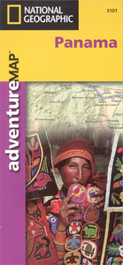
Panama Adventure Map
Double-sided, waterproof and tear-resistant map with a street plan of central Panama City and an enlargement of the Panama Canal region. The country is divided east/west, with a generous overlap between the two sides. Relief is shown by contours at 100m intervals, enhanced by hill-shading and spot heights. The map indicates forests, mangroves, swamps and coral reefs. Road detail emphasises the Pan-America Highway and includes primary and secondary roads and trails. Intermediate road distances are marked on main routes. Railways, sea ferries, airports and airstrips are marked, as well as the country’s internal administrative boundaries together with names of the provinces. The country’s various national parks and other types of protected area are marked, and symbols denote
archeological sites and other sites of interest, ports, border crossings and fishing, diving and surfing sites. A UTM grid is printed on the map, plus latitude and longitude margin ticks at 20` intervals. An index lists the protected areas and a selection of towns, and the map is annotated with facts various localities and aspects of the country’s geography.The map includes a street plan of central Panama City, naming principal streets and districts, and highlighting various notable buildings, places of interest to visitors, embassies, hospitals and churches. There is a further enlargement of the historic heart - San Felipe. The Panama Canal region is shown at 1:165, 000, indicating more places of interest, the shipping lane and the canal locks.
archeological sites and other sites of interest, ports, border crossings and fishing, diving and surfing sites. A UTM grid is printed on the map, plus latitude and longitude margin ticks at 20` intervals. An index lists the protected areas and a selection of towns, and the map is annotated with facts various localities and aspects of the country’s geography.The map includes a street plan of central Panama City, naming principal streets and districts, and highlighting various notable buildings, places of interest to visitors, embassies, hospitals and churches. There is a further enlargement of the historic heart - San Felipe. The Panama Canal region is shown at 1:165, 000, indicating more places of interest, the shipping lane and the canal locks.

Product Description
Reviews/Comments
Add New
Intelligent Comparison
Archived Product

Mayan Adventure Map Stanfords
£9.95
Archived Product

China Adventure Map Stanfords
£9.99
Archived Product
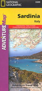
Sardinia Adventure Map Stanfords
£9.99
Archived Product
Langtang Adventure Map Stanfords
£9.99
Archived Product

Annapurna Adventure Map Stanfords
£9.99
Archived Product
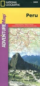
Peru Adventure Map Stanfords
£9.99
Archived Product

Tuscany Adventure Map Stanfords
£9.99
Archived Product
Germany Adventure Map Stanfords
£9.99
Vouchers
No voucher codes found.
Do you know a voucher code for this product or supplier? Add it to Insights for others to use.
Do you know a voucher code for this product or supplier? Add it to Insights for others to use.
 Denmark