
 United Kingdom
 France
 Germany
 Netherlands
 Sweden
 USA
USA
 Italy
Italy
 Spain
Spain
More From Contributor


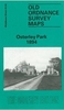

Ossett North 1905
Ossett North in 1905 in a fascinating series of reproductions of old Ordnance Survey plans in the Alan Godfrey Editions, ideal for anyone interested in the history of their neighbourhood or family. The map covers the northern part of Ossett, stretching from Ossett Street Side eastward to Low Laiths. Features include Holy Trinity church, Temperance Mill, North Field Mills, Shepherd Hill area, Flushdyke area, railway with Flushdyke station, mineral lines, Low Laiths Farm, m Whitley Spring Mill, Brooks Mill, Town End area, Pale Side Mill, Paleside, Northfield Colliery, Lodge Hill Farm, Gedham Mill, Ings Mill, etc. On the reverse is a list of private residents from an 1889 directory of Ossett. About the Alan Godfrey Editions of the 25” OS Series:Selected towns in Great
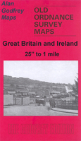
Britain and Ireland are covered by maps showing the extent of urban development in the last decades of the 19th and early 20th century. The plans have been taken from the Ordnance Survey mapping and reprinted at about 15 inches to one mile (1:4, 340). On the reverse most maps have historical notes and many also include extracts from contemporary directories. Most maps cover about one mile (1.6kms) north/south, one and a half miles (2.4kms) across; adjoining sheets can be combined to provide wider coverage.FOR MORE INFORMATION AND A COMPLETE LIST OF ALL AVAILABLE TITLES PLEASE CLICK ON THE SERIES LINK.
Britain and Ireland are covered by maps showing the extent of urban development in the last decades of the 19th and early 20th century. The plans have been taken from the Ordnance Survey mapping and reprinted at about 15 inches to one mile (1:4, 340). On the reverse most maps have historical notes and many also include extracts from contemporary directories. Most maps cover about one mile (1.6kms) north/south, one and a half miles (2.4kms) across; adjoining sheets can be combined to provide wider coverage.FOR MORE INFORMATION AND A COMPLETE LIST OF ALL AVAILABLE TITLES PLEASE CLICK ON THE SERIES LINK.

Product Description
Reviews/Comments
Add New
Intelligent Comparison
Archived Product
Ossett Central 1905 Stanfords
£3.50
Archived Product
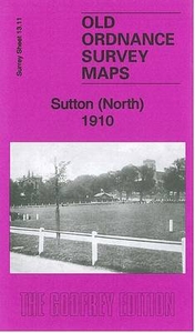
Sutton North 1910 Stanfords
£2.95
Archived Product
Sutton North 1910 Stanfords
£3.50
Archived Product
Lowestoft North 1904 Stanfords
£2.95
Vouchers
No voucher codes found.
Do you know a voucher code for this product or supplier? Add it to Insights for others to use.
Do you know a voucher code for this product or supplier? Add it to Insights for others to use.
 Denmark