
 United Kingdom
 France
 Germany
 Netherlands
 Sweden
 USA
USA
 Italy
Italy
 Spain
Spain
More From Contributor


Northfield South 1903
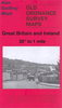
Northfield South in 1903 in a fascinating series of reproductions of old Ordnance Survey plans in the Alan Godfrey Editions, ideal for anyone interested in the history of their neighbourhood or family. The map covers most of Northfield and extends southward to Turves Green. Features include Midland Railway with Northfield station, St Lawrence`s church, Moat Farm, Quarry House, Hawkesley Mill Farm, Turves Green Farm, Staplehall Farm, Wychall Farm, part of Wychall Reservoir, etc. On the reverse is a directory of private residents of Northfield, plus a timetable for the Redditch-Birmingham line in 1916. About the Alan Godfrey Editions of the 25” OS Series:Selected towns in Great Britain and Ireland are covered by maps showing the extent of urban development in the last decades of
the 19th and early 20th century. The plans have been taken from the Ordnance Survey mapping and reprinted at about 15 inches to one mile (1:4, 340). On the reverse most maps have historical notes and many also include extracts from contemporary directories. Most maps cover about one mile (1.6kms) north/south, one and a half miles (2.4kms) across; adjoining sheets can be combined to provide wider coverage.FOR MORE INFORMATION AND A COMPLETE LIST OF ALL AVAILABLE TITLES PLEASE CLICK ON THE SERIES LINK.
the 19th and early 20th century. The plans have been taken from the Ordnance Survey mapping and reprinted at about 15 inches to one mile (1:4, 340). On the reverse most maps have historical notes and many also include extracts from contemporary directories. Most maps cover about one mile (1.6kms) north/south, one and a half miles (2.4kms) across; adjoining sheets can be combined to provide wider coverage.FOR MORE INFORMATION AND A COMPLETE LIST OF ALL AVAILABLE TITLES PLEASE CLICK ON THE SERIES LINK.

Product Description
Reviews/Comments
Add New
Intelligent Comparison
Archived Product

Northfield North 1903 Stanfords
£3.50
Archived Product
Sheffield North 1903 Stanfords
£3.50
Archived Product

Wakefield South 1890 Stanfords
£3.50
Archived Product
Huddersfield South 1905 Stanfords
£2.95
Archived Product

Huddersfield South 1905 Stanfords
£3.50
Archived Product

Enfield South 1895 Stanfords
£3.50
Archived Product

Norwich South 1905 Stanfords
£3.50
Archived Product

Mirfield South West 1930 Stanfords
£3.50
Vouchers
No voucher codes found.
Do you know a voucher code for this product or supplier? Add it to Insights for others to use.
Do you know a voucher code for this product or supplier? Add it to Insights for others to use.
 Denmark