
 United Kingdom
 France
 Germany
 Netherlands
 Sweden
 USA
USA
 Italy
Italy
 Spain
Spain
More From Contributor


Northern Thailand
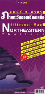
Northern Thailand at 1:550, 000 in a series of regional road maps of Thailand from the Bangkok based ThinkNet, with street plans of Mae Hong Son, Pai, Chiang Rai, Nan, Mae Sot, Phitsanulok, Phetchanbun and Mae Sot. Both the main map and the city plans have very extensive bilingual overprint highlighting not only various places of interest but also public buildings and/or facilities such as schools, medical centres, etc. All information is bilingual, shown in Thai and English.Road and rail networks are shown on a base with colouring indicating the country’s administrative provinces. The map offers no topographic information beyond rivers and lakes. Road network does not give driving distances but does indicate locations of petrol stations. The map is indexed and has latitude and
longitude lines are drawn at intervals of 30’. Map legends are in English. No information is provided outside Thailand’s borders.PLEASE NOTE: place names on maps in this series, apart from names of administrative units, are in print size significantly smaller than usually found on most road maps. All the information is clearly legible, but it’s not always easy to locate main towns. To see the list of titles in this series please click on the series link.
longitude lines are drawn at intervals of 30’. Map legends are in English. No information is provided outside Thailand’s borders.PLEASE NOTE: place names on maps in this series, apart from names of administrative units, are in print size significantly smaller than usually found on most road maps. All the information is clearly legible, but it’s not always easy to locate main towns. To see the list of titles in this series please click on the series link.

Product Description
Reviews/Comments
Add New
Intelligent Comparison
Archived Product

Southern Thailand Stanfords
£8.99
Archived Product
North-Eastern Thailand Stanfords
£8.99
Archived Product
Northern Highlands Stanfords
£5.99
Archived Product

Caves Of Northern Thailand Stanfords
£16.95
Archived Product
Northern Ireland Stanfords
£3.99
Archived Product
Northern England Stanfords
£4.99
Archived Product

Northern Tajikistan Stanfords
£13.99
Archived Product
Northern Spain Stanfords
£4.79
Vouchers
No voucher codes found.
Do you know a voucher code for this product or supplier? Add it to Insights for others to use.
Do you know a voucher code for this product or supplier? Add it to Insights for others to use.
 Denmark