More From Contributor
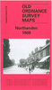
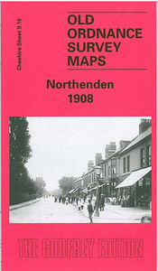
£5.99
The Penguin English Library Edition of Northanger Abbey by Jane Austen` To look almost pretty, is an acquisition of higher delight to a girl who has been looking plain the first fifteen years of her life, than a beauty from her cradle can ever receive` During an eventful season at Bath, young, naive Catherine Morland experiences the joys of fashionable society for the first time. She is delighted with her new acquaintances: flirtatious Isabella, who shares Catherine`s love of Gothic romance & horror, & sophisticated Henry & Eleanor Tilney, who invite her to their father`s mysterious house, Northanger Abbey. There, her imagination influenced by novels of sensation & intrigue, Catherine imagines terrible crimes committed by General Tilney. With its broad comedy & irrepressible heroine, this is the most youthful & and optimistic of Jane Austen`s works. The Penguin English Library
- 100 editions of the best fiction in English, from the eighteenth century & the very first novels to the beginning of the First World War.
...
Archived Product
£7.99
WITH AN INTRODUCTION BY P.D. JAMESThe Vintage Classics Austen series is designed by the writer & illustrator Leanne Shapton & introduced by some of our finest contemporary writers & Austen fans: Alexander Mc Call Smith, Lynne Truss, Amanda Vickery, Francesca Segal, P.D. James & Andrew Motion.` Jane Austen is a genius, & Northanger Abbey is hugely underrated` Martin Amis Catherine Morland is a young girl with a very active imagination. Her naivety & love of sensational novels lead her to approach the fashionable social scene in Bath & her stay at nearby Northanger Abbey with preconceptions that have embarrassing & entertaining consequences. ...
Archived Product
£14.99
Northeast India in the Handbooks series from Footprint; comprehensive & leading guides designed & written for independent travellers who enjoy exploring off the beaten track. Footprint guides have an established reputation, built up since 1921, for catering for more adventurous & individual travellers. An unrestrictive editorial style also gives authors the freedom to capture & explore local cultures, sights & areas that are often not covered in other guides. Widely recognised for their reliability & independent writing style, Footprint guides all have the same layout. Introductory sections introduce the reader to the destination, with chapters on planning on your trip & essentials, including practical information & guidance on subjects such as when & where to go, itineraries, sport & activities, arts, getting there & around, eating & drinks, sleeping & a dedicated section on the anticipated carbon footprint involved in travelling to the destination. Each guide is organised geographically by region or country, with individual sections having a particular focus on an extensive range of sights & places of interest. Further, there are also details of accommodation, nightlife, restaurants & any notable local activities. Information boxes throughout the text give readers an insight into local customs, stories & sights of particular interest.A ...
Archived Product
£5.99
Northeastern USA
- Eastern Canada at 1:2, 400, 000 is a fully indexed map in the Michelin Regional USA series for motorists &
...
Archived Product
£5.99
North-eastern USA & Eastern Canada at 1:2, 400, 000 (1” to 38 miles) on an indexed road map from Michelin with coverage extending westwards to the western borders of the Dakotas & Nebraska, & south beyond Washington DC to Norfolk in Virginia &, in the west, to St. Louis & Kansas City. The map is part of Michelin’s series covering USA on three maps at this scale. Road network indicates toll roads & clearly shows road numbers of interstate & state highways plus on selected local roads. Driving distances are marked on main routes in both miles & kilometres, & on selected state roads in kilometres only. State borders are clearly marked & the maps also show time zone boundaries. Topography is indicated by relief shading, with colouring for national/state parks & forests, Indian lands & restricted entry military zones. The maps have no geographical coordinates; each title is indexed. To see all the titles in this series, including more detailed coverage of New England & the Mid-Atlantic States, please click on the series link. ...
Archived Product
£3.50
Northenden in 1908 in a fascinating series of reproductions of old Ordnance Survey plans in the Alan Godfrey Editions, ideal for anyone interested in the history of their neighbourhood or family. The map covers the western part of Northenden, from St Wilfrid`s church (which is split by the margin) westward to Button Lane. Features include Wythenshawe Hall, Rack House, Yewtree Lane, Kenworthy, Kenworthy House, Moorend, Northenden Mill, Lawton Moor, etc. On the reverse is a selection of street directory entries, including Albert Road, Beech Avenue, Church Road, Kenworthy Lane, Palatine Road, Princess Road, Royle Green Road & Wythenshawe Road. About the Alan Godfrey Editions of the 25” OS Series: Selected towns in Great Britain & Ireland are covered by maps showing the extent of urban development in the last decades of the 19th & early 20th century. The plans have been taken from the Ordnance Survey mapping & reprinted at about 15 inches to one mile (1:4, 340). On the reverse most maps have historical notes & many also include extracts from contemporary directories. Most maps cover about one mile (1.6kms) north/south, one & a half miles (2.4kms) across; adjoining sheets can be combined to provide wider coverage.FOR MORE INFORMATION & A COMPLETE LIST OF ALL AVAILABLE TITLES PLEASE CLICK ON THE SERIES LINK. ...
Archived Product
£8.99
Two very detailed maps (printed on both sides) for Mt Imittos. The first (northern) covers the part of the mountain that extends between Agia Paraskevi & Ilioupoli & from Glyka Nera to Koropi while the second covers all the remaining southern part, between Argyroupoli, Glyfada, Koropi & Vari. ...
Archived Product
£5.99
Northern Agrafa
- Plastira Lake area at 1:50, 000 on a light, waterproof & tear-resistant, GPS compatible contoured map from
...
Archived Product
£14.99
Take to the open road with Back Roads Northern & Central Italy & discover 25 leisurely drives through the country`s beautiful villages & stunning landscapes. Tour the Italian lakes, explore the Chianti vineyards of Tuscany or discover the historic towns & cities of the Veneto Plain. Packed with insider tips & information, this easy-to-use guide reveals incredible sights, hidden gems & authentic local experiences that can only be discovered by road. Inside Back Roads Northern & Central Italy:- A free laminated pull-out road map of Italy helps you navigate with ease- 25 easy-to-follow driving tours, each lasting one to five days- Guided walks take you through Italy`s historic towns & villages- Experts suggest the best off-road activities in each area, from taking a wine tour to visiting art galleries- Contains essential travel tips, including our pick of where to stay, eat & shop, plus useful travel, visa & health information- Covers all the Italian rules of the road
-

Includes::
postcodes for use with GPS, plus information on road conditions & parking tips
- Covers Turin, Piedmont, Italian Lakes, Lake Maggiore, Lake Como, Lombardy, Lake Garda, Trentino-Alto Adige, the Dolomites, Friuli-Venezia Giulia, the Veneto Plain, the Po Delta, Ravenna, Genoa, Azure Coast, Cinque Terre, Tuscany, Chianti vineyards, Umbria, Perugia, Apennine Mountains, Montefeltro Mountains, Le Marche & more. Looking for a comprehensive guide to Italy? Try our DK Eyewitness Travel Guide Italy. About DK Eyewitness Travel: DK`s award-winning Back Roads guide books take the work out of planning a road trip, with easy-to-read maps, tips & tours to inform & enrich your journey. DK is the world`s leading illustrated reference publisher, producing beautifully designed books for adults & children in over 120 countries.


...
Archived Product
£14.99
Northern & Central Italy in The ‘ Back Roads’ series from Eyewitness; comprising a range of touring guides concentrating on driving off the beaten track & away from main roads. Each title in the series

Includes::
25 driving tours, ranging from 1 to 5 days, which take drivers deep into the heart of remote countryside, taking in beautiful villages, picturesque landscapes, authentic restaurants & a range of small hotels. Each itinerary

Includes::
a guided walk through a historic town or unspoilt countryside, in addition to a range of activities & tips on buying local crafts & produce. Postcodes are also listed for use with in-car sat-nav & there is detailed advice on the rules of the road, clear driving instructions & overview maps that are designed to be useful & informative to the driver. Each drive

Includes::
a ‘plan your drive’ section providing comprehensive information on the route & day trip options. A series of listings indicates activities in the local area, places where to eat & drink & where to stay. There are also colour photographs illustrating some of the highlights of the region.


...
Archived Product

Northenden 1908

Northenden in 1908 in a fascinating series of reproductions of old Ordnance Survey plans in the Alan Godfrey Editions, ideal for anyone interested in the history of their neighbourhood or family. Selected towns in Great Britain and Ireland are covered by maps showing the extent of urban development in the last decades of the 19th and early 20th century.In this title: this detailed map covers the western part of Northenden, from St Wilfrid's church (which is split by the margin) westward to Button Lane. Features include Wythenshawe Hall, Rack House, Yewtree Lane, Kenworthy, Kenworthy House, Moorend, Northenden Mill, Lawton Moor etc. On the reverse is a selection of street directory entries, including Albert Road, Beech Avenue, Church Road, Kenworthy Lane, Palatine Road,
Princess Road, Royle Green Road, Wythenshawe Road. About the Alan Godfrey Editions of the 25
RIP - This product is no longer available on our network. It was last seen on 25.09.2019

This page now acts as a permanent archive for this product. Add more information using the comments box below to ensure it can still be found by future generations.

Use our search facility to see if it is available from an alternative contributor.
  • External links may include paid for promotion
  • Availability: Out Of Stock
  • Supplier: Stanfords
  • SKU: 9786000006174
Availability: In Stock
£2.95

Product Description

Northenden in 1908 in a fascinating series of reproductions of old Ordnance Survey plans in the Alan Godfrey Editions, ideal for anyone interested in the history of their neighbourhood or family. Selected towns in Great Britain & Ireland are covered by maps showing the extent of urban development in the last decades of the 19th & early 20th century. In this title: this detailed map covers the western part of Northenden, from St Wilfrid's church (which is split by the margin) westward to Button Lane. Features include Wythenshawe Hall, Rack House, Yewtree Lane, Kenworthy, Kenworthy House, Moorend, Northenden Mill, Lawton Moor etc. On the reverse is a selection of street directory entries, including Albert Road, Beech Avenue, Church Road, Kenworthy Lane, Palatine Road, Princess Road, Royle Green Road, Wythenshawe Road. About the Alan Godfrey Editions of the 25

Reviews/Comments

Add New

Price History

Vouchers

No voucher codes found.
Do you know a voucher code for this product or supplier? Add it to Insights for others to use.

Facebook

Jargon Buster

Button - A round or square object used for fastening clothing or other items
button - A small fastener used on clothing to secure two pieces of fabric together.
History - Anything that happens in the past. An acedemic subject.
Road - a manmade lane or a path that is used to speed up travel.
Mill - A building which can grind grain into flour.
Hall - A room at the inside of an entrance of a house.
Ideal - Something that satisfies a perfect criteria.
Family - A group of people that live together made up from parents and children.

Supplier Information

Stanfords
Stanfords was established in 1853 and opened their iconic Covent Garden flagship store in 1901. They have become the top retailer of maps, travel books and accessories in the UK and arguably offer the largest selection of maps and travel books worldwide. Famous names such as Captain Robert Falcon Scott, Ranulph Fiennes and Michael Palin have purchased from Stanfords. They now have a shop in Bristol and both stores together with other venues operate a calendar of events including talks, book signings and exhibitions. As a specialist map retailer, the map selection is comprehensive and includes road maps, street maps and walking maps from worldwide destinations, as well as a selection of world atlases and wall maps. Books include travel guides and travel literature. Stanfords also stock globes, from miniatures made of blue marble to magnificent floor-standing globes. The website features a selection of interesting articles on travel topics.
Page Updated: 2023-11-12 20:15:36

Community Generated Product Tags

Oh No! The productWIKI community hasn't generated any tags for this product yet!
Menu