
 United Kingdom
 France
 Germany
 Netherlands
 Sweden
 USA
USA
 Italy
Italy
 Spain
Spain
More From Contributor

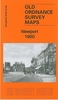

Newport 1900
Newport in 1900 in a fascinating series of reproductions of old Ordnance Survey plans in the Alan Godfrey Editions, ideal for anyone interested in the history of their neighbourhood or family. Selected towns in Great Britain and Ireland are covered by maps showing the extent of urban development in the last decades of the 19th and early 20th century.In this title: the map is double-sided. The main map covers the centre and northern part of the town, stretching from the High Street northward to Islington and Meretown House, and from Bromfield Place eastward to Broom Hill. Features include St Nicholas church, St Mary's Iron Works, Smithfield, Shropshire Union Canal, Chetwynd End, malthouse, tannery etc. On the reverse is part of the adjacent sheet 31.09 extending coverage southward
to include railway station, Workhouse, cemetery, Upper Bar and Station Road area. About the Alan Godfrey Editions of the 25
to include railway station, Workhouse, cemetery, Upper Bar and Station Road area. About the Alan Godfrey Editions of the 25
Product Description
Reviews/Comments
Add New
Intelligent Comparison
Archived Product

Newport 1900 Stanfords
£3.50
Archived Product
Newark 1900 Stanfords
£2.95
Archived Product
Newark 1900 Stanfords
£3.50
Archived Product
Newry 1903 Stanfords
£2.95
Archived Product

Tamworth 1900 Stanfords
£3.50
Vouchers
No voucher codes found.
Do you know a voucher code for this product or supplier? Add it to Insights for others to use.
Do you know a voucher code for this product or supplier? Add it to Insights for others to use.
 Denmark