
 United Kingdom
 France
 Germany
 Netherlands
 Sweden
 USA
USA
 Italy
Italy
 Spain
Spain
More From Contributor


Newmarket 1901
Newmarket in 1901 in a fascinating series of reproductions of old Ordnance Survey plans in the Alan Godfrey Editions, ideal for anyone interested in the history of their neighbourhood or family. The map provides good coverage of Newmarket, which is split between Suffolk and Cambridgeshire. Coverage extends northward to Warren Hill station, and westward to Scaltback Farm. Features include the station, High Street, St Mary`s Square, Jockey Club Rooms, All Saints church, St Mary`s church, Cattle Market, Lincoln Lodge, Phantom House, Warren House, Newmarket Mills, Workhouse, St Etheldreda`s church, The Severals, Tan Gallop, Rous Memorial Hospital, Severals House and other villas, Tattersall`s Sale Paddock, etc. A list of private residents from a 1912 directory is included
on the reverse.About the Alan Godfrey Editions of the 25” OS Series:Selected towns in Great Britain and Ireland are covered by maps showing the extent of urban development in the last decades of the 19th and early 20th century. The plans have been taken from the Ordnance Survey mapping and reprinted at about 15 inches to one mile (1:4, 340). On the reverse most maps have historical notes and many also include extracts from contemporary directories. Most maps cover about one mile (1.6kms) north/south, one and a half miles (2.4kms) across; adjoining sheets can be combined to provide wider coverage.FOR MORE INFORMATION AND A COMPLETE LIST OF ALL AVAILABLE TITLES PLEASE CLICK ON THE SERIES LINK.
on the reverse.About the Alan Godfrey Editions of the 25” OS Series:Selected towns in Great Britain and Ireland are covered by maps showing the extent of urban development in the last decades of the 19th and early 20th century. The plans have been taken from the Ordnance Survey mapping and reprinted at about 15 inches to one mile (1:4, 340). On the reverse most maps have historical notes and many also include extracts from contemporary directories. Most maps cover about one mile (1.6kms) north/south, one and a half miles (2.4kms) across; adjoining sheets can be combined to provide wider coverage.FOR MORE INFORMATION AND A COMPLETE LIST OF ALL AVAILABLE TITLES PLEASE CLICK ON THE SERIES LINK.

Product Description
Reviews/Comments
Add New
Intelligent Comparison
Archived Product
Newark 1900 Stanfords
£2.95
Archived Product
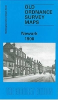
Newark 1900 Stanfords
£3.50
Archived Product
Stowmarket 1903 Stanfords
£2.95
Archived Product

Stowmarket 1903 Stanfords
£3.50
Archived Product
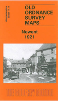
Newent 1921 Stanfords
£3.50
Vouchers
No voucher codes found.
Do you know a voucher code for this product or supplier? Add it to Insights for others to use.
Do you know a voucher code for this product or supplier? Add it to Insights for others to use.
 Denmark