
 United Kingdom
 France
 Germany
 Netherlands
 Sweden
 USA
USA
 Italy
Italy
 Spain
Spain
More From Contributor

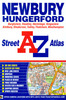


Newbury And Wantage
Map No. 174, Newbury and Wantage, in the Ordnance Survey Landranger series at 1:50, 000 including Didcot, Cholsey, Blewbury, Chilton, Steventon, Drayton, Goosey, Sparsholt, Uffington, Watchfield, Highworth, Bourton, Ashbury, Wanborough, Lambourn, Brightwalton, Great Shefford, Compton, Aldworth, Upper Basildon, Peasemore, Welford, Aldbourne, Ramsbury, Mildenhall, Hungerford, Boxford, Hermitage, Thatcham, Kintbury, Woolhampton, Headley, Kingsclere, Hannington, Highclere, Ball Hill, Inkpen, Shalbourne, Vernham Dean, Tidcombe Burbage and Great Bedwyn, with the Vale of White Horse and a section of the Ridgeway - the European E2 long-distance route. Edition D2; Publication Date April 2011 This title is also available on our website in a waterproof and
tear-resistant version.Maps in this series are only published folded. Stanfords can also print flat versions of Ordnance Survey maps through the OS Select system, centring the map on a location of your choice and with a picture provided by you on the cover. For more information please click on the link at the bottom of this description.About Ordnance Survey
tear-resistant version.Maps in this series are only published folded. Stanfords can also print flat versions of Ordnance Survey maps through the OS Select system, centring the map on a location of your choice and with a picture provided by you on the cover. For more information please click on the link at the bottom of this description.About Ordnance Survey
Product Description
Reviews/Comments
Add New
Intelligent Comparison
Archived Product
Newbury And Wantage 1919 Stanfords
£9.99
Archived Product
Newbury And Wantage 1817-1830 Stanfords
£7.99
Archived Product

Newbury And Wantage 1897-1900 Stanfords
£9.99
Archived Product
Newbury And Wantage WATERPROOF Stanfords
£10.39
Archived Product
Newbury And Wantage OS ACTIVE Map Stanfords
£9.09
Vouchers
No voucher codes found.
Do you know a voucher code for this product or supplier? Add it to Insights for others to use.
Do you know a voucher code for this product or supplier? Add it to Insights for others to use.
 Denmark