
 United Kingdom
 France
 Germany
 Netherlands
 Sweden
 USA
USA
 Italy
Italy
 Spain
Spain
More From Contributor


New England Flexi Map
New England on a laminated, tear-resistant Insight Flexi Map, with a road map of the region, street plans of central Boston, Hartford and Providence, all indexed and highlighting various sights, plus extensive tourist information.New England is presented at 1: 900, 000, divided north/south between the two sides of the map with a generous overlap. The map covers the whole of Connecticut, Rhode Island, Massachusetts, New Hampshire, Vermont and Maine, extending south to the outskirts of New York City and inland to Albany, NY.Topography is shown by relief shading with spot heights, plus names of mountain ranges. National parks and other protected areas are highlighted. The maps show the regions
Product Description
Reviews/Comments
Add New
Intelligent Comparison
Archived Product
Ireland Flexi Map Stanfords
£4.99
Archived Product
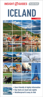
Iceland Flexi Map Stanfords
£5.99
Archived Product
Orlando Flexi Map Stanfords
£5.99
Archived Product
Milan Flexi Map Stanfords
£4.99
Archived Product
Milan Flexi Map Stanfords
£4.99
Archived Product

Milan Flexi Map Stanfords
£5.99
Archived Product
Thailand Flexi Map Stanfords
£4.99
Archived Product
Thailand Flexi Map Stanfords
£3.74
Vouchers
No voucher codes found.
Do you know a voucher code for this product or supplier? Add it to Insights for others to use.
Do you know a voucher code for this product or supplier? Add it to Insights for others to use.
 Denmark