
 United Kingdom
 France
 Germany
 Netherlands
 Sweden
 USA
USA
 Italy
Italy
 Spain
Spain
More From Contributor


Miami Borch
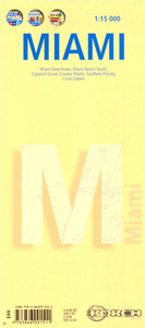
Printed on durable, laminated paper, this title provides indexed street plans of Downtown Miami, Miami Beach South, Coconut Grove and Coral Gables, plus road maps of Greater Miami and southern Florida. The clear street plans of the first 3 regions named above are at 1:15, 000 and show one-way streets, railway lines, metro lines and stations, notable buildings, public buildings, hotels, shopping malls and parks. Symbols denote information centres, beaches, monuments, marinas, places of worship, theatres, sites of interest, car parks, hospitals, police stations and post offices..On the reverse is the similarly detailed street map of Coral Gables at 1:30, 000, and road maps of Greater Miami (1:350, 000) from Homestead to West Palm Beach, and southern Florida, including
the Keys (1:500, 000), which indicates many nature reserves. Thirty recommended attractions are highlighted on the maps. All the maps are indexed for streets, locations and places of interest as appropriate for the scale and level of detail. The multilingual map legend includes English.
the Keys (1:500, 000), which indicates many nature reserves. Thirty recommended attractions are highlighted on the maps. All the maps are indexed for streets, locations and places of interest as appropriate for the scale and level of detail. The multilingual map legend includes English.

Product Description
Reviews/Comments
Add New
Intelligent Comparison
Archived Product
Miami Noir Stanfords
£9.99
Vouchers
No voucher codes found.
Do you know a voucher code for this product or supplier? Add it to Insights for others to use.
Do you know a voucher code for this product or supplier? Add it to Insights for others to use.
 Denmark