
 United Kingdom
 France
 Germany
 Netherlands
 Sweden
 USA
USA
 Italy
Italy
 Spain
Spain
More From Contributor


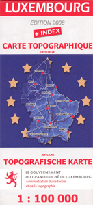
Luxembourg
Indexed topographic map of the country with contours at 20-metre intervals. An overprint shows the GR5/E2 long-distance footpath, youth hostels and chateaux open to the public. The map also includes a detailed plan of the European Union institutions outside Luxembourg City. Margin ticks give latitude and longitude in steps of 10`. Map legend is in French and German only.

Product Description
Reviews/Comments
Add New
Intelligent Comparison
Archived Product
Luxembourg Stanfords
£5.99
Archived Product

Luxembourg North Stanfords
£11.50
Archived Product

Luxembourg South Stanfords
£11.50
Vouchers
No voucher codes found.
Do you know a voucher code for this product or supplier? Add it to Insights for others to use.
Do you know a voucher code for this product or supplier? Add it to Insights for others to use.
 Denmark