
 United Kingdom
 France
 Germany
 Netherlands
 Sweden
 USA
USA
 Italy
Italy
 Spain
Spain
More From Contributor


London Children`s Map
Guy Fox`s ”London Children`s Map” is a simple, illustrated pocket-sized map of central London, showing all the city`s top sites and fun attractions with cartoon images. The map comes with free stickers, so you can decorate your map yourself! Major roads are marked, as are London`s parks. Tube and rail stations are shown. A special mini-map gives detailed information about the Changing of the Guard, including the route, timetable and how to tell the different regiments apart.Visitor Information is given about all the top sites, including phone numbers and web addresses, as well as for general London tourist information centres and some sightseeing transport companies. The map is indexed for top sights and landmarks. The map covers from Mile End Park in the east to Kensington
Gardens in the west, and from Battersea Park in the south to Primrose Hill in the north.
Gardens in the west, and from Battersea Park in the south to Primrose Hill in the north.

Product Description
Reviews/Comments
Add New
Intelligent Comparison
Archived Product
London Children's Wall Map Stanfords
£3.95
Archived Product

London Cycle Map Stanfords
£5.99
Archived Product
Iceland Children's Map Stanfords
£7.50
Archived Product
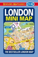
London Mini Map Stanfords
£1.95
Archived Product
London Big Ben Map Stanfords
£2.99
Archived Product
London For Children 2012 Stanfords
£11.99
Vouchers
No voucher codes found.
Do you know a voucher code for this product or supplier? Add it to Insights for others to use.
Do you know a voucher code for this product or supplier? Add it to Insights for others to use.
 Denmark