More From Contributor

£3.95
London all-on-one Transport Map from Quickmap, a handy-size, very useful pocket map for everyone who needs an at-a glance picture of public transport options, combining together information on the capital’s bus, tube & train lines. Bus routes are annotated with line numbers & streets are drawn with their width indicating the frequency of the services. Presenting Underground, Overground, DLR & train routes with the names of lines or the operating companies makes it easy to plan a journey & work out the necessary connections. Colour-coding is used throughout to enhance the clarity of information. Coverage clockwise: Brent Cross, Harringay, Walthamstow, Wanstead, Plaistow, Bexleyheath, Catford, Herne Hill, Balham, Roehampton, Barnes, Chiswick, Acton, Wembley. On the reverse is the publishers’ map of central London, with insets for the Docklands
- Greenwich, Richmond & Hampstead, designed to highlight places of interest, main shopping streets & areas, etc. The index lists transport hubs & attractions by indicating their position from the centre of the map. Also included is a diagram showing walking times between tube stations. Current edition of this map was published in 2012.
...
Archived Product
£14.99
Georgian London was the hub of the world`s largest industrial-military complex, underpinning & securing a global trading empire that was entirely dependent on the Royal Navy for its existence. Philip Mac Dougall explores the bureaucratic web that operated within the wider city area before giving attention to London`s association with the practical aspects of supplying & manning the operational fleet & shipbuilding, repair & maintenance. His detailed geographical exploration of these areas

Includes::
a discussion of key personalities, buildings & work. The book examines significant locations as well as the importance of Londoners in the manning of ships & how the city memorialised the navy & its personnel during times of victory. A gazetteer & walking guide complete this fascinating study.

...
Archived Product
£34.95
London & the M25 Postcode Sector Map at 1:60, 000, encapsulated version, in a series of postcode sector maps showing the first part of the postcode & the first number of the second part, the Inward Code. An enlargement shows central London in greater detail. Coverage extends north to Potters Bar, south to Oxted, east to Thurrock & west to Slough. Map Marketing’s series of postcode sector maps covers Great Britain & Northern Ireland on 36 titles, each available only as a flat map, either on paper or encapsulated for greater durability. Presentation

Includes::
postcode changes in the most recent Royal Mail Postcode updates. The series covers Great Britain at 1:150, 000 (1” to 2.4 miles), with Northern Ireland shown at 1:210, 000 & London at two scales: 1:60, 000 for the area within the M25 & in more detail at 1:15, 000 for central London. Postcode area, district & sector boundaries & numbers/letters are shown in red, with County & Unitary Authority boundaries in green. The map base shows motorways, primary, ‘A’ & down to unclassified roads, with conurbation shapes & city plan insets showing street level detail for major cities. To see the list of all the titles in this series please click on the series link.LAMINATED & ENCAPSULATED WALL MAPS:- LAMINATED wall maps have a thin layer of plastic usually applied to the printed side only. They can be written on with suitable marker pens without any damage to the map but, unless laminated on both sides, they are not damp-proof.- ENCAPSULATED wall maps are sealed between two sheets of plastic. They are more rigid & heavier than laminated maps of the same size. They are damp-proof & do not crinkle in humid conditions. Encapsulation gives the map a shiny surface, similar to being displayed behind glass.- PLEASE NOTE: many publishers & retailers often use these two terms interchangeably. Our map titles & descriptions follow the definitions provided above.

...
Archived Product
£24.95
London & the M25 Postcode Sector Map at 1:60, 000, encapsulated version, in a series of postcode sector maps showing the first part of the postcode & the first number of the second part, the Inward Code. An enlargement shows central London in greater detail. Coverage extends north to Potters Bar, south to Oxted, east to Thurrock & west to Slough. Map Marketing’s series of postcode sector maps covers Great Britain & Northern Ireland on 36 titles, each available only as a flat map, either on paper or encapsulated for greater durability. Presentation

Includes::
postcode changes in the most recent Royal Mail Postcode updates. The series covers Great Britain at 1:150, 000 (1” to 2.4 miles), with Northern Ireland shown at 1:210, 000 & London at two scales: 1:60, 000 for the area within the M25 & in more detail at 1:15, 000 for central London. Postcode area, district & sector boundaries & numbers/letters are shown in red, with County & Unitary Authority boundaries in green. The map base shows motorways, primary, ‘A’ & down to unclassified roads, with conurbation shapes & city plan insets showing street level detail for major cities. To see the list of all the titles in this series please click on the series link.

...
Archived Product
£7.99
Paul Rainey, an ad salesman, perceives dimly through a fog of psychoactive substances his dissatisfaction with his life- professional, sexual, weekends, the lot. He only wishes there was something he could do about it. & `something` seems to fall into his lap when a meeting with an old friend & fellow salesman, Eddy Jaw, leads to the offer of a new job. But when this offer turns out to be as misleading as Paul`s sales patter, his life & that of his family are transformed in ways very much more peculiar than he ever thought possible. ...
Archived Product
£11.99
New & updated edition featuring an exhaustive collection of London`s Art Deco style from factories & underground stations to theatres & private residences. Contains more than 200 stunning photographs offering a visual journey through London & beyond. The Art Deco style gained prominence at the 1925 Paris Exposition, after which each nation seemed to adapt its own distinct architectural style. Less florid than the French or that of the United States, Great Britain s buildings reflected the country s imperial status. From the imposing style of the Savoy Hotel, through the ornate detail of the West End theatres, to Art Deco factories like the Hoover Building, they also demonstrated Britain s love of detail. Remarkably, many of London s Art Deco buildings still survive their once grime-covered indigenous Portland stone now mostly scrubbed clean, beautifully displaying their many sculptural details. This richly illustrated book offers a fascinating & detailed look at the Art Deco style from building design to decorative detail. ...
Archived Product
£7.95
London Artwise in a series of handy concertina street plans from the Florida-based Streetwise Maps, one of a pair of titles covering London with the same map but with different additional information:- STREETWISE London: with a street index which also

Includes::
a list of parks, railway stations, points of interest & selected hotels- ARTWISE London: with no index but instead of it a list of museums with opening hours, telephone numbers, nearest underground station & a brief description of the collection Both titles have an identical map covering roughly the area of central London from Holland Park to the Tower & from Regents Park in the north to the Thames in the south-western part. Several important buildings are shown by small drawings, with colour-coding indicating their use. The maps also show main shopping streets. Underground stations are clearly marked. Also provided is a diagram of the underground network.

...
Archived Product
£12.99
The two world wars of the twentieth century seem so distant from us now, a lifetime ago, in a different age. Yet in London the evidence of these conflicts is around us, near at h&, in the many relics & reminders that are scattered across the fabric of the modern city. &, as Alan Brooks demonstrates in this fascinating photographic record, they can be seen & visited today. Plaques & inscriptions, graves, cemeteries & rolls of honour, stone monuments & stained glass, war-damaged buildings, pillboxes & air-raid shelters, painted signs & camouflage
- these are just some of the mementoes of war, & of the experience of Londoners, during the greatest conflicts the country has known.
...
Archived Product
£25.00
London was a city on the front line in the Second World War. It suffered hits from nearly 12, 000 tons of bombs, with nearly 30, 000 civilians killed by enemy action. The Blitz changed the landscape of the city. Many famous landmarks were hit, including Buckingham Palace, the Houses of Parliament, the Tower of London
- even the Imperial War Museum. Some areas, such as Stepney, were so badly damaged that they had to be almost entirely rebuilt after the war. But it wasn`t just the city`s physical landscape that was transformed. With the arrival of large numbers of Commonwealth & overseas service personnel, London became much more cosmopolitan. After 1942, vast numbers of American servicemen were deployed in the capital, & it was also a busy transport hub & a popular destination for troops on leave. This book tells the story of these momentous years in London`s history through IWM`s unique collections. Using personal accounts from letters & diaries, objects, photographs, maps & documents it gives an up-close & revealing insight into those turbulent years in the capital, experienced by those who lived there.
...
Archived Product
£6.99
Whether you`re looking for uber-trendy style bars or traditional boozers, the capital boasts an unbeatable range of places to drink. This handy guide tells you where to find the beautiful people, the happy hours, the historic inns, the classic cocktails, the gastropubs, the sunny-day hang-outs... Whatever your taste, with over a thousand suggestions this guide is sure to help you find the bar or pub your looking for. ...
Archived Product

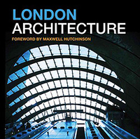
London Architecture

From the remains of the Roman amphitheatre to the soaring glass structures of the 21st century city, London offers a unique architectural experience. This revised and expanded, authoritative guide takes the reader through almost 2.000 years of architectural achievement in the capital. Each chapter contains readily accessible examples of buildings of every period and sets them in their historical context. This guide is the first to deal with the subject chronologically while also giving ideas about how to explore the Capital`s architecture. It will be of interest to any visitor to London with a fascination for architecture and history. The book includes nine fully described walks and easy to follow maps to accompany a saunter through the fascinating story of London`s architecture. Also
featured are some of the many shops, bars and restaurants in London of architectural interest, making this guide an essential resource for both Londoners and visitors alike.
RIP - This product is no longer available on our network. It was last seen on 25.09.2019

This page now acts as a permanent archive for this product. Add more information using the comments box below to ensure it can still be found by future generations.

Use our search facility to see if it is available from an alternative contributor.
  • Availability: Out Of Stock
  • Supplier: Stanfords
  • SKU: 9781902910383
Availability: In Stock
£12.99

Product Description

From the remains of the Roman amphitheatre to the soaring glass structures of the 21st century city, London offers a unique architectural experience. This revised & expanded, authoritative guide takes the reader through almost 2.000 years of architectural achievement in the capital. Each chapter contains readily accessible examples of buildings of every period & sets them in their historical context. This guide is the first to deal with the subject chronologically while also giving ideas about how to explore the Capital`s architecture. It will be of interest to any visitor to London with a fascination for architecture & history. The book

Includes::
nine fully described walks & easy to follow maps to accompany a saunter through the fascinating story of London`s architecture. Also featured are some of the many shops, bars & restaurants in London of architectural interest, making this guide an essential resource for both Londoners & visitors alike.

Reviews/Comments

Add New

Price History

Vouchers

No voucher codes found.
Do you know a voucher code for this product or supplier? Add it to Insights for others to use.

Facebook

Jargon Buster

Glass - A solid, typically transparent. Brittle and used in windows. The first patent granted in the UK was for Glass.
History - Anything that happens in the past. An acedemic subject.
Experience - To gain further knowledge by practising.

Supplier Information

Stanfords
Stanfords was established in 1853 and opened their iconic Covent Garden flagship store in 1901. They have become the top retailer of maps, travel books and accessories in the UK and arguably offer the largest selection of maps and travel books worldwide. Famous names such as Captain Robert Falcon Scott, Ranulph Fiennes and Michael Palin have purchased from Stanfords. They now have a shop in Bristol and both stores together with other venues operate a calendar of events including talks, book signings and exhibitions. As a specialist map retailer, the map selection is comprehensive and includes road maps, street maps and walking maps from worldwide destinations, as well as a selection of world atlases and wall maps. Books include travel guides and travel literature. Stanfords also stock globes, from miniatures made of blue marble to magnificent floor-standing globes. The website features a selection of interesting articles on travel topics.
Page Updated: 2023-11-12 20:15:36

Community Generated Product Tags

Oh No! The productWIKI community hasn't generated any tags for this product yet!
Menu