
 United Kingdom
 France
 Germany
 Netherlands
 Sweden
 USA
USA
 Italy
Italy
 Spain
Spain
More From Contributor


London 1891
London Street Map 1891, in the Cassini Historical Series reproducing old Ordnance Survey mapping of England and Wales, here at 1:10, 500. Unlike other historical London maps from Cassini, the London Street Map 1981 covers only the central London area and does not extend in coverage to approximately today's Greater London area, nor does it directly correlate to a fusion of Ordnance Survey's current 176 and 177 maps.Other relevant Cassini historical cartography of Lodon is published as part of the the following series (please see individual title descriptions): Old Series: the first detailed survey mapping dating for most areas from the first half of the 19th century, in black and white and with relief shown by hachuring. Revised New Series from 1880s/1900s, with some colouring and a
mixture of hachuring and contour lines. Popular Edition from the inter-war years, with contour lines and colouring to indicate woodlands, parks, etc. New Popular Edition from the late 1940s, reproduced in the Cassini series for the major cities. PLEASE NOTE: Stanfords can also print on request mapping from all four series centring the map on a location of your choice. For more information please click on the link below.
mixture of hachuring and contour lines. Popular Edition from the inter-war years, with contour lines and colouring to indicate woodlands, parks, etc. New Popular Edition from the late 1940s, reproduced in the Cassini series for the major cities. PLEASE NOTE: Stanfords can also print on request mapping from all four series centring the map on a location of your choice. For more information please click on the link below.
Product Description
Reviews/Comments
Add New
Intelligent Comparison
Archived Product
London 1921 Stanfords
£6.99
Archived Product
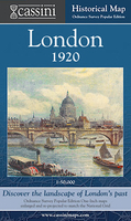
London 1920 Stanfords
£9.99
Archived Product

London 1945 Stanfords
£12.99
Archived Product

London 1897-1898 Stanfords
£9.99
Archived Product
London 1805-1822 Stanfords
£9.99
Archived Product
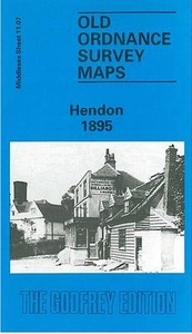
Hendon 1895 Stanfords
£3.50
Archived Product

Hendon 1912 Stanfords
£3.50
Archived Product
London Stanfords
£3.99
Vouchers
No voucher codes found.
Do you know a voucher code for this product or supplier? Add it to Insights for others to use.
Do you know a voucher code for this product or supplier? Add it to Insights for others to use.
 Denmark