
 United Kingdom
 France
 Germany
 Netherlands
 Sweden
 USA
USA
 Italy
Italy
 Spain
Spain
More From Contributor


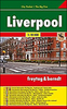


Liverpool Central 1906
Central Liverpool in 1906 in a fascinating series of reproductions of old Ordnance Survey plans in the Alan Godfrey Editions, ideal for anyone interested in the history of their neighbourhood or family. Two versions have been published for this area, with the 1890 map printed in colour. The maps cover the heart of Liverpool, stretching from Albert Dock and the Pierhead eastward to Abercromby Square, and from St George`s Hall southward to Upper Parliament Street. Features include Lime Street station, Central station, Anglican Cathedral (half built on 1906 map), tramways, Philharmonic Hall, St Luke`s church, Duke Street, St John`s Market, Wapping Goods station; Overhead Railway with Pierhead, Customs House and Wapping Dock stations; Albert Dock, King`s Dock, Wapping Dock,
Salthouse Dock, Canning Dock, Manchester Dock, Dock Office, Canning Graving Docks, Town Hall, St Nicholas church, Custom House, Lord Street, etc. A selection of street directory entries is on the reverse of each map.About the Alan Godfrey Editions of the 25” OS Series:Selected towns in Great Britain and Ireland are covered by maps showing the extent of urban development in the last decades of the 19th and early 20th century. The plans have been taken from the Ordnance Survey mapping and reprinted at about 15 inches to one mile (1:4, 340). On the reverse most maps have historical notes and many also include extracts from contemporary directories. Most maps cover about one mile (1.6kms) north/south, one and a half miles (2.4kms) across; adjoining sheets can be combined to provide
wider coverage.FOR MORE INFORMATION AND A COMPLETE LIST OF ALL AVAILABLE TITLES PLEASE CLICK ON THE SERIES LINK.

Product Description
Reviews/Comments
Add New
Intelligent Comparison
Archived Product

Liverpool Toxteth 1906 Stanfords
£3.50
Archived Product
Liverpool North 1906 Stanfords
£2.95
Archived Product

Liverpool North 1906 Stanfords
£3.50
Archived Product

Liverpool And The Wirral 1904 Stanfords
£3.50
Vouchers
No voucher codes found.
Do you know a voucher code for this product or supplier? Add it to Insights for others to use.
Do you know a voucher code for this product or supplier? Add it to Insights for others to use.
 Denmark