
 United Kingdom
 France
 Germany
 Netherlands
 Sweden
 USA
USA
 Italy
Italy
 Spain
Spain
More From Contributor

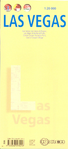
Las Vegas Borch
Very clear, indexed tourist street plan of the city on durable, laminated paper, with additional maps of the surrounding area and the Grand Canyon. The main map includes the Strip, Interstate 15 to the west, Downtown, the international airport, and much of the Winchester district east of the Strip. Detail includes one-way streets, casinos, resorts, hotels, shopping malls, pedestrian zones, notable buildings, public buildings, railways and the monorail. Symbols denote landmarks and tourism features such as information centres, car parks, attractions, shows and museums. The map is indexed for streets, casinos, hotels, tourism sites, shopping malls and other notable buildings.On the reverse is a road map at 1:150, 000 of the surrounding region including the city’s
northern suburbs, Henderson, Boulder City, Lake Mead and the Hoover Dam. Features indicated by symbols, include golf courses, campsites and marinas. Going further afield, there is a 1:3, 000, 000 road map showing the national and state parks and preserves of northern Arizona and southern Utah and Nevada. A 1:225, 000 map (with hill-shading) shows the Grand Canyon NP and its tourism features eg. lodges, viewpoints, major trails and petrol stations. These maps are also indexed for roads and tourist attractions. A smaller plan at 1:40, 000 concentrates on the hotels and roads of the Grand Canyon Village. Thirty recommended attractions are highlighted on the maps and listed. The multilingual map legend includes English.
northern suburbs, Henderson, Boulder City, Lake Mead and the Hoover Dam. Features indicated by symbols, include golf courses, campsites and marinas. Going further afield, there is a 1:3, 000, 000 road map showing the national and state parks and preserves of northern Arizona and southern Utah and Nevada. A 1:225, 000 map (with hill-shading) shows the Grand Canyon NP and its tourism features eg. lodges, viewpoints, major trails and petrol stations. These maps are also indexed for roads and tourist attractions. A smaller plan at 1:40, 000 concentrates on the hotels and roads of the Grand Canyon Village. Thirty recommended attractions are highlighted on the maps and listed. The multilingual map legend includes English.

Product Description
Reviews/Comments
Add New
Intelligent Comparison
Archived Product

Las Vegas Noir Stanfords
£9.99
Archived Product
Las Vegas ITMB Stanfords
£9.99
Archived Product
Las Vegas Stanfords
£4.99
Archived Product
Las Vegas Stanfords
£12.99
Archived Product
Las Vegas Stanfords
£6.99
Archived Product
Las Vegas Stanfords
£4.99
Archived Product
Las Vegas Top 10 Stanfords
£7.99
Archived Product

Las Vegas PopOut Stanfords
£3.99
Vouchers
No voucher codes found.
Do you know a voucher code for this product or supplier? Add it to Insights for others to use.
Do you know a voucher code for this product or supplier? Add it to Insights for others to use.
 Denmark