
 United Kingdom
 France
 Germany
 Netherlands
 Sweden
 USA
USA
 Italy
Italy
 Spain
Spain
More From Contributor

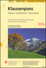
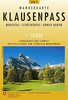


Klausenpass Swisstopo 246
Klausenpass, map No. 246, in the standard topographic survey of Switzerland at 1:50, 000 from Swisstopo, i.e. without the special overprint highlighting walking trails, local bus stops, etc, presented in Swisstopo’s hiking editions of the 50K survey. Highly regarded for their superb use of graphic relief and hill shading, the maps give an almost 3-D picture of Switzerland`s mountainous terrain. Contours are at 20m intervals. All the maps have a 1-km grid with the Swiss national coordinates. This standard version of the 50K survey covers the whole country on 78 small format sheets, with special larger format maps published for several popular tourist destinations. Small format sheets cover an area of 35 x 24 km (21 x 15 miles approx) and have map legend in the language of the area
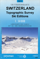
covered by the map. The special larger sheets cover 50 x 35 km (31 x 22 miles approx) and have no map legend, but a separate leaflet can be provided instead.PLEASE NOTE: the hiking editions of the 1:50, 000 Swisstopo survey are listed on our website in a separate series.
covered by the map. The special larger sheets cover 50 x 35 km (31 x 22 miles approx) and have no map legend, but a separate leaflet can be provided instead.PLEASE NOTE: the hiking editions of the 1:50, 000 Swisstopo survey are listed on our website in a separate series.

Product Description
Reviews/Comments
Add New
Intelligent Comparison
Archived Product
Klausenpass Swisstopo SKI 246S Stanfords
£22.99
Archived Product

Klausenpass Swisstopo Hiking 246T Stanfords
£18.99
Archived Product
Sustenpass Swisstopo 255 Stanfords
£12.99
Archived Product
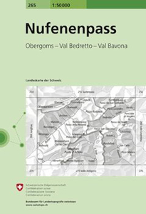
Nufenenpass Swisstopo 265 Stanfords
£12.99
Archived Product

Julierpass Swisstopo 268 Stanfords
£12.99
Archived Product
Ofenpass Swisstopo 259 Stanfords
£12.99
Archived Product

Splügenpass Swisstopo 1255 Stanfords
£12.99
Archived Product

Olten Swisstopo 224 Stanfords
£12.99
Vouchers
No voucher codes found.
Do you know a voucher code for this product or supplier? Add it to Insights for others to use.
Do you know a voucher code for this product or supplier? Add it to Insights for others to use.
 Denmark