
 United Kingdom
 France
 Germany
 Netherlands
 Sweden
 USA
USA
 Italy
Italy
 Spain
Spain
More From Contributor


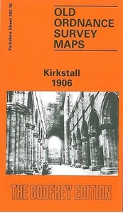
Kirkstall 1906
Kirkstall in 1906 in a fascinating series of reproductions of old Ordnance Survey plans in the Alan Godfrey Editions, ideal for anyone interested in the history of their neighbourhood or family. The map covers the Kirkstall area of Leeds. The village of Kirkstall is near the centre of the map and features include St Stephen`s church, Savins Mill, Commercial Road, Bridge Road, Abbey Mills, Kirkstall Abbey, Abbey House, Crooked Acres, tanneries, Kirkstall Bridge, etc. East of the map is a stretch of the NER Leeds Northern railway with Headingley station. The River Aire runs through the map and west of it is the Midland Railway with Kirkstall station. Other features there include a good stretch of the Leeds & Liverpool Canal, Kirkstall Brewery, Toads Hole Wood, Kirkstall Hall;
several streets are being laid out for building between Bramley Hill and Raynville Road. Lincroft Gardens is in the south-west corner of the map, Kirkstall Forge in the north-west corner. A good selection of street directory entries is on the reverse.About the Alan Godfrey Editions of the 25” OS Series:Selected towns in Great Britain and Ireland are covered by maps showing the extent of urban development in the last decades of the 19th and early 20th century. The plans have been taken from the Ordnance Survey mapping and reprinted at about 15 inches to one mile (1:4, 340). On the reverse most maps have historical notes and many also include extracts from contemporary directories. Most maps cover about one mile (1.6kms) north/south, one and a half miles (2.4kms) across; adjoining sheets
can be combined to provide wider coverage.FOR MORE INFORMATION AND A COMPLETE LIST OF ALL AVAILABLE TITLES PLEASE CLICK ON THE SERIES LINK.

Product Description
Reviews/Comments
Add New
Intelligent Comparison
Archived Product

Kirkdale 1906 Stanfords
£3.50
Vouchers
No voucher codes found.
Do you know a voucher code for this product or supplier? Add it to Insights for others to use.
Do you know a voucher code for this product or supplier? Add it to Insights for others to use.
 Denmark