
 United Kingdom
 France
 Germany
 Netherlands
 Sweden
 USA
USA
 Italy
Italy
 Spain
Spain
More From Contributor


Kingston Upon Hull
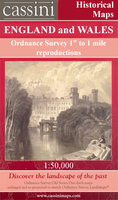
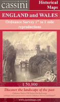
Map No. 107, Kingston upon Hull, in the Ordnance Survey Landranger series at 1:50, 000, including Barton-upon-Humber, Welwick, Patrington, Keyingham, Withernsea, Hedon, Roos, Burton Pidsea, Bilton, Cottingham, Sproatley, Aldbrough, Wawne, Beverley, Skirlaugh, Tickton, Leven, Withernwick, Mappleton, Hornsea, Leconfield, Beswick, Brandesburton, Hutton Cranswick, North Frodingham, Skerne, Skipsea, Driffield, Barmston, Sunk Island, Easington and Kilnsea, with the Spurn Head and the northern part of the Humber Estuary. Edition C2; Revised for selected changes 2006; Copyright date: 2006; Reprinted with minor change 2007 This title is also available on our website in a waterproof and tear-resistant version.Maps in this series are only published folded. Stanfords
can also print flat versions of Ordnance Survey maps through the OS Select system, centring the map on a location of your choice and with a picture provided by you on the cover. For more information please click on the link at the bottom of this description.About Ordnance Survey
can also print flat versions of Ordnance Survey maps through the OS Select system, centring the map on a location of your choice and with a picture provided by you on the cover. For more information please click on the link at the bottom of this description.About Ordnance Survey
Product Description
Reviews/Comments
Add New
Intelligent Comparison
Archived Product

Kingston Upon Hull 1924 Stanfords
£9.99
Archived Product
Kingston Upon Hull 1824-1858 Stanfords
£9.99
Archived Product
Kingston Upon Hull 1903-1908 Stanfords
£9.99
Archived Product
Kingston Upon Hull WATERPROOF Stanfords
£10.39
Archived Product
Kingston Upon Hull (midi Pbk) Stanfords
£4.50
Archived Product
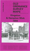
Kingston Upon Hull & Beverley Stanfords
£6.39
Archived Product
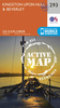
Kingston Upon Hull OS ACTIVE Map Stanfords
£9.09
Vouchers
No voucher codes found.
Do you know a voucher code for this product or supplier? Add it to Insights for others to use.
Do you know a voucher code for this product or supplier? Add it to Insights for others to use.
 Denmark