More From Contributor

£160.00
A Map Of The Hundred Of Eastry With The Town & Port Of Sandwich in Kent, an original antique map by E. Hasted, published in Canterbury around 1779. A copperplate engraving, coloured. Map size 38 x 42 cm, overall mounted size 54 x 58.5 cm.A detailed map of the hundred of Eastry together with the Liberty of the town & port of Sandwich, one of the Cinque Ports, in Kent that was published in Edward Hasted's History & Topographical Survey Of The County Of Kent. Towns & villages include Denton, Waldershare & Knolton, amongst others. The map depicts roads, woodl&, common land & the Sandwich & Deal marshes. Hasted's maps are among the most detailed & large scale of the county, & were often folded into small format editions of the book. The term ` Hundred' dates back to Anglo-Saxon times & Kent's peculiar system of land & social administration. The community was made up of `tithes' (a ten household unit), which was responsible to the ` Hundred Court' (normally consisting of ten `tithes'), & `lathes' (into which the Hundreds were grouped), there being five lathes in Kent. The tithes were responsible for the behaviour of their individual members & the lathes responsible for providing the King with food & men when required. Antique maps from various original publishers are presented on the Stanford ...
Archived Product
£180.00
The Hundred Of Maidstone in Kent, an original antique map by E. Hasted, published in Canterbury around 1778. A copperplate engraving, coloured. Map size 38.5 x 49.5 cm, overall mounted size 53 x 64.5 cm.A very detailed map from Hasted's History & Topgraphical Survey Of Kent, showing Maidstone & environs. Hasted's maps were among the most detailed & large scale of the county, & were often folded into small format editions of the book. The term ` Hundred' dates back to Anglo-Saxon times & Kent's peculiar system of land & social administration. The community was made up of `tithes' (a ten household unit), which was responsible to the ` Hundred Court' (normally consisting of ten `tithes'), & `lathes' (into which the Hundreds were grouped), there being five lathes in Kent. The tithes were responsible for the behaviour of their individual members & the lathes responsible for providing the King with food & men when required. Protective margins added & tears repaired. Antique maps from various original publishers are presented on the Stanford ...
Archived Product
£160.00
The Hundreds Of Loningborough & Folkestone in Kent, an original antique map by E. Hasted, published in Canterbury around 1778. A copperplate engraving, coloured. Map size 37 x 46.5 cm, overall mounted size 52 x 61.5 cm.A very detailed map from Hasted's History of Kent, showing the area inland from the Channel coast at Folkestone. Hasted's maps are amongst the most detailed & large scale of the county, & were often folded into small format editions of the book. The term ` Hundred' dates back to Anglo-Saxon times & Kent's peculiar system of land & social administration. The community was made up of `tithes' (a ten household unit), which was responsible to the ` Hundred Court' (normally consisting of ten `tithes'), & `lathes' (into which the Hundreds were grouped), there being five lathes in Kent. The tithes were responsible for the behaviour of their individual members & the lathes responsible for providing the King with food & men when required. Protective margins added & tears repaired. Antique maps from various original publishers are presented on the Stanford ...
Archived Product
£160.00
The Hundreds Of Stowting, Street & Heane in Kent, an original antique map by E. Hasted, published in Canterbury around 1778. A copperplate engraving, coloured. Map size 37 x 46.5 cm, overall mounted size 52 x 58.5 cm.A very detailed map from Edward Hasted's History & Topgraphical Survey Of Kent, showing the hundreds of Stowting, Street & Heane: & Of Bircholt Barony & Franchise. The map

Includes::
the town of Hythe & sailing ships decorate the English Channel. Hasted's maps are amongst the most detailed & large scale of the county, & were often folded into small format editions of the book. The term ` Hundred' dates back to Anglo-Saxon times & Kent's peculiar system of land & social administration. The community was made up of `tithes' (a ten household unit), which was responsible to the ` Hundred Court' (normally consisting of ten `thithes'), & `lathes' (into which the Hundreds were grouped), there being five lathes in Kent. The tithes were responsible for the behaviour of their individual members & the lathes responsible for providing the King with food & men when required. Antique maps from various original publishers are presented on the Stanford

...
Archived Product
£160.00
The Hundreds Of Westgate, Whitstable, Blengate & Preston in Kent, an original antique map by E. Hasted, published in Canterbury around 1778. A copperplate engraving, coloured. Map size 49 x 37 cm, overall mounted size 64.5 x 52 cm.A very detailed map from Hasted's History of Kent, showing the area of the north Kent coast between Whitstable & Reculver. The map extends inland to Canterbury. Hasted's maps are amongst the most detailed & large scale of the county, & were often folded into small format editions of the book. The term ` Hundred' dates back to Anglo-Saxon times & Kent's peculiar system of land & social administration. The community was made up of `tithes' (a ten household unit), which was responsible to the ` Hundred Court' (normally consisting of ten `tithes'), and `lathes' (into which the Hundreds were grouped), there being five lathes in Kent. The tithes were responsible for the behaviour of their individual members & the lathes responsible for providing the King with food & men when required. Protective margins added. Restoration to old folds & areas of paper weakness. Antique maps from various original publishers are presented on the Stanford ...
Archived Product
£35.00
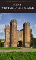
Kent: West Kent & the Weald Pevsner Architectural Guide, in a series of publications begun with the express aim of providing up-to-date guides to the most significant buildings in every part of the country, suitable for both general reader & specialist. Each volume provides an introductory overview of the architecture of the area, followed by a descriptive gazetteer arranged alphabetically by place. Whilst cathedrals & their furnishings, great country houses & their parks form the grand set pieces, the books demonstrate the enjoyable diversity of architecture in the British Isles in accounts of rural churches & farmsteads, Victorian public buildings & industrial monuments. A continuing programme of publication keeps the series up-to-date with new information on older buildings & recent architecture while maintaining the tradition of Pevsner`s own succinct accounts. Each book has over 100 photographs, mostly specially commissioned, numerous maps & plans, a glossary & indexes. ...
Archived Product
£3.50
Kentish Town & Camden in 1870 in a fascinating series of reproductions of old Ordnance Survey plans in the Alan Godfrey Editions, ideal for anyone interested in the history of their neighbourhood or family. Three versions are available for this area. The maps extend from Primrose Hill eastward to Camden Square & Marquis Road, & from Leighton Road southward to Pratt Street, covering much of Kentish Town, Camden Town & the old St Pancras borough. There are many railway features including the approaches to St Pancras, with Kentish Town & Camden Road stations; the approaches to Euston, including Chalk Farm station, Camden Goods station & engine shed; the North London Railway, with Kentish Town & Camden Town stations; & the GNER engine sheds. Other features include tramways, the Regents Canal, part of Primrose Hill, Maitland Park, Camden Brewery, etc. The 1894 version

Includes::
street directory entries for Chalk Farm Road, Gloucester Road, Kentish Town Road, King`s Road, Prince of Wales Road & Regent`s Park Road. About the Alan Godfrey Editions of the 25” OS Series: Selected towns in Great Britain & Ireland are covered by maps showing the extent of urban development in the last decades of the 19th & early 20th century. The plans have been taken from the Ordnance Survey mapping & reprinted at about 15 inches to one mile (1:4, 340). On the reverse most maps have historical notes & many also include extracts from contemporary directories. Most maps cover about one mile (1.6kms) north/south, one & a half miles (2.4kms) across; adjoining sheets can be combined to provide wider coverage.FOR MORE INFORMATION & A COMPLETE LIST OF ALL AVAILABLE TITLES PLEASE CLICK ON THE SERIES LINK.

...
Archived Product
£3.50
Kentish Town & Camden in 1894 in a fascinating series of reproductions of old Ordnance Survey plans in the Alan Godfrey Editions, ideal for anyone interested in the history of their neighbourhood or family. Three versions are available for this area. The maps extend from Primrose Hill eastward to Camden Square & Marquis Road, & from Leighton Road southward to Pratt Street, covering much of Kentish Town, Camden Town & the old St Pancras borough. There are many railway features including the approaches to St Pancras, with Kentish Town & Camden Road stations; the approaches to Euston, including Chalk Farm station, Camden Goods station & engine shed; the North London Railway, with Kentish Town & Camden Town stations; & the GNER engine sheds. Other features include tramways, the Regents Canal, part of Primrose Hill, Maitland Park, Camden Brewery, etc. The 1894 version

Includes::
street directory entries for Chalk Farm Road, Gloucester Road, Kentish Town Road, King`s Road, Prince of Wales Road & Regent`s Park Road. About the Alan Godfrey Editions of the 25” OS Series: Selected towns in Great Britain & Ireland are covered by maps showing the extent of urban development in the last decades of the 19th & early 20th century. The plans have been taken from the Ordnance Survey mapping & reprinted at about 15 inches to one mile (1:4, 340). On the reverse most maps have historical notes & many also include extracts from contemporary directories. Most maps cover about one mile (1.6kms) north/south, one & a half miles (2.4kms) across; adjoining sheets can be combined to provide wider coverage.FOR MORE INFORMATION & A COMPLETE LIST OF ALL AVAILABLE TITLES PLEASE CLICK ON THE SERIES LINK.

...
Archived Product
£2.95
Kentish Town & Camden in 1913 in a fascinating series of reproductions of old Ordnance Survey plans in the Alan Godfrey Editions, ideal for anyone interested in the history of their neighbourhood or family. Selected towns in Great Britain & Ireland are covered by maps showing the extent of urban development in the last decades of the 19th & early 20th century. In this title: two versions of this map have been published to show how the area developed across the years. It covers an area stretching from Primrose Hill eastward to Camden Square & Marquis Road; from Leighton Road southward to Preatt Street. These are very busy maps covering much of Kentish Town, Camden Town & the old St Pancras borough. There are many railway features including the approaches to St Pancras, with Kentish Town & Camden Road stations; the approaches to Euston, including Chalk Farm station, Camden Goods station & engine shed; the North London Railway, with Kentish Town & Camden Town stations; & the GNER engine sheds. Other features include tramways, the Regents Canal, part of Primrose Hill, Maitland Park, Camden Brewery, & countless streets of housing. Streets include Prince of Wales Road, Haverstock Hill, Camden Road, Kentish Town Road, High Street & many more. Directories extracts are included on the reverse. About the Alan Godfrey Editions of the 25 ...
Archived Product
£3.50
Kentish Town & Camden in 1913 in a fascinating series of reproductions of old Ordnance Survey plans in the Alan Godfrey Editions, ideal for anyone interested in the history of their neighbourhood or family. Three versions are available for this area. The maps extend from Primrose Hill eastward to Camden Square & Marquis Road, & from Leighton Road southward to Pratt Street, covering much of Kentish Town, Camden Town & the old St Pancras borough. There are many railway features including the approaches to St Pancras, with Kentish Town & Camden Road stations; the approaches to Euston, including Chalk Farm station, Camden Goods station & engine shed; the North London Railway, with Kentish Town & Camden Town stations; & the GNER engine sheds. Other features include tramways, the Regents Canal, part of Primrose Hill, Maitland Park, Camden Brewery, etc. The 1894 version

Includes::
street directory entries for Chalk Farm Road, Gloucester Road, Kentish Town Road, King`s Road, Prince of Wales Road & Regent`s Park Road. About the Alan Godfrey Editions of the 25” OS Series: Selected towns in Great Britain & Ireland are covered by maps showing the extent of urban development in the last decades of the 19th & early 20th century. The plans have been taken from the Ordnance Survey mapping & reprinted at about 15 inches to one mile (1:4, 340). On the reverse most maps have historical notes & many also include extracts from contemporary directories. Most maps cover about one mile (1.6kms) north/south, one & a half miles (2.4kms) across; adjoining sheets can be combined to provide wider coverage.FOR MORE INFORMATION & A COMPLETE LIST OF ALL AVAILABLE TITLES PLEASE CLICK ON THE SERIES LINK.

...
Archived Product

Kent: West Kent And The Weald Pevsner Architectural Guide

Kent: West Kent and the Weald Pevsner Architectural Guide, in a series of publications begun with the express aim of providing up-to-date guides to the most significant buildings in every part of the country, suitable for both general reader and specialist. Each volume provides an introductory overview of the architecture of the area, followed by a descriptive gazetteer arranged alphabetically by place. Whilst cathedrals and their furnishings, great country houses and their parks form the grand set pieces, the books demonstrate the enjoyable diversity of architecture in the British Isles in accounts of rural churches and farmsteads, Victorian public buildings and industrial monuments. A continuing programme of publication keeps the series up-to-date with new information on older
buildings and recent architecture while maintaining the tradition of Pevsner's own succinct accounts. Each book has over 100 photographs, mostly specially commissioned, numerous maps and plans, a glossary and indexes.
RIP - This product is no longer available on our network. It was last seen on 25.09.2019

This page now acts as a permanent archive for this product. Add more information using the comments box below to ensure it can still be found by future generations.

Use our search facility to see if it is available from an alternative contributor.
  • Availability: Out Of Stock
  • Supplier: Stanfords
  • SKU: 9780300096149
Availability: In Stock
£25.00

Product Description

Kent: West Kent & the Weald Pevsner Architectural Guide, in a series of publications begun with the express aim of providing up-to-date guides to the most significant buildings in every part of the country, suitable for both general reader & specialist. Each volume provides an introductory overview of the architecture of the area, followed by a descriptive gazetteer arranged alphabetically by place. Whilst cathedrals & their furnishings, great country houses & their parks form the grand set pieces, the books demonstrate the enjoyable diversity of architecture in the British Isles in accounts of rural churches & farmsteads, Victorian public buildings & industrial monuments. A continuing programme of publication keeps the series up-to-date with new information on older buildings & recent architecture while maintaining the tradition of Pevsner's own succinct accounts. Each book has over 100 photographs, mostly specially commissioned, numerous maps & plans, a glossary & indexes.

Reviews/Comments

Add New

Price History

Vouchers

No voucher codes found.
Do you know a voucher code for this product or supplier? Add it to Insights for others to use.

Facebook

Jargon Buster

Date - A day on a calendar
Date - A social activity whith a current or potential partner
Set - a group of items usually related to one another. Some objects cannot function without the complete set of items.

Supplier Information

Stanfords
Stanfords was established in 1853 and opened their iconic Covent Garden flagship store in 1901. They have become the top retailer of maps, travel books and accessories in the UK and arguably offer the largest selection of maps and travel books worldwide. Famous names such as Captain Robert Falcon Scott, Ranulph Fiennes and Michael Palin have purchased from Stanfords. They now have a shop in Bristol and both stores together with other venues operate a calendar of events including talks, book signings and exhibitions. As a specialist map retailer, the map selection is comprehensive and includes road maps, street maps and walking maps from worldwide destinations, as well as a selection of world atlases and wall maps. Books include travel guides and travel literature. Stanfords also stock globes, from miniatures made of blue marble to magnificent floor-standing globes. The website features a selection of interesting articles on travel topics.
Page Updated: 2023-11-12 20:15:36

Community Generated Product Tags

Oh No! The productWIKI community hasn't generated any tags for this product yet!
Menu