More From Contributor

£9.99
Map No. 760, Kenai NWR/ Chugach National Forest, AK, in an extensive series of GPS compatible, contoured hiking maps of USA’s national & state parks or forests & other popular recreational areas. Cartography based on the national topographic survey, with additional tourist information. The maps, with most titles now printed on light, waterproof & tear-resistant plastic paper, highlight walking trails along with campsites & other accommodation, picnic sites, areas for various recreational pursuits such as horse riding or skiing, drinking water sources, & many other facilities of interest to the outdoor enthusiast. Cartography is based on information from the USGS (United States Geological Survey
- the country’s national survey organization), revised by the National Geographic Maps in cooperation with the National Park Service, USDA Forest Service, etc. Topography is excellently presented by contours (interval varies according to scale), enhanced by relief shading & colouring/graphics for wood cover, glaciers, etc. All heights are given in feet. The maps have a UTM grid plus latitude & longitude margin ticks & GPS waypoints for selected important locations. Each map is double-sided to give either maximum coverage of the chosen area or additional enlargements of its important sections. Accompanying notes provide useful information on relevant regulations, safety precautions, contact addresses, etc.* *IMPORTANT
- PLEASE NOTE: the series is very extensive, ranging in scale from 1:400, 000 for the vast national parks of Alaska to 1:25, 000 for local map in several states. We recommend, therefore, viewing the series by state rather than the whole list.*

...
Archived Product
£8.99
The OS Landranger Map series covers Great Britain with 204 detailed maps, perfect for day trips & short breaks. Each map provides all the information you need to get to know your local area &

Includes::
places of interest, tourist information, picnic areas & camp sites, plus Rights of Way information for England & Wales. OS Landranger now

Includes::
a digital version of the paper map, accessed through the OS smartphone app, OS Maps.


...
Archived Product
£14.99
The OS Landranger Active Map series covers Great Britain with 204 detailed maps, perfect for day trips & short breaks. Tough, durable & weatherproof, covered in a lightweight protective plastic coating that can be written on, so that your favourite routes can be easily highlighted. Each map provides all the information you need to get to know your local area &

Includes::
places of interest, tourist information, picnic areas & camp sites, plus Rights of Way information for England & Wales. OS Landranger Active now

Includes::
a digital version of the paper map, accessed through the OS smartphone app, OS Maps.


...
Archived Product
£5.59
Map No. 97, Kendal & Morecambe, in the Ordnance Survey Landranger series at 1:50, 000, including Lancaster, Heysham, Halton, Hornby, Cranforth, Melling, Kirkby Lonsdale, Silverdale, Burton-in-Kendal, Arnside, Milnthorpe, Berbon, Endmoor, Middleshaw, Sedbergh, Grayrigg, Windermere, Burnside, Crosthwaite, Levens, Newby Bridge, Lindale, Grange-over-Sands, Flookburgh, Aldingham, Ulverston, Haverthwaite, Spark Bridge, Lakeside, Blawith, Torver & Coniston, with the Lake District National Park including lakes Windermere, Coniston Water & Esthwaite Water, plus Goodber Common & a small part of the Yorkshire Dales National Park. Edition C4; Publication date November 2011 About Ordnance Survey ...
Archived Product
£7.99
Map No. 97, Kendal & Morecambe 1852-1865, in the Cassini Historical Series of old Ordnance Survey mapping of England & Wales at 1:50, 000 in a format designed to offer a convenient comparison with the present day coverage from the OS, & most locations in three different editions. Old historical maps have been combined so that the sheet lines correspond to the current Landranger series & reproduced with the scale changed from one inch to one mile to 1:50, 000. Most locations are covered by three separate maps, showing how the area has changed over the decades, with selected major cities also presented in a fourth edition. Old Series: the first detailed survey mapping dating for most areas from the first half of the 19th century, in black & white & with relief shown by hachuring. Revised New Series from 1880s/1900s, with some colouring & a mixture of hachuring & contour lines. Popular Edition from the inter-war years, with contour lines & colouring to indicate woodlands, parks, etc. New Popular Edition from the late 1940s, reproduced in the Cassini series for the major cities. Each map

Includes::
notes on the development of Ordnance Survey & the various series produced by them. For those interested in maps & cartography in general, the Cassini series also provides a fascinating insight into how Ordnance Survey cartographic style has developed over a period of over 100 years. Coverage

Includes::
present day Lancaster, Heysham, Halton, Hornby, Cranforth, Melling, Kirkby Lonsdale, Silverdale, Burton-in-Kendal, Arnside, Milnthorpe, Berbon, Endmoor, Middleshaw, Sedbergh, Grayrigg, Windermere, Burnside, Crosthwaite, Levens, Newby Bridge, Lindale, Grange-over-Sands, Flookburgh, Aldingham, Ulverston, Haverthwaite, Spark Bridge, Lakeside, Blawith, Torver & Coniston, with the Lake District National Park including lakes Windermere, Coniston Water & Esthwaite Water, plus Goodber Common & a small part of the Yorkshire Dales National Park. PLEASE NOTE: Stanfords can also print on request mapping from all four series centring the map on a location of your choice. For more information please click on the link below.


...
Archived Product
£7.99
Map No. 97, Kendal & Morecambe 1903-1904, in the Cassini Historical Series of old Ordnance Survey mapping of England & Wales at 1:50, 000 in a format designed to offer a convenient comparison with the present day coverage from the OS, & most locations in three different editions. Old historical maps have been combined so that the sheet lines correspond to the current Landranger series & reproduced with the scale changed from one inch to one mile to 1:50, 000. Most locations are covered by three separate maps, showing how the area has changed over the decades, with selected major cities also presented in a fourth edition. Old Series: the first detailed survey mapping dating for most areas from the first half of the 19th century, in black & white & with relief shown by hachuring. Revised New Series from 1880s/1900s, with some colouring & a mixture of hachuring & contour lines. Popular Edition from the inter-war years, with contour lines & colouring to indicate woodlands, parks, etc. New Popular Edition from the late 1940s, reproduced in the Cassini series for the major cities. Each map

Includes::
notes on the development of Ordnance Survey & the various series produced by them. For those interested in maps & cartography in general, the Cassini series also provides a fascinating insight into how Ordnance Survey cartographic style has developed over a period of over 100 years. Coverage

Includes::
present day Lancaster, Heysham, Halton, Hornby, Cranforth, Melling, Kirkby Lonsdale, Silverdale, Burton-in-Kendal, Arnside, Milnthorpe, Berbon, Endmoor, Middleshaw, Sedbergh, Grayrigg, Windermere, Burnside, Crosthwaite, Levens, Newby Bridge, Lindale, Grange-over-Sands, Flookburgh, Aldingham, Ulverston, Haverthwaite, Spark Bridge, Lakeside, Blawith, Torver & Coniston, with the Lake District National Park including lakes Windermere, Coniston Water & Esthwaite Water, plus Goodber Common & a small part of the Yorkshire Dales National Park. PLEASE NOTE: Stanfords can also print on request mapping from all four series centring the map on a location of your choice. For more information please click on the link below.


...
Archived Product
£7.99
Map No. 97, Kendal & Morecambe 1924-1925, in the Cassini Historical Series of old Ordnance Survey mapping of England & Wales at 1:50, 000 in a format designed to offer a convenient comparison with the present day coverage from the OS, & most locations in three different editions. Old historical maps have been combined so that the sheet lines correspond to the current Landranger series & reproduced with the scale changed from one inch to one mile to 1:50, 000. Most locations are covered by three separate maps, showing how the area has changed over the decades, with selected major cities also presented in a fourth edition. Old Series: the first detailed survey mapping dating for most areas from the first half of the 19th century, in black & white & with relief shown by hachuring. Revised New Series from 1880s/1900s, with some colouring & a mixture of hachuring & contour lines. Popular Edition from the inter-war years, with contour lines & colouring to indicate woodlands, parks, etc. New Popular Edition from the late 1940s, reproduced in the Cassini series for the major cities. Each map

Includes::
notes on the development of Ordnance Survey & the various series produced by them. For those interested in maps & cartography in general, the Cassini series also provides a fascinating insight into how Ordnance Survey cartographic style has developed over a period of over 100 years. Coverage

Includes::
present day Lancaster, Heysham, Halton, Hornby, Cranforth, Melling, Kirkby Lonsdale, Silverdale, Burton-in-Kendal, Arnside, Milnthorpe, Berbon, Endmoor, Middleshaw, Sedbergh, Grayrigg, Windermere, Burnside, Crosthwaite, Levens, Newby Bridge, Lindale, Grange-over-Sands, Flookburgh, Aldingham, Ulverston, Haverthwaite, Spark Bridge, Lakeside, Blawith, Torver & Coniston, with the Lake District National Park including lakes Windermere, Coniston Water & Esthwaite Water, plus Goodber Common & a small part of the Yorkshire Dales National Park. PLEASE NOTE: Stanfords can also print on request mapping from all four series centring the map on a location of your choice. For more information please click on the link below.


...
Archived Product
£9.09
Map No. 97, Kendal & Morecambe, in a waterproof & tear-resistant OS Active version of the Ordnance Survey Landranger series at 1:50, 000, including Lancaster, Heysham, Halton, Hornby, Cranforth, Melling, Kirkby Lonsdale, Silverdale, Burton-in-Kendal, Arnside, Milnthorpe, Berbon, Endmoor, Middleshaw, Sedbergh, Grayrigg, Windermere, Burnside, Crosthwaite, Levens, Newby Bridge, Lindale, Grange-over-Sands, Flookburgh, Aldingham, Ulverston, Haverthwaite, Spark Bridge, Lakeside, Blawith, Torver & Coniston, with the Lake District National Park including lakes Windermere, Coniston Water & Esthwaite Water, plus Goodber Common & a small part of the Yorkshire Dales National Park. Edition C4; Publication date November 2011 About Ordnance Survey ...
Archived Product
£3.50
North Kendall in 1911 in a fascinating series of reproductions of old Ordnance Survey plans in the Alan Godfrey Editions, ideal for anyone interested in the history of their neighbourhood or family. The map covers the northern part of Kendal, stretching from the railway station northward to Mint Bridge & Middle Sparrowmire, & from Hallgarth eastward to Spital & Fowl Ing. Features include railway with station, goods station, Ale Stores, Auction Mart, Kendal Green, St Thomas church, Dockray Hall Mill, Mintsfeet, Sunny Brow, Workhouse, Airethwaite, Sparrowmire, Kentrigg, etc. About the Alan Godfrey Editions of the 25” OS Series: Selected towns in Great Britain & Ireland are covered by maps showing the extent of urban development in the last decades of the 19th & early 20th century. The plans have been taken from the Ordnance Survey mapping & reprinted at about 15 inches to one mile (1:4, 340). On the reverse most maps have historical notes & many also include extracts from contemporary directories. Most maps cover about one mile (1.6kms) north/south, one & a half miles (2.4kms) across; adjoining sheets can be combined to provide wider coverage.FOR MORE INFORMATION & A COMPLETE LIST OF ALL AVAILABLE TITLES PLEASE CLICK ON THE SERIES LINK. ...
Archived Product
£3.50
South Kendall in 1911 in a fascinating series of reproductions of old Ordnance Survey plans in the Alan Godfrey Editions, ideal for anyone interested in the history of their neighbourhood or family. The map covers the centre of Kendal, stretching from Sandes Avenue southward to Romney Road, & from Ghyll Brow eastward to Castle Street. Features include Kendal Castle, Boot Factory, Stricklandgate & High Street, County Hospital, River Kent, Castle Mills, Abbot Hall, Sanatorium, Cemetery, Holy Trinity church, Serpentine Walks, Dalton House, Goose Holme, Maude`s Meadow, mills, Nether Bridge, Mill Bridge, Stramongate Bridge, Grammar School, The Lound, Gillingrove Brewery, etc. A list of private residents from a contemporary directory is on the reverse. About the Alan Godfrey Editions of the 25” OS Series: Selected towns in Great Britain & Ireland are covered by maps showing the extent of urban development in the last decades of the 19th & early 20th century. The plans have been taken from the Ordnance Survey mapping & reprinted at about 15 inches to one mile (1:4, 340). On the reverse most maps have historical notes & many also include extracts from contemporary directories. Most maps cover about one mile (1.6kms) north/south, one & a half miles (2.4kms) across; adjoining sheets can be combined to provide wider coverage.FOR MORE INFORMATION & A COMPLETE LIST OF ALL AVAILABLE TITLES PLEASE CLICK ON THE SERIES LINK. ...
Archived Product

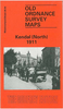
Kendal And Morecambe 1852-1925 (3-map Set)

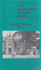
Map No. 97, Kendal and Morecambe 1853-1925 (3-map set), in the Cassini Historical Series of old Ordnance Survey mapping of England and Wales at 1:50, 000 in a format designed to offer a convenient comparison with the present day coverage from the OS, and most locations in three different editions. Old historical maps have been combined so that the sheet lines correspond to the current Landranger series and reproduced with the scale changed from one inch to one mile to 1:50, 000. Most locations are covered by three separate maps, showing how the area has changed over the decades, with selected major cities also presented in a fourth edition. Old Series: the first detailed survey mapping dating for most areas from the first half of the 19th century, in black and white and with relief
shown by hachuring. Revised New Series from 1880s/1900s, with some colouring and a mixture of hachuring and contour lines. Popular Edition from the inter-war years, with contour lines and colouring to indicate woodlands, parks, etc. New Popular Edition from the late 1940s, reproduced in the Cassini series for the major cities.Each map includes notes on the development of Ordnance Survey and the various series produced by them. For those interested in maps and cartography in general, the Cassini series also provides a fascinating insight into how Ordnance Survey cartographic style has developed over a period of over 100 years.Coverage includes present day Lancaster, Heysham, Halton, Hornby, Cranforth, Melling, Kirkby Lonsdale, Silverdale, Burton-in-Kendal, Arnside,
Milnthorpe, Berbon, Endmoor, Middleshaw, Sedbergh, Grayrigg, Windermere, Burnside, Crosthwaite, Levens, Newby Bridge, Lindale, Grange-over-Sands, Flookburgh, Aldingham, Ulverston, Haverthwaite, Spark Bridge, Lakeside, Blawith, Torver and Coniston, with the Lake District National Park including lakes Windermere, Coniston Water and Esthwaite Water, plus Goodber Common and a small part of the Yorkshire Dales National Park. PLEASE NOTE: Stanfords can also print on request mapping from all four series centring the map on a location of your choice. For more information please click on the link below.
RIP - This product is no longer available on our network. It was last seen on 25.09.2019

This page now acts as a permanent archive for this product. Add more information using the comments box below to ensure it can still be found by future generations.

Use our search facility to see if it is available from an alternative contributor.
  • Availability: Out Of Stock
  • Supplier: Stanfords
  • SKU: 9781847368362
Availability: In Stock
£14.99

Product Description

Map No. 97, Kendal & Morecambe 1853-1925 (3-map set), in the Cassini Historical Series of old Ordnance Survey mapping of England & Wales at 1:50, 000 in a format designed to offer a convenient comparison with the present day coverage from the OS, & most locations in three different editions. Old historical maps have been combined so that the sheet lines correspond to the current Landranger series & reproduced with the scale changed from one inch to one mile to 1:50, 000. Most locations are covered by three separate maps, showing how the area has changed over the decades, with selected major cities also presented in a fourth edition. Old Series: the first detailed survey mapping dating for most areas from the first half of the 19th century, in black & white & with relief shown by hachuring. Revised New Series from 1880s/1900s, with some colouring & a mixture of hachuring & contour lines. Popular Edition from the inter-war years, with contour lines & colouring to indicate woodlands, parks, etc. New Popular Edition from the late 1940s, reproduced in the Cassini series for the major cities. Each map

Includes::
notes on the development of Ordnance Survey & the various series produced by them. For those interested in maps & cartography in general, the Cassini series also provides a fascinating insight into how Ordnance Survey cartographic style has developed over a period of over 100 years. Coverage

Includes::
present day Lancaster, Heysham, Halton, Hornby, Cranforth, Melling, Kirkby Lonsdale, Silverdale, Burton-in-Kendal, Arnside, Milnthorpe, Berbon, Endmoor, Middleshaw, Sedbergh, Grayrigg, Windermere, Burnside, Crosthwaite, Levens, Newby Bridge, Lindale, Grange-over-Sands, Flookburgh, Aldingham, Ulverston, Haverthwaite, Spark Bridge, Lakeside, Blawith, Torver & Coniston, with the Lake District National Park including lakes Windermere, Coniston Water & Esthwaite Water, plus Goodber Common & a small part of the Yorkshire Dales National Park. PLEASE NOTE: Stanfords can also print on request mapping from all four series centring the map on a location of your choice. For more information please click on the link below.

Reviews/Comments

Add New

Price History

Vouchers

No voucher codes found.
Do you know a voucher code for this product or supplier? Add it to Insights for others to use.

Facebook

Jargon Buster

Black - A colour which does not emit any colour of the spectrum. Black absorbs all frequencies of the spectrum.
Inch - Equivalent to approximately 2.5cm
White - A colour combining all colours
water - A chemical substance. Chemical formula H2O.
England - A country within the United Kingdom.
Day - The time it takes a planet or other space objects to complete one rotation.
Set - a group of items usually related to one another. Some objects cannot function without the complete set of items.
Small - something that takes up less space than normal.
Popular - Something that is admired and liked by many people.
Print - A mechanical process of putting text onto paper. It can also relate to a pattern on an item.
Convenient - Something that suits and fits well to other activities.

Supplier Information

Stanfords
Stanfords was established in 1853 and opened their iconic Covent Garden flagship store in 1901. They have become the top retailer of maps, travel books and accessories in the UK and arguably offer the largest selection of maps and travel books worldwide. Famous names such as Captain Robert Falcon Scott, Ranulph Fiennes and Michael Palin have purchased from Stanfords. They now have a shop in Bristol and both stores together with other venues operate a calendar of events including talks, book signings and exhibitions. As a specialist map retailer, the map selection is comprehensive and includes road maps, street maps and walking maps from worldwide destinations, as well as a selection of world atlases and wall maps. Books include travel guides and travel literature. Stanfords also stock globes, from miniatures made of blue marble to magnificent floor-standing globes. The website features a selection of interesting articles on travel topics.
Page Updated: 2023-11-12 20:15:36

Community Generated Product Tags

Oh No! The productWIKI community hasn't generated any tags for this product yet!
Menu