More From Contributor

£3.50
Kempston in 1924 in a fascinating series of reproductions of old Ordnance Survey plans in the Alan Godfrey Editions, ideal for anyone interested in the history of their neighbourhood or family. Bedford is covered by a group of five maps. The map of Kempston

Includes::
an extract from sheet 16.07 for maximum coverage of the town. Features include Springfield House, St Stephens Church, St Johns Church, Cauldwell House, Saxon Burial Ground, Kempston Grange & The Leather Works. Main streets on the map are Bedford Road, High Street, Elstow Road & Spring Road. On the reverse is an area south of the main map to include Kempston Works, The School & Postley Farm. About the Alan Godfrey Editions of the 25” OS Series: Selected towns in Great Britain & Ireland are covered by maps showing the extent of urban development in the last decades of the 19th & early 20th century. The plans have been taken from the Ordnance Survey mapping & reprinted at about 15 inches to one mile (1:4, 340). On the reverse most maps have historical notes & many also include extracts from contemporary directories. Most maps cover about one mile (1.6kms) north/south, one & a half miles (2.4kms) across; adjoining sheets can be combined to provide wider coverage.FOR MORE INFORMATION & A COMPLETE LIST OF ALL AVAILABLE TITLES PLEASE CLICK ON THE SERIES LINK.

...
Archived Product
£8.99
Kempten (Allgau) on a topographic map at 1:200, 000 from the Bundesamt für Kartographie und Geodäsie, Germany’s federal mapping agency. The map covers an area of Approx. 100 x 90km. This map is belongs to a series of 58 topographic maps from Bundesamt für Kartographie und Geodäsie, the federal cartographic agency of Germany responsible for topographic mapping at 1:200, 000 & maps at smaller scales (the more detailed topographic & leisure maps are prepared & published by the survey organizations of the individual states). Cartography is from the 200K topographic survey & the maps have very elegant, modern look whilst retaining the traditional German presentation of names of smaller towns & villages in italics. Contours are at 12, 5m intervals, enhanced by relief shading, with colouring for woodlands, moors, marches, vineyards & hop plantations. Waterways & rivers are also described in detail, with currents, waterfalls, dams, & jetties clearly marked. Road network, graded into five types, highlights in colour national & regional roads; no driving distances are marked Railway network is also shown in detail, with stations, goods only lines, etc. The maps show administrative boundaries of states & counties, & have a UTM grid plus margin ticks for latitude & longitude at 2’ intervals. Map legend is in German only. PLEASE NOTE: maps in this series provide an excellent presentation of the areas covered by them, with plenty of place names & detailed representation of the road network, & will appeal to anyone who likes quality cartography, but they are not necessarily the best option for holiday & business travel. To see other titles in this series please click on the series link. ...
Archived Product
£11.50
Maps in this series feature extensive overprint highlighting local & long-distance footpaths & cycle routes, including King Ludwig Way or different variants of the Way of St James, indicating their waymarking. Symbols highlight different types of accommodation (campsites, youth hostels, refuges, etc), sport & recreational facilities, various places of interest, etc. The maps have a 1-km UTM grid. Map legend & all the text are in German only. ...
Archived Product
£12.99
Kempten
- Allgau area of the German Alps at 1:35, 000 from Kümmerly+ Frey in a series GPS compatible, double-sided maps printed
...
Archived Product
£8.25
Kempten & the Surrounding Area, map no. 17, in a series of special GPS compatible recreational editions of the German topographic survey at 1:50, 000, with waymarked hiking trails & cycling routes, campsites & youth hostels, etc. All the maps have cartography identical to the standard topographic survey of Germany, with extensive overprint highlighting local & long-distance footpaths & cycle routes, including King Ludwig Way, different variants of the Way of St James, etc, indicating their waymarking. Symbols highlight various types of accommodation (campsites, youth hostels, refuges, etc), sport & recreational facilities, places of interest, ski & cable car lift, etc. The maps have an overprint showing 1-km UTM grid. Many of the titles have on the reverse photos of fauna & flora & descriptions of the area covered by them. Map legend & all the text are in German only. ...
Archived Product
£11.50
Kempten & the Surrounding Area, map no. UKL50-46 covering an area around Bad Grönenbach, Immenstadt, Nesselwang & Pfronten, in a series of special contoured & GP-compatible recreational maps from the Bavarian state survey organization, with cartography of the German topographic survey at 1:50, 000 & extensive additional tourist overprint highlighting waymarked hiking trails & cycling routes, campsites & youth hostels, etc. Maps in this series have cartography identical to the standard topographic survey of Germany. Topography is vividly presented by contours at 20m intervals, enhanced by bold shading & graphic relief, plus colouring and/or graphics to show forests & other types of vegetation. Extensive tourist overprint highlights local & long-distance footpaths & cycle routes
- including King Ludwig Way, different variants of the Way of St James, etc
- indicating, where appropriate, their waymarking designation. Symbols show various types of accommodation (campsites, youth hostels, refuges, etc), sport & recreational facilities, places of interest, ski & cable car lift, etc. The maps have UTM grid lines at 1-km UTM intervals. Map legend &, where included, additional text, are in German only. To see the other titles in this series please click on the series link.

...
Archived Product
£3.50
Kempton Park & South-West Hampton in 1934 in a fascinating series of reproductions of old Ordnance Survey plans in the Alan Godfrey Editions, ideal for anyone interested in the history of their neighbourhood or family. The map covers the western part of Hampton & the eastern tip of Sunbury. Features include part of Kempton Park race course, Sunbury Court, The Mark Way, Water Works & reservoirs, Hampton UDC Offices, Thames Valley Line with Hampton station, Grammar School, River Thames. The area south of river is blank. A 1933 commercial directory of Hampton is included on the reverse. About the Alan Godfrey Editions of the 25” OS Series: Selected towns in Great Britain & Ireland are covered by maps showing the extent of urban development in the last decades of the 19th & early 20th century. The plans have been taken from the Ordnance Survey mapping & reprinted at about 15 inches to one mile (1:4, 340). On the reverse most maps have historical notes & many also include extracts from contemporary directories. Most maps cover about one mile (1.6kms) north/south, one & a half miles (2.4kms) across; adjoining sheets can be combined to provide wider coverage.FOR MORE INFORMATION & A COMPLETE LIST OF ALL AVAILABLE TITLES PLEASE CLICK ON THE SERIES LINK. ...
Archived Product
£9.99
Map No. 231, Kenai Fjords National Park, AK, in an extensive series of GPS compatible, contoured hiking maps of USA’s national & state parks or forests & other popular recreational areas. Cartography based on the national topographic survey, with additional tourist information. The maps, with most titles now printed on light, waterproof & tear-resistant plastic paper, highlight walking trails along with campsites & other accommodation, picnic sites, areas for various recreational pursuits such as horse riding or skiing, drinking water sources, & many other facilities of interest to the outdoor enthusiast. Cartography is based on information from the USGS (United States Geological Survey
- the country’s national survey organization), revised by the National Geographic Maps in cooperation with the National Park Service, USDA Forest Service, etc. Topography is excellently presented by contours (interval varies according to scale), enhanced by relief shading & colouring/graphics for wood cover, glaciers, etc. All heights are given in feet. The maps have a UTM grid plus latitude & longitude margin ticks & GPS waypoints for selected important locations. Each map is double-sided to give either maximum coverage of the chosen area or additional enlargements of its important sections. Accompanying notes provide useful information on relevant regulations, safety precautions, contact addresses, etc.* *IMPORTANT
- PLEASE NOTE: the series is very extensive, ranging in scale from 1:400, 000 for the vast national parks of Alaska to 1:25, 000 for local map in several states. We recommend, therefore, viewing the series by state rather than the whole list.*

...
Archived Product
£9.99
Map No. 760, Kenai NWR/ Chugach National Forest, AK, in an extensive series of GPS compatible, contoured hiking maps of USA’s national & state parks or forests & other popular recreational areas. Cartography based on the national topographic survey, with additional tourist information. The maps, with most titles now printed on light, waterproof & tear-resistant plastic paper, highlight walking trails along with campsites & other accommodation, picnic sites, areas for various recreational pursuits such as horse riding or skiing, drinking water sources, & many other facilities of interest to the outdoor enthusiast. Cartography is based on information from the USGS (United States Geological Survey
- the country’s national survey organization), revised by the National Geographic Maps in cooperation with the National Park Service, USDA Forest Service, etc. Topography is excellently presented by contours (interval varies according to scale), enhanced by relief shading & colouring/graphics for wood cover, glaciers, etc. All heights are given in feet. The maps have a UTM grid plus latitude & longitude margin ticks & GPS waypoints for selected important locations. Each map is double-sided to give either maximum coverage of the chosen area or additional enlargements of its important sections. Accompanying notes provide useful information on relevant regulations, safety precautions, contact addresses, etc.* *IMPORTANT
- PLEASE NOTE: the series is very extensive, ranging in scale from 1:400, 000 for the vast national parks of Alaska to 1:25, 000 for local map in several states. We recommend, therefore, viewing the series by state rather than the whole list.*

...
Archived Product
£8.99
The OS Landranger Map series covers Great Britain with 204 detailed maps, perfect for day trips & short breaks. Each map provides all the information you need to get to know your local area &

Includes::
places of interest, tourist information, picnic areas & camp sites, plus Rights of Way information for England & Wales. OS Landranger now

Includes::
a digital version of the paper map, accessed through the OS smartphone app, OS Maps.


...
Archived Product

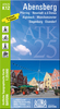
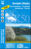
Kempten And The Surrounding Area

Kempten and the Surrounding Area, map no. UKL50-46 in a series of special GPS compatible recreational editions of the German topographic survey at 1:50, 000, with waymarked hiking trails and cycling routes, campsites and youth hostels, etc.All the maps have cartography identical to the standard topographic survey of Germany, with extensive overprint highlighting local and long-distance footpaths and cycle routes, including King Ludwig Way, different variants of the Way of St James, etc, indicating their waymarking. Symbols highlight various types of accommodation (campsites, youth hostels, refuges, etc), sport and recreational facilities, places of interest, ski and cable car lift, etc. The maps have an overprint showing 1-km UTM grid. Many of the titles have on the reverse
photos of fauna and flora and descriptions of the area covered by them. Map legend and all the text are in German only.
RIP - This product is no longer available on our network. It was last seen on 25.09.2019

This page now acts as a permanent archive for this product. Add more information using the comments box below to ensure it can still be found by future generations.

Use our search facility to see if it is available from an alternative contributor.
  • Availability: Out Of Stock
  • Supplier: Stanfords
  • SKU: 9783899335507
Availability: In Stock
£11.50

Product Description

Kempten & the Surrounding Area, map no. UKL50-46 in a series of special GPS compatible recreational editions of the German topographic survey at 1:50, 000, with waymarked hiking trails & cycling routes, campsites & youth hostels, etc. All the maps have cartography identical to the standard topographic survey of Germany, with extensive overprint highlighting local & long-distance footpaths & cycle routes, including King Ludwig Way, different variants of the Way of St James, etc, indicating their waymarking. Symbols highlight various types of accommodation (campsites, youth hostels, refuges, etc), sport & recreational facilities, places of interest, ski & cable car lift, etc. The maps have an overprint showing 1-km UTM grid. Many of the titles have on the reverse photos of fauna & flora & descriptions of the area covered by them. Map legend & all the text are in German only.

Reviews/Comments

Add New

Intelligent Comparison

Oooops!
We couldn't find anything!
Perhaps this product's unique.... Or perhaps we are still looking for comparisons!
Click to bump this page and we'll hurry up.

Price History

Vouchers

No voucher codes found.
Do you know a voucher code for this product or supplier? Add it to Insights for others to use.

Facebook

Jargon Buster

GPS - Global Positioning System - Global position using satellites
Hiking - An outdoor activity envolving walking in nature
Germany - A country in Central Europe.
Cable - A series of wires bonded to form a single thread
King - The figure head of a monarch
Car - A machine used for transport which runs on roads
Km - Kilometre. A unit of measurement equal to 1000 metres.
Accommodation - A room in which someone can live in, for example in a hotel

Supplier Information

Stanfords
Stanfords was established in 1853 and opened their iconic Covent Garden flagship store in 1901. They have become the top retailer of maps, travel books and accessories in the UK and arguably offer the largest selection of maps and travel books worldwide. Famous names such as Captain Robert Falcon Scott, Ranulph Fiennes and Michael Palin have purchased from Stanfords. They now have a shop in Bristol and both stores together with other venues operate a calendar of events including talks, book signings and exhibitions. As a specialist map retailer, the map selection is comprehensive and includes road maps, street maps and walking maps from worldwide destinations, as well as a selection of world atlases and wall maps. Books include travel guides and travel literature. Stanfords also stock globes, from miniatures made of blue marble to magnificent floor-standing globes. The website features a selection of interesting articles on travel topics.
Page Updated: 2023-11-12 20:15:36

Community Generated Product Tags

Oh No! The productWIKI community hasn't generated any tags for this product yet!
Menu