More From Contributor
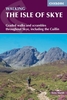
£2.95
Isle of Portland: Easton & Weston in 1927 in a fascinating series of reproductions of old Ordnance Survey plans in the Alan Godfrey Editions, ideal for anyone interested in the history of their neighbourhood or family. Selected towns in Great Britain & Ireland are covered by maps showing the extent of urban development in the last decades of the 19th & early 20th century. In this title: the Isle of Portland is covered by four maps. The Castletown map covers the northern part of the isl&, & features here include The Mere, Portland Castle, Portland station, Victoria Square, Castletown, cemeteries, Balaclava Bay, naval piers, part of the Easton & Church Hope Railway, Portland Tramway. On the reverse is part of the 1st Edition map of 1889, showing the original Portland station, Castletown, Royal Breakwater Hotel, New Coaling Camber, Breakwater Branch Railway. The Fortuneswell map climbs upwards &

Includes::
Chesil Cove, Fortuneswell centre, Verne Yeates, The Grove, Portland tramway, Nicodemus Knob, St Peter's church & the vicarage, & numerous quarries: Tout Quarries, Trade Quarries, Inmosthay Quarries, Waycroft Quarries, Withies Croft Quarries, Independent Quarries. Prisons are left blank for security.. On the reverse an extract from the 1st Edition 1889 map of The Grove & this shows many sidings running into Admiralty Quarries behind Grove, leading from Admiralty Incline. The Easton & Weston map covers the centre of the isl&, with what might be termed its town centre, Easton. Features here include St George's church, Easton station, Wakeham, All Saints church, remains of St Andrew's church, Pennsylvania Castle, France Quarries, Rufus Castle, Church Hope Cove, Combefield Quarries, Suckthumb Quarries, Weston, many strip fields, Reforne Street, Easton & Church Hope Railway. On the back are extracts from a contemporary directory. The Southwell map completes the quartet, & is a double-sided map taking coverage right down to Portland Bill. Features include Southwell, St Andrew's ' Avalanche' church, old & new lighthouses; but this is a more rural map, almost covered with strip fields & with smaller quarries on the west cliff. About the Alan Godfrey Editions of the 25

...
Archived Product
£3.50
Isle of Portland: Easton & Weston in 1927 in a fascinating series of reproductions of old Ordnance Survey plans in the Alan Godfrey Editions, ideal for anyone interested in the history of their neighbourhood or family. The Isle of Portland is covered by four maps. The Castletown map covers the northern part of the isl&, & features here include The Mere, Portland Castle, Portland station, Victoria Square, Castletown, cemeteries, Balaclava Bay, naval piers, part of the Easton & Church Hope Railway, Portland Tramway. On the reverse is part of the 1st Edition map of 1889, showing the original Portland station, Castletown, Royal Breakwater Hotel, New Coaling Camber, Breakwater Branch Railway. The Fortuneswell map climbs upwards &

Includes::
Chesil Cove, Fortuneswell centre, Verne Yeates, The Grove, Portland tramway, Nicodemus Knob, St Peter`s church & the vicarage, & numerous quarries: Tout Quarries, Trade Quarries, Inmosthay Quarries, Waycroft Quarries, Withies Croft Quarries, Independent Quarries. Prisons are left blank for security. On the reverse iis s an extract from the 1st Edition 1889 map of The Grove & this shows many sidings running into Admiralty Quarries behind Grove, leading from Admiralty Incline. This title, Easton & Weston map, covers the centre of the isl&, with what might be termed its town centre, Easton. Features here include St George`s church, Easton station, Wakeham, All Saints church, remains of St Andrew`s church, Pennsylvania Castle, France Quarries, Rufus Castle, Church Hope Cove, Combefield Quarries, Suckthumb Quarries, Weston, many strip fields, Reforne Street, Easton & Church Hope Railway. On the back are extracts from a contemporary directory. The Southwell map completes the quartet & is a double-sided, taking coverage right down to Portland Bill. Features include Southwell, St Andrew`s ` Avalanche` church, old & new lighthouses; but this is a more rural map, almost covered with strip fields & with smaller quarries on the west cliff. About the Alan Godfrey Editions of the 25” OS Series Selected towns in Great Britain & Ireland are covered by maps showing the extent of urban development in the last decades of the 19th & early 20th century. The plans have been taken from the Ordnance Survey mapping & reprinted at about 15 inches to one mile (1:4, 340). On the reverse most maps have historical notes & many also include extracts from contemporary directories. Most maps cover about one mile (1.6kms) north/south, one & a half miles (2.4kms) across; adjoining sheets can be combined to provide wider coverage.FOR MORE INFORMATION & A COMPLETE LIST OF ALL AVAILABLE TITLES PLEASE CLICK ON THE SERIES LINK.

...
Archived Product
£3.50
Isle of Portland: Fortuneswell & Grove in 1927 in a fascinating series of reproductions of old Ordnance Survey plans in the Alan Godfrey Editions, ideal for anyone interested in the history of their neighbourhood or family. The Isle of Portland is covered by four maps. The Castletown map covers the northern part of the isl&, & features here include The Mere, Portland Castle, Portland station, Victoria Square, Castletown, cemeteries, Balaclava Bay, naval piers, part of the Easton & Church Hope Railway, Portland Tramway. On the reverse is part of the 1st Edition map of 1889, showing the original Portland station, Castletown, Royal Breakwater Hotel, New Coaling Camber, Breakwater Branch Railway. This title, the Fortuneswell map, climbs upwards &

Includes::
Chesil Cove, Fortuneswell centre, Verne Yeates, The Grove, Portland tramway, Nicodemus Knob, St Peter`s church & the vicarage, & numerous quarries: Tout Quarries, Trade Quarries, Inmosthay Quarries, Waycroft Quarries, Withies Croft Quarries, Independent Quarries. Prisons are left blank for security. On the reverse iis s an extract from the 1st Edition 1889 map of The Grove & this shows many sidings running into Admiralty Quarries behind Grove, leading from Admiralty Incline. The Easton & Weston map covers the centre of the isl&, with what might be termed its town centre, Easton. Features here include St George`s church, Easton station, Wakeham, All Saints church, remains of St Andrew`s church, Pennsylvania Castle, France Quarries, Rufus Castle, Church Hope Cove, Combefield Quarries, Suckthumb Quarries, Weston, many strip fields, Reforne Street, Easton & Church Hope Railway. On the back are extracts from a contemporary directory. The Southwell map completes the quartet & is a double-sided, taking coverage right down to Portland Bill. Features include Southwell, St Andrew`s ` Avalanche` church, old & new lighthouses; but this is a more rural map, almost covered with strip fields & with smaller quarries on the west cliff. About the Alan Godfrey Editions of the 25” OS Series Selected towns in Great Britain & Ireland are covered by maps showing the extent of urban development in the last decades of the 19th & early 20th century. The plans have been taken from the Ordnance Survey mapping & reprinted at about 15 inches to one mile (1:4, 340). On the reverse most maps have historical notes & many also include extracts from contemporary directories. Most maps cover about one mile (1.6kms) north/south, one & a half miles (2.4kms) across; adjoining sheets can be combined to provide wider coverage.FOR MORE INFORMATION & A COMPLETE LIST OF ALL AVAILABLE TITLES PLEASE CLICK ON THE SERIES LINK.

...
Archived Product
£3.50
Isle of Portland: Southwell in 1927 in a fascinating series of reproductions of old Ordnance Survey plans in the Alan Godfrey Editions, ideal for anyone interested in the history of their neighbourhood or family. The Isle of Portland is covered by four maps. The Castletown map covers the northern part of the isl&, & features here include The Mere, Portland Castle, Portland station, Victoria Square, Castletown, cemeteries, Balaclava Bay, naval piers, part of the Easton & Church Hope Railway, Portland Tramway. On the reverse is part of the 1st Edition map of 1889, showing the original Portland station, Castletown, Royal Breakwater Hotel, New Coaling Camber, Breakwater Branch Railway. The Fortuneswell map climbs upwards &

Includes::
Chesil Cove, Fortuneswell centre, Verne Yeates, The Grove, Portland tramway, Nicodemus Knob, St Peter`s church & the vicarage, & numerous quarries: Tout Quarries, Trade Quarries, Inmosthay Quarries, Waycroft Quarries, Withies Croft Quarries, Independent Quarries. Prisons are left blank for security. On the reverse iis s an extract from the 1st Edition 1889 map of The Grove & this shows many sidings running into Admiralty Quarries behind Grove, leading from Admiralty Incline. The Easton & Weston map covers the centre of the isl&, with what might be termed its town centre, Easton. Features here include St George`s church, Easton station, Wakeham, All Saints church, remains of St Andrew`s church, Pennsylvania Castle, France Quarries, Rufus Castle, Church Hope Cove, Combefield Quarries, Suckthumb Quarries, Weston, many strip fields, Reforne Street, Easton & Church Hope Railway. On the back are extracts from a contemporary directory. This title, the Southwell map, completes the quartet, and is a double-sided, taking coverage right down to Portland Bill. Features include Southwell, St Andrew`s ` Avalanche` church, old & new lighthouses; but this is a more rural map, almost covered with strip fields & with smaller quarries on the west cliff. About the Alan Godfrey Editions of the 25” OS Series Selected towns in Great Britain & Ireland are covered by maps showing the extent of urban development in the last decades of the 19th & early 20th century. The plans have been taken from the Ordnance Survey mapping & reprinted at about 15 inches to one mile (1:4, 340). On the reverse most maps have historical notes & many also include extracts from contemporary directories. Most maps cover about one mile (1.6kms) north/south, one & a half miles (2.4kms) across; adjoining sheets can be combined to provide wider coverage.FOR MORE INFORMATION & A COMPLETE LIST OF ALL AVAILABLE TITLES PLEASE CLICK ON THE SERIES LINK.

...
Archived Product
£12.99
Produced in association with the Ramblers, this walking guide covers the beautiful Isle of Skye & combines detailed route descriptions with information on the local history & wildlife. This famous corner of the Scottish Highlands & Islands is home to a spectacular variety of mountain landscapes & dramatic coastlines. There is also a wealth of fascinating places to explore: caves & sea stacks, headlands & arches, waterfalls & castles. The introduction gives information about the topography, geology & history of the area, & describes the flora & fauna inhabiting it. / The main section of the book comprises 30 walks, suitable for all abilities, from young children to experienced walkers. Each walk has a key illustrating principal features, such as level of difficulty & type of terrain, a route profile indicating altitude & distances, as well as a fact file summarising useful information, such as start & finish points, duration, safety advice & points of interest. / Illustrated with colour maps from the Ordnance Survey each walk is then described in detail with clear, easy-to-follow instructions. The text gives the history of the main landmarks along the way & information about the natural history of the area, & is accompanied by stunning colour photographs. NEW FOR 2010 / Overview map on inside front cover showing start points of the walks. / Walks are colour coded to indicated level of difficulty: green for the simpler walks, then amber for moderate walks, then red for the more challenging walks aimed at more experienced walkers. / Front cover flap contains the key to symbols used in the text & on the route maps. Ideal as a book mark during use. ...
Archived Product
£14.95
This guidebook describes 87 of the best walks & scrambles on the Isle of Skye. Not only limited to the popular routes on the Black Cuillin or Skye`s 12 Munros, the guide offers a comprehensive selection of routes in all areas of the island; in Sleat & South-East Skye, Strath, Minginish, Duirinish, Waternish & Trotternish. The routes range in length from 2 to 23km, so while there are opportunities for novice walkers, routes can also be combined for longer trails & difficult scrambles. Skye can delight walkers & scramblers at every turn, from sea stacks to fell tops; corries to rugged cliffs & plenty in between. Walkers on Skye should be prepared for strenuous trails & wilderness, as well as changeable weather, navigation, &
- depending on the route
- scrambling skills. However, the routes in this guide range in length from 2 to 23km, so while there are opportunities for novice walkers, routes can also be combined for longer trails & difficult scrambles. Alongside detailed descriptions & OS maps for every route, the guidebook also

Includes::
practical information essential to making the most out of a visit to Skye. From travel to & around the isl&, to advice on accommodation, where to stock up on supplies & who to call in emergencies. The result is an excellent companion to exploring the best of Skye.


...
Archived Product
£9.99
This is an alternative guide to the wildlife & geology of Skye detailing where to see the island`s lesser-known natural history. There are 20 walks based aroud Portree, Dunvegan, Broadford & Sleat together with detailed maps & quality photographs. ...
Archived Product
£4.99
The Nicolson Isle of Skye Tourist map is a 1:100, 000 scale road map suitable for touring the Isle of Skye. This map has clear, easy to read road mapping that shows all major & minor roads, tracks & paths as well as roads under construction. Also shown are railways & stations, tourist railway stations & disused railway lines, national cycle routes, & long distance footpaths. County boundaries are clearly marked, as are airports, hospitals, parking, hostels, visitor information centres, historic sites, peaks with height in meters, gardens, museums, heritage centres, viewpoints, nature reserves, picnic sites, camping grounds, caravan sites, golf courses, fishing spots & other places of interest. Natural features shown on the map include woodland areas, national/forest parklands, mud, shingle, beaches & dunes, rocks, built up-areas & National Scottish Trust areas. The map is fully indexed. ...
Archived Product
£3.50
The Isle of Thanet in 1893 in a series of reproductions of Ordnance Survey’s famous ” Inch to the Mile” maps published in the Alan Godfrey Editions to provide a historical record of England & Wales in the second half of 19th & early 20th century. The map covers most of the Isle of Thanet including Margate, Ramsgate & Broadstairs. Other locations in this title include Acol, Birchington, Minster, St Lawrence, St Nicholas at Wade, St Peters & Westgate on Sea. On the reverse is a detailed map of the historic village of Minster. About the Alan Godfrey Editions of the OS Inch to the Mile Maps: the maps provide an invaluable overview of a wider area, typically 18 x 12 miles (29 x 19 kms approx.), & offer historical mapping for small towns & villages not covered by the more detailed series for which the Godfrey Editions are better known. On the reverse all the maps have historical notes & most titles also include a more detailed, large scale map of a small town or a village in the area. To see other titles in this series please click on the series link. ...
Archived Product
£6.39
A detailed topographic map of the Isle of Wight from the Ordnance Survey Explorer series, covering Cowes, Newport, Ryde, Sandown, Shanklin, Yarmouth & Ventnor. Edition B2; Publication date March 2008 About this series: These highly detailed maps show all the administrative boundaries, settlements as small as isolated farms, the road network down to unfenced roads & country tracks, & field boundaries (hedges & drystone walls) which make navigation across the countryside much easier. Steep gradients on roads are indicated. Various landmarks, e.g. powerlines, archaeological sites, windmills, churches & lighthouses are shown & additional graphics indicate natural terrain features such as cliffs, scree, mud & vegetation variations. The contour interval is 5 metres in the lower parts of the country & 10 metres in the uplands, & spot heights are marked. Each map covers an area of 30 x 20km (i.e. approx. 19 x 12 miles), with some double-sided maps covering more, as indicated in the individual descriptions. The maps are fully GPS compatible, with the National Grid shown at 1km intervals & latitude & longitude indicated by margin ticks at 1'. The Explorer series has replaced the earlier, green-cover Pathfinder maps. The Explorer series is now complete & covers all of Engl&, Wales & Scotl&. Some sheets for popular areas like the National Parks are still branded as Outdoor Leisure (OL) maps, but are now included in this series as the cartography is the same as that in the Explorer Maps. The Explorer maps offer a substantial improvement on the Pathfinder series, with greater use of colour, larger area per map, & stronger emphasis on information for ramblers & tourists. This series is ideal for walking & other outdoor pursuits & each map shows a large amount of information for ramblers & tourists. Public rights of way are shown (except in Scotland), together with other routes with public access: National Trails & Recreational Paths, permitted paths & bridleways, & selected cycle routes. Open access land created under the Countryside & Rights of Way Act 2000 is marked. Tourist information

Includes::
caravan & camp sites, Park & Ride locations, recreation/leisure/sport centres, museums, historic buildings, English Heritage & National Trust sites, rural pubs, etc. The map legend is in English only, except for the tourist information content which is also in French & German.

...
Archived Product

Isle Of Skye

The Isle of Skye (or Ant-Eilean Sgitheanach in its native Gaelic tongue) occupies an almost mythical place in the minds of many Scots. Romantic castles, magnificent sea-scapes, the alpine peaks of the Cuillin Ridge, marching pipe bands, scattered white crofters` cottages and a bloody history; the island has all these and more. This book features 40 moderate walks that take in much of this celebrated landscape, but reveal hidden gems too. In spite of its popularity Skye is still rich in undiscovered treasures, from coastal caves and arches, ruined villages cruelly cleared of their inhabitants, to fossilised dinosaur footprints and a rich array of wildlife. Written by Skye residents Paul and Helen Webster, these walks will reveal both the wild and gentler sides of this dramatic
landscape.
RIP - This product is no longer available on our network. It was last seen on 25.09.2019

This page now acts as a permanent archive for this product. Add more information using the comments box below to ensure it can still be found by future generations.

Use our search facility to see if it is available from an alternative contributor.
  • External links may include paid for promotion
  • Availability: Out Of Stock
  • Supplier: Stanfords
  • SKU: 9780955454882
Availability: In Stock
£6.99

Product Description

The Isle of Skye (or Ant-Eilean Sgitheanach in its native Gaelic tongue) occupies an almost mythical place in the minds of many Scots. Romantic castles, magnificent sea-scapes, the alpine peaks of the Cuillin Ridge, marching pipe bands, scattered white crofters` cottages & a bloody history; the island has all these & more. This book features 40 moderate walks that take in much of this celebrated landscape, but reveal hidden gems too. In spite of its popularity Skye is still rich in undiscovered treasures, from coastal caves & arches, ruined villages cruelly cleared of their inhabitants, to fossilised dinosaur footprints & a rich array of wildlife. Written by Skye residents Paul & Helen Webster, these walks will reveal both the wild & gentler sides of this dramatic landscape.

Reviews/Comments

Add New

Intelligent Comparison

Oooops!
We couldn't find anything!
Perhaps this product's unique.... Or perhaps we are still looking for comparisons!
Click to bump this page and we'll hurry up.

Price History

Vouchers

No voucher codes found.
Do you know a voucher code for this product or supplier? Add it to Insights for others to use.

Facebook

Jargon Buster

White - A colour combining all colours
History - Anything that happens in the past. An acedemic subject.
Dinosaur - Animals that are now extinct due to not adapting.
Tongue - The muscular organ found inside the mouth used for tasting.

Supplier Information

Stanfords
Stanfords was established in 1853 and opened their iconic Covent Garden flagship store in 1901. They have become the top retailer of maps, travel books and accessories in the UK and arguably offer the largest selection of maps and travel books worldwide. Famous names such as Captain Robert Falcon Scott, Ranulph Fiennes and Michael Palin have purchased from Stanfords. They now have a shop in Bristol and both stores together with other venues operate a calendar of events including talks, book signings and exhibitions. As a specialist map retailer, the map selection is comprehensive and includes road maps, street maps and walking maps from worldwide destinations, as well as a selection of world atlases and wall maps. Books include travel guides and travel literature. Stanfords also stock globes, from miniatures made of blue marble to magnificent floor-standing globes. The website features a selection of interesting articles on travel topics.
Page Updated: 2023-11-12 20:15:36

Community Generated Product Tags

Oh No! The productWIKI community hasn't generated any tags for this product yet!
Menu