
 United Kingdom
 France
 Germany
 Netherlands
 Sweden
 USA
USA
 Italy
Italy
 Spain
Spain
More From Contributor


Hereford Past And Present
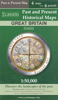
Hereford in the Cassini Past and Present map series which covers town and cities of England and Wales and offers a unique way of tracing their history and expansion by showing four different periods of their development using Ordnance Survey mapping from the mid-19th century, the late 19th century, the 1920s and the present day. Coverage includes Clehonger, Credenhill, Fownhope, King’s Thorn, Lugwardine, Marden and Withington.Each Past and Present map consists of four panels, all centred on a city or a town and covering exactly the same 15km x 15km area. Three of the panels reproduce Ordnance Survey’s historical editions: the Old Series, the Revised New Series and the Popular Edition, enlarged from their original inch-to-the-mile to match the 1:50, 000 scale of the
present-day Landranger extract shown in the fourth panel.* Old Series: the first detailed survey mapping dating from the first half of the 19th century, in black and white and with relief shown by hachuring.* Revised New Series from 1880s/1900s, with some colouring and a mixture of hachuring and contour lines.* Popular Edition from the inter-war years, with contour lines and colouring to indicate woodlands, parks, etc.National Grid lines are shown on all four panels for easy comparison across the four time periods. Historical notes, details of the original maps used and web-links for local history societies and other sources of information are also provided. *PLEASE NOTE:** Reproductions from the Ordnance Survey’s historical series are also available as maps of a wider area, with
each title corresponding in its coverage to a present day Landranger map. Please see Great Britain: Cassini Historical Reproductions of Ordnance Survey One-Inch Maps series.* Stanfords can also print on request mapping from all the series *centring the map on a location of your choice.* For more information please click on the link below.

Product Description
Reviews/Comments
Add New
Intelligent Comparison
Archived Product
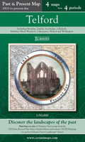
Telford Past And Present Stanfords
£9.99
Archived Product

Bradford Past And Present Stanfords
£9.99
Archived Product
Oxford Past And Present Stanfords
£8.99
Archived Product

Leeds Past And Present Stanfords
£9.99
Archived Product
York Past And Present Stanfords
£8.99
Archived Product

Derby Past And Present Stanfords
£9.99
Archived Product
Liverpool Past And Present Stanfords
£8.99
Archived Product
Norwich Past And Present Stanfords
£8.99
Vouchers
No voucher codes found.
Do you know a voucher code for this product or supplier? Add it to Insights for others to use.
Do you know a voucher code for this product or supplier? Add it to Insights for others to use.
 Denmark