
 United Kingdom
 France
 Germany
 Netherlands
 Sweden
 USA
USA
 Italy
Italy
 Spain
Spain
More From Contributor
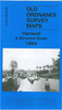


Hanworth Park 1934
Hanworth Park in 1934 in a fascinating series of reproductions of old Ordnance Survey plans in the Alan Godfrey Editions, ideal for anyone interested in the history of their neighbourhood or family. The map catches the area at the peak of its fame, when the London Air Park was thriving. This airport was twice visited by the Graf Zeppelin, and survived until 1947, by which time it was too close to the expanding Heathrow. The map includes the Air Park and the area east towards New Hanworth, and north towards the SR Windsor line of which just a small section is shown. The map is crossed diagonally by Hampton Road, becoming Uxbridge Road, and other roads include Hounslow Road, Waverley Avenue, Twickenham Road. Other features include farms and nurseries, while the River Crane meanders
through the map. There is a directory of Hanworth on the back, together with a very informative history of the area by Tony Painter.About the Alan Godfrey Editions of the 25” OS Series:Selected towns in Great Britain and Ireland are covered by maps showing the extent of urban development in the last decades of the 19th and early 20th century. The plans have been taken from the Ordnance Survey mapping and reprinted at about 15 inches to one mile (1:4, 340). On the reverse most maps have historical notes and many also include extracts from contemporary directories. Most maps cover about one mile (1.6kms) north/south, one and a half miles (2.4kms) across; adjoining sheets can be combined to provide wider coverage.FOR MORE INFORMATION AND A COMPLETE LIST OF ALL AVAILABLE TITLES PLEASE
CLICK ON THE SERIES LINK.

Product Description
Reviews/Comments
Add New
Intelligent Comparison
Archived Product

Handsworth 1913 Stanfords
£3.50
Vouchers
No voucher codes found.
Do you know a voucher code for this product or supplier? Add it to Insights for others to use.
Do you know a voucher code for this product or supplier? Add it to Insights for others to use.
 Denmark