More From Contributor

£5.99
Greece at 1:300, 000 on a double-sided from Insight Guides with cartography from Mair Dumont. The map covers the mainland but without the eastern part of Thrace, plus the Ionian islands & the Sporades, with the Cyclades shown in various insets as either groups or individual islands. The map aims to provide good coverage of the mainl&, divided north/south around the town of Lamia & across northern Evia/ Euboea. It is not recommended for island hopping across the Aegean where not all the islands are shown in their proper geographical locations: southern Cyclades are on one large inset, but the northern part of the group, e.g. Mykonos or Syros, is on separate individual insets. Relief shading with numerous spot heights & names of mountain ranges shows the topography. Road network

Includes::
selected minor roads & local tracks, & indicates distances on main routes. Scenic routes are highlighted. Railway lines are included, plus numerous ferry routes between the mainland & the islands. The map highlights numerous places of interest, both cultural sights including archaeological remains & various natural sites, showing national parks & other protected areas. Symbols mark selected campsites & youth hostels, viewpoints, etc. All place names are in both Greek & Latin alphabet, except those of places of interest shown in Latin script only. The map has no geographical coordinates. The index is in a separate booklet attached to the map cover. Map legend

Includes::
English. In addition to numerous insets covering various islands, the map also

Includes::
street plans of central Athens & Thessaloniki. Please note: the same map is also available from Mair Dumont with special features to aid navigation & route planning, or from Geo Center.


...
Archived Product
£6.99
Greece at 1:300, 000 from Marco Polo Travel Publishing on a double-sided map with special features to aid navigation. Coverage: mainland without the eastern Thrace, Ionian Islands, Sporades, plus Cyclades on insets as either groups or individual islands. A fold-out extension of the map cover gives at-a-glance overview of the whole area covered by the map with the adjoining regions, highlighting main places of interest & making it much easier to find various localities on the main map and/or plan a route. A set of seven peel-on/peel-off stickers, removable without damaging the map, is provided to make routes or locations more prominent when navigating. The map aims to provide good coverage of the mainl&, divided north/south around the town of Lamia & across northern Evia/ Euboea. It is not recommended for island hopping across the Aegean where not all the islands are shown in their proper geographical locations: southern Cyclades are on one large inset, but the northern part of the group, e.g. Mykonos or Syros, is on separate individual insets. Cartography is from the renowned German publishers Mair Dumont. Relief shading with numerous spot heights & names of mountain ranges shows the topography. Road network

Includes::
selected minor roads & local tracks, & indicates distances on main routes. Scenic routes are highlighted. Railway lines are included, plus numerous ferry routes between the mainland & the islands. The map highlights numerous places of interest, both cultural sights including archaeological remains & various natural sites, showing national parks & other protected areas. Symbols mark selected campsites & youth hostels, viewpoints, etc. All place names are in both Greek & Latin alphabet, except those of places of interest shown in Latin script only. The map has no geographical coordinates. The index is in a separate booklet attached to the map cover. Multilingual map legend

Includes::
English. In addition to numerous insets covering various islands the map also

Includes::
street plans of central Athens & Thessaloniki.


...
Archived Product
£4.99
Greece & the Aegean coast of Turkey at 1:800, 000 on a double-sided indexed road map from the AA, with cartography by Freytag & Berndt, with enlargements showing motorway access to Athens & Istanbul. Numerous places of interest are prominently highlighted. On one side is mainland Greece without Thrace, but including Macedonia & most of Albania. The reverse side shows the Aegean, including the Greek side Attica with Athens, Chalkidiki Peninsula & Thrace, with Crete shown as an inset
- coverage of the Turkish side extends east to include the whole of the Sea of Marmara with Istanbul & along the southern coast the Dalaman airport & Fethiye. The region
...
Archived Product
£8.95
Greece at 1:300, 000 from Mair Dumont on a double-sided map with special features to aid navigation. The map covers the mainland but without the eastern part of Thrace, plus the Ionian islands & the Sporades, with the Cyclades shown in various insets as either groups or individual islands. Maps in the Mair Dumont ...
Archived Product
£9.95
Greece at 1:800, 000 from Mair Dumont with special features to aid navigation. Coverage

Includes::
the whole

...
Archived Product
£9.99
Discover what it would be like to travel back in time & explore the ancient world with this new history series written in the style of contemporary travel guides. Packed with all the maps, illustrations & fascinating insights that a tourist or traveller would expect from a guidebook. Each carefully researched guide paints a vivid picture of the past allowing you to experience ancient wonders when they were new & get to know the people who used them. The third title in this exciting series is a detailed guide to Athens & its environs, listing everything from how to buy a slave to where to get a room for the night. ...
Archived Product
£9.99
In A Traveller's History of Greece, the reader is provided with an authoritative general history of Greece from its earliest beginnings down to the present day. It covers in a clear & comprehensive manner the classical past, the conflict with Persia, the conquest by the Romans, the Byzantine era & the occupation by the Turks; the struggle for independence & the turbulence of recent years, right up to current events. This history will help the visitor make sense of modern Greece against the background of its diverse heritage. Illustrated with maps & line drawings, A Traveller's History of Greece is an invaluable companion for your vacation. ...
Archived Product
£12.99
This travel guide for art lovers takes you through the main periods & styles covering over three millennia of art on this island & mainl&. Even without a detailed knowledge of Greek civilization, this book enhances the enjoyment by throwing light on the myths & beliefs that inspired & guided the art. ...
Archived Product
£10.99
This new title in this excellent Charming Small Hotel Guides series has been a long time coming. Meticulously researched, anyone who chooses a place to stay from this guide will not be disappointed. Like all Charming Small Hotel Guides, it is highly selective. Every entry is more than just a bed for the night: it's an experience, worth planning a holiday around, or going out of your way for. This remains the only independently inspected English-language accommodation guide to small & charming hotels in Italy. No hotel pays to be in the guide. ...
Archived Product
£6.95
Greece in the Culture Smart range of pocket-sized guide books; providing detailed information on local customs, culture, etiquette & manners & ensuring that visitors are prepared for a diverse range of social environments. The series covers an extensive number of countries worldwide & are designed both for those working & living abroad, as well as for visitors who do not want to offend, either intentionally or inadvertently. Their aim is to prevent readers from making embarrassing mistakes & feel confident in unfamiliar situations, while preparing them before arrival on what to expect & how to behave. Each guide is arranged thematically, with dedicated individual chapters on land & people, values & attitudes, customs & traditions, making friends, people at home, ‘time-out’, travelling & communicating. There is also a separate chapter for business travelers, with important information on subjects such as business culture, meetings & making appointments. A Further Reading section also offers a list of recommended other history, travel literature & language titles available on the country. ...
Archived Product

Greece (800K)

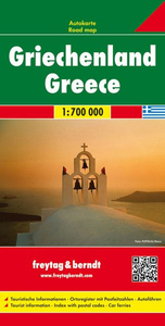
Greece at 1:800, 000 from GeoCenter with cartography from MairDumont. Coverage includes the whole of the Aegean with the western coast of Turkey and Istanbul. Street plans are provided for central Athens, Thessaloniki, Iraklion and Rhodes Town.The map covers the whole of Greece with the Aegean Sea and its islands, including the northern coast of Crete to provide clearer information on various ferry routes. The whole of Crete is also included as an inset. The map also shows Aegean coast of Turkey, extending north to cover the Sea of Marmara with Istanbul and the Bosphorus, and south to Bodrum and Marmaris.Relief shading with numerous spot heights and names of mountain ranges shows the topography. Road network includes selected minor roads and local tracks, and indicates distances on
main routes. Scenic routes are highlighted. Railway lines are included, plus numerous ferry routes between the mainland and the islands. The map highlights numerous places of interest, both cultural sights including archaeological remains and various natural sites, showing national parks and other protected areas. Symbols mark selected campsites and youth hostels, viewpoints, etc. Names of larger towns are also shown in Greek alphabet. The map has a latitude and longitude grid at intervals of 1
RIP - This product is no longer available on our network. It was last seen on 25.09.2019

This page now acts as a permanent archive for this product. Add more information using the comments box below to ensure it can still be found by future generations.

Use our search facility to see if it is available from an alternative contributor.
  • External links may include paid for promotion
  • Availability: Out Of Stock
  • Supplier: Stanfords
  • SKU: 9783829765305
Availability: In Stock
£4.99

Product Description

Greece at 1:800, 000 from Geo Center with cartography from Mair Dumont. Coverage

Includes::
the whole of the Aegean with the western coast of Turkey & Istanbul. Street plans are provided for central Athens, Thessaloniki, Iraklion & Rhodes Town. The map covers the whole of Greece with the Aegean Sea & its islands, including the northern coast of Crete to provide clearer information on various ferry routes. The whole of Crete is also included as an inset. The map also shows Aegean coast of Turkey, extending north to cover the Sea of Marmara with Istanbul & the Bosphorus, & south to Bodrum & Marmaris. Relief shading with numerous spot heights & names of mountain ranges shows the topography. Road network

Includes::
selected minor roads & local tracks, & indicates distances on main routes. Scenic routes are highlighted. Railway lines are included, plus numerous ferry routes between the mainland & the islands. The map highlights numerous places of interest, both cultural sights including archaeological remains & various natural sites, showing national parks & other protected areas. Symbols mark selected campsites & youth hostels, viewpoints, etc. Names of larger towns are also shown in Greek alphabet. The map has a latitude & longitude grid at intervals of 1

Reviews/Comments

Add New

Price History

Vouchers

No voucher codes found.
Do you know a voucher code for this product or supplier? Add it to Insights for others to use.

Facebook

Jargon Buster

Natural - not manmade
Network - A link and communication between things. Often computers or people.
Road - a manmade lane or a path that is used to speed up travel.

Supplier Information

Stanfords
Stanfords was established in 1853 and opened their iconic Covent Garden flagship store in 1901. They have become the top retailer of maps, travel books and accessories in the UK and arguably offer the largest selection of maps and travel books worldwide. Famous names such as Captain Robert Falcon Scott, Ranulph Fiennes and Michael Palin have purchased from Stanfords. They now have a shop in Bristol and both stores together with other venues operate a calendar of events including talks, book signings and exhibitions. As a specialist map retailer, the map selection is comprehensive and includes road maps, street maps and walking maps from worldwide destinations, as well as a selection of world atlases and wall maps. Books include travel guides and travel literature. Stanfords also stock globes, from miniatures made of blue marble to magnificent floor-standing globes. The website features a selection of interesting articles on travel topics.
Page Updated: 2023-11-12 20:15:36

Community Generated Product Tags

Oh No! The productWIKI community hasn't generated any tags for this product yet!
Menu