More From Contributor

£3.50
Glasgow East End in 1893 in a fascinating series of reproductions of old Ordnance Survey plans in the Alan Godfrey Editions, ideal for anyone interested in the history of their neighbourhood or family. The map covers the eastern part of Glasgow, stretching from Gallowgate & East Nelson Street eastward to Carntyne station, & northward to Alexandra Park. Features include Camlachie Goods station, Camlachie Burn, Parkhead Forge Steel Works, Glenpark Tan Works, Vinegarhill, Dennistoun Bakery, Duke Street station, Parkhead Junction with engine shed, Carntyne Iron Works, Burnbank Bleach Dye Works, Haghill House, Carntyne Hall, Gartcraig House, etc. On the reverse are street directory extracts for Duke Street, Great Eastern Road & Gallowgate. About the Alan Godfrey Editions of the 25” OS Series: Selected towns in Great Britain & Ireland are covered by maps showing the extent of urban development in the last decades of the 19th & early 20th century. The plans have been taken from the Ordnance Survey mapping & reprinted at about 15 inches to one mile (1:4, 340). On the reverse most maps have historical notes & many also include extracts from contemporary directories. Most maps cover about one mile (1.6kms) north/south, one & a half miles (2.4kms) across; adjoining sheets can be combined to provide wider coverage.FOR MORE INFORMATION & A COMPLETE LIST OF ALL AVAILABLE TITLES PLEASE CLICK ON THE SERIES LINK. ...
Archived Product
£5.99
From the vibrant city of Glasgow, perfect for shopaholics, to the sparkling lochs & the deep, forested glens of the Trossachs, Footprint Focus Glasgow will provide you with the essential information for you to make the most of your trip. This guide contains useful tips for getting there & around, plus comprehensive listings on where to eat, sleep & party. Essentials section with useful advice on getting to & around Glasgow. Comprehensive, up-to-date listings of where to eat, sleep & play.

Includes::
information on tour operators, activities, walks & festivals. Detailed maps for Glasgow & other key areas. Slim enough to fit in your pocket. With detailed information on all the main sights, plus many lesser-known attractions, Footprint Focus Glasgow provides concise & comprehensive coverage of Scotland`s most energetic city. The content of the Footprint Focus Glasgow guide has been partially extracted from Scotland Highlands & Islands Footprint Handbook.

...
Archived Product
£5.99
Glasgow in the Great Breaks mini series from Insight Guides is a slim, focussed short break guide to the city, whether you are aiming for a relaxing or active break, illustrated with vivid colour photographs & containing easy to navigate information. A top 10 sites for the destination & its surrounding area are given, with a selection of detailed & mapped tour/walk ideas, special features on the uniqueness of the place e.g. its heritage, festivals & wildlife, as well as practical information on active pursuits, themed holidays, & selected places to stay to suit a cross section of budgets & tastes. An overview map showing selected tour routes & a selection of five summary boxes of top five great things to do or places to do adorn the inside jackets. ...
Archived Product
£6.99
Glasgow in the Great Breaks mini series from Insight Guides is a slim, focussed short break guide to the city, whether you are aiming for a relaxing or active break, illustrated with vivid colour photographs & containing easy to navigate information. A top 10 sites for the destination & its surrounding area are given, with a selection of detailed & mapped tour/walk ideas, special features on the uniqueness of the place e.g. its heritage, festivals & wildlife, as well as practical information on active pursuits, themed holidays, & selected places to stay to suit a cross section of budgets & tastes. An overview map showing selected tour routes & a selection of five summary boxes of top five great things to do or places to do adorn the inside jackets. ...
Archived Product
£7.99
Explore the best of Glasgow with this indispensably practical Insight Guides Great Breaks book. From making sure you don`t miss out on must-see attractions like Riverside Museum, to discovering hidden gems, including Loch Lomond, the easy-to-follow, ready-made walking routes will save you time, help you plan, & enhance your Great Break in Glasgow.· Practical, pocket-sized & packed with inspirational insider information, this is the ideal on-the-move companion to your trip to Glasgow· Features 12 detailed walking tour itineraries, including the high street & the west· Overview section features concise insider information covering everything from landscape & location, to history & culinary highlights· Top Ten section takes you to the heart of your destination, from exploring the art scene to Burns Country· Rainy Day recommendations offer plenty of options, whatever the weather·

Includes::
an innovative extra that`s unique in the market
- all Great Breaks Guides come with a free e Book· Invaluable itinerary maps & practical Travel Tips section ensure effortless exploration · Inspirational colour photography throughout


...
Archived Product
£3.50
Glasgow High Street in 1909 in a fascinating series of reproductions of old Ordnance Survey plans in the Alan Godfrey Editions, ideal for anyone interested in the history of their neighbourhood or family. Two versions have been published for this area. Coverage stretches from Buchanan Street eastward to Whitevale Street & Armadale Street, & from Parliamentary Road southward to the north part of Glasgow Green. Features include St Enoch station with engine shed, Queen Street station, Buchanan Street Goods station, College Goods station, NBR High Street Goods station, Cattle Market, Royal Infirmary, Necropolis, Wellpark Brewery, Cathedral of St Mungo, Dennistoun, Milnbank, tramways, Fish Market, The Bazaa, etc. Extracts from street directories are on the reverse; those for the 1909 version include Gallowgate & Trongate. About the Alan Godfrey Editions of the 25” OS Series: Selected towns in Great Britain & Ireland are covered by maps showing the extent of urban development in the last decades of the 19th & early 20th century. The plans have been taken from the Ordnance Survey mapping & reprinted at about 15 inches to one mile (1:4, 340). On the reverse most maps have historical notes & many also include extracts from contemporary directories. Most maps cover about one mile (1.6kms) north/south, one & a half miles (2.4kms) across; adjoining sheets can be combined to provide wider coverage.FOR MORE INFORMATION & A COMPLETE LIST OF ALL AVAILABLE TITLES PLEASE CLICK ON THE SERIES LINK. ...
Archived Product
£3.50
Glasgow High Street in 1933 in a fascinating series of reproductions of old Ordnance Survey plans in the Alan Godfrey Editions, ideal for anyone interested in the history of their neighbourhood or family. Two versions have been published for this area. Coverage stretches from Buchanan Street eastward to Whitevale Street & Armadale Street, & from Parliamentary Road southward to the north part of Glasgow Green. Features include St Enoch station with engine shed, Queen Street station, Buchanan Street Goods station, College Goods station, NBR High Street Goods station, Cattle Market, Royal Infirmary, Necropolis, Wellpark Brewery, Cathedral of St Mungo, Dennistoun, Milnbank, tramways, Fish Market, The Bazaa, etc. Extracts from street directories are on the reverse; those for the 1909 version include Gallowgate & Trongate. About the Alan Godfrey Editions of the 25” OS Series: Selected towns in Great Britain & Ireland are covered by maps showing the extent of urban development in the last decades of the 19th & early 20th century. The plans have been taken from the Ordnance Survey mapping & reprinted at about 15 inches to one mile (1:4, 340). On the reverse most maps have historical notes & many also include extracts from contemporary directories. Most maps cover about one mile (1.6kms) north/south, one & a half miles (2.4kms) across; adjoining sheets can be combined to provide wider coverage.FOR MORE INFORMATION & A COMPLETE LIST OF ALL AVAILABLE TITLES PLEASE CLICK ON THE SERIES LINK. ...
Archived Product
£14.99
From its status as the Second City of the Empire to its current role as a vibrant & cosmopolitan centre of new industry & education, Glasgow has a proud history &, through the years, has invested in much loved buildings that have shaped its growth & contributed to its cultural identity. ` Glasgow in 50 Buildings` explores the history of this rich & vibrant community by presenting a selection of its greatest architectural treasures. From the medieval Provand`s Lordship to the new Riverside Museum, this unique study celebrates Glasgow`s architectural heritage in a new & accessible way. Glaswegian historian Michael guides the reader on a tour of the city`s historic buildings & modern architectural marvels. The churches, theatres, commercial & public edifices of Glasgow`s rich industrial heritage are presented alongside the innovative buildings of a 21st century city. Images are arranged chronologically to tell the story of Glasgow`s development through its most significant buildings.A specially designed map appears at the beginning of the volume to show where each building is located & the text is illustrated with colour photographs & archival images showcasing the best of Glasgow`s heritage. ...
Archived Product
£2.95
Glasgow Maryhill in 1894 in a fascinating series of reproductions of old Ordnance Survey plans in the Alan Godfrey Editions, ideal for anyone interested in the history of their neighbourhood or family. Selected towns in Great Britain & Ireland are covered by maps showing the extent of urban development in the last decades of the 19th & early 20th century. In this title: the map covers an area of north-western Glasgow which
Includes: part of Maryhill (top left), Wyndford, Eastpark, Ruchill & Possil Park. Features include Ruchill Park, the CR's Hamiltonhill Branch under construction, Firhill Iron Works, Western Saw Mills, Parkhouse Farm, Forth & Clyde Canal, Phoenix Chemical Works, Tamshill, Gilshochill, Maryhill Barracks, Lochburn Magdalene Institution, Maryhill Iron Works, Kelburn Park. On the reverse is a section of the adjacent map 1.14, extending coverage northward to include Lambhill, part of Possil Loch, Kenmure Row, Lambhill House, Western Necropolis, St Kentigern's RC Cemetery, a further stretch of the Forth & Clyde Canal. About the Alan Godfrey Editions of the 25
...
Archived Product
£3.50
Glasgow North East in 1893 in a fascinating series of reproductions of old Ordnance Survey plans in the Alan Godfrey Editions, ideal for anyone interested in the history of their neighbourhood or family. The map covers an area north-east of Glasgow city centre, including Provanmill, Blackhill & Riddrie. Features include Hogganfield Church, Hogganfield Bleach Works, Barlinnie Prison (left blank for security reasons), Governor`s House, Monkland Canal, Blackhill Locks, Provanmill Distillery, Riddrie Vale, Blackhill House, Blochairn Salt Works, Eclipse Works, various railways including the Blochairn Branch, etc. On the reverse is a section of the 1st Edition 1858 map. About the Alan Godfrey Editions of the 25” OS Series: Selected towns in Great Britain & Ireland are covered by maps showing the extent of urban development in the last decades of the 19th & early 20th century. The plans have been taken from the Ordnance Survey mapping & reprinted at about 15 inches to one mile (1:4, 340). On the reverse most maps have historical notes & many also include extracts from contemporary directories. Most maps cover about one mile (1.6kms) north/south, one & a half miles (2.4kms) across; adjoining sheets can be combined to provide wider coverage.FOR MORE INFORMATION & A COMPLETE LIST OF ALL AVAILABLE TITLES PLEASE CLICK ON THE SERIES LINK. ...
Archived Product

Glasgow Green 1892

Glasgow Green in 1892 in a fascinating series of reproductions of old Ordnance Survey plans in the Alan Godfrey Editions, ideal for anyone interested in the history of their neighbourhood or family. The map is centred on Glasgow Green but also includes parts of the Gorbals, Hutcheson Town and Bridgeton. Gorbals Cross is in the top left corner and coverage stretches eastward to Baltic Street and Bridgeton station, and southward to Polmadie House and Arthur Street. Features include the Southern Necropolis, Hutcheson Square, Gorbals Ropeworks, Gushetfaulds Goods Yard, Springfield Print Works, Bridgeton Cross, Rutherglen Bridge Factory, Newhall Factory, gasworks, Barrowfield Park football ground, Dalmarnock Factory, Bridgeton and Bridgeton Cross stations, Brookside Factory,
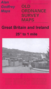
tramways, Govan Iron Works, etc. Street directory extracts for Canning Street, M`Neil Street, Rutherglen Road, Wellington Street South and Greenhead Street are on the reverse.About the Alan Godfrey Editions of the 25” OS Series:Selected towns in Great Britain and Ireland are covered by maps showing the extent of urban development in the last decades of the 19th and early 20th century. The plans have been taken from the Ordnance Survey mapping and reprinted at about 15 inches to one mile (1:4, 340). On the reverse most maps have historical notes and many also include extracts from contemporary directories. Most maps cover about one mile (1.6kms) north/south, one and a half miles (2.4kms) across; adjoining sheets can be combined to provide wider coverage.FOR MORE INFORMATION AND A
COMPLETE LIST OF ALL AVAILABLE TITLES PLEASE CLICK ON THE SERIES LINK.
RIP - This product is no longer available on our network. It was last seen on 25.09.2019

This page now acts as a permanent archive for this product. Add more information using the comments box below to ensure it can still be found by future generations.

Use our search facility to see if it is available from an alternative contributor.
  • External links may include paid for promotion
  • Availability: Out Of Stock
  • Supplier: Stanfords
  • SKU: 9780907554929
Availability: In Stock
£3.50

Product Description

Glasgow Green in 1892 in a fascinating series of reproductions of old Ordnance Survey plans in the Alan Godfrey Editions, ideal for anyone interested in the history of their neighbourhood or family. The map is centred on Glasgow Green but also

Includes::
parts of the Gorbals, Hutcheson Town & Bridgeton. Gorbals Cross is in the top left corner & coverage stretches eastward to Baltic Street & Bridgeton station, & southward to Polmadie House & Arthur Street. Features include the Southern Necropolis, Hutcheson Square, Gorbals Ropeworks, Gushetfaulds Goods Yard, Springfield Print Works, Bridgeton Cross, Rutherglen Bridge Factory, Newhall Factory, gasworks, Barrowfield Park football ground, Dalmarnock Factory, Bridgeton & Bridgeton Cross stations, Brookside Factory, tramways, Govan Iron Works, etc. Street directory extracts for Canning Street, M` Neil Street, Rutherglen Road, Wellington Street South & Greenhead Street are on the reverse. About the Alan Godfrey Editions of the 25” OS Series: Selected towns in Great Britain & Ireland are covered by maps showing the extent of urban development in the last decades of the 19th & early 20th century. The plans have been taken from the Ordnance Survey mapping & reprinted at about 15 inches to one mile (1:4, 340). On the reverse most maps have historical notes & many also include extracts from contemporary directories. Most maps cover about one mile (1.6kms) north/south, one & a half miles (2.4kms) across; adjoining sheets can be combined to provide wider coverage.FOR MORE INFORMATION & A COMPLETE LIST OF ALL AVAILABLE TITLES PLEASE CLICK ON THE SERIES LINK.

Reviews/Comments

Add New

Price History

Vouchers

No voucher codes found.
Do you know a voucher code for this product or supplier? Add it to Insights for others to use.

Facebook

Jargon Buster

Contemporary - Modern era design
Contemporary - A design reference to indicate post war modern design
Football - A sport involving kicking a ball and trying to score a goal
iron - An electrical deviced used for removing creases from fabrics
iron - A chemical element (FE). The most common element on earth
History - Anything that happens in the past. An acedemic subject.
Road - a manmade lane or a path that is used to speed up travel.
Contemporary - An object that is living in the same time.
Ideal - Something that satisfies a perfect criteria.
Print - A mechanical process of putting text onto paper. It can also relate to a pattern on an item.
Family - A group of people that live together made up from parents and children.

Supplier Information

Stanfords
Stanfords was established in 1853 and opened their iconic Covent Garden flagship store in 1901. They have become the top retailer of maps, travel books and accessories in the UK and arguably offer the largest selection of maps and travel books worldwide. Famous names such as Captain Robert Falcon Scott, Ranulph Fiennes and Michael Palin have purchased from Stanfords. They now have a shop in Bristol and both stores together with other venues operate a calendar of events including talks, book signings and exhibitions. As a specialist map retailer, the map selection is comprehensive and includes road maps, street maps and walking maps from worldwide destinations, as well as a selection of world atlases and wall maps. Books include travel guides and travel literature. Stanfords also stock globes, from miniatures made of blue marble to magnificent floor-standing globes. The website features a selection of interesting articles on travel topics.
Page Updated: 2023-11-12 20:15:36

Community Generated Product Tags

Oh No! The productWIKI community hasn't generated any tags for this product yet!
Menu