
 United Kingdom
 France
 Germany
 Netherlands
 Sweden
 USA
USA
 Italy
Italy
 Spain
Spain
More From Contributor


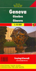
Geneva
Detailed, clear street plan of Geneva extending south to the Perly motorway junction and north to include the Ferney Airport, and combining road & tourist information.Road names, parking places and houses, and international and administrative boundaries are marked alongside pedestrian zones. A series of symbols indicates monuments & places of interest, tourist information points, various religious buildings, natural curiosities, youth hostels, shopping centres, police stations, post offices and some leisure and sport facilities. Also railways and ferry lines are clearly marked.Four insets show a plan of the transport system, an enlargement of the city centre from Gare du Tornavir to the Petit Palais (at 1:8, 000), an overview of the city's surroundings (including the various
airports) highlighting motorway exits, and one of the Leman Lake including Lausanne with border crossings.The plan also includes an extensive index, some general tourist listings and emergency numbers.Map legend includes English.
airports) highlighting motorway exits, and one of the Leman Lake including Lausanne with border crossings.The plan also includes an extensive index, some general tourist listings and emergency numbers.Map legend includes English.
Product Description
Reviews/Comments
Add New
Intelligent Comparison
Archived Product
Geneva Stanfords
£15.95
Archived Product
Geneva Stanfords
£7.95
Archived Product
Geneva Stanfords
£17.99
Archived Product
Geneva F&B Stanfords
£9.99
Archived Product
Genoa Stanfords
£10.99
Vouchers
No voucher codes found.
Do you know a voucher code for this product or supplier? Add it to Insights for others to use.
Do you know a voucher code for this product or supplier? Add it to Insights for others to use.
 Denmark